
Mount Erebus is the southernmost active volcano on Earth, located on Ross Island in the Ross Dependency in Antarctica. With a summit elevation of 3,792 metres (12,441 ft), it is the second most prominent mountain in Antarctica and the second-highest volcano in Antarctica. It is the highest point on Ross Island, which is also home to three inactive volcanoes: Mount Terror, Mount Bird, and Mount Terra Nova. It makes Ross Island the sixth-highest island on Earth.
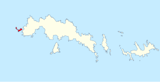
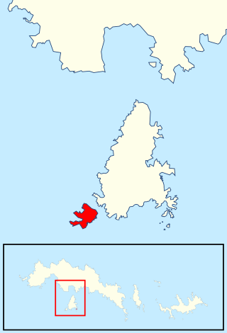
Arthur Harbour is a small harbour entered between Bonaparte Point and Amsler Island on the south-west coast of Anvers Island in the Palmer Archipelago of Antarctica.
The Larsen Islands are a small group of islands north-west of Moreton Point, the western extremity of Coronation Island, in the South Orkney Islands of Antarctica. They were discovered by Captains George Powell and Nathaniel Palmer on the occasion of their joint cruise in December 1821. The islands were named on Petter Sørlle's chart, based upon his survey of the South Orkney Islands in 1912–1913, in honour of Carl Anton Larsen.
Mount Bird is a 1,765 metres (5,791 ft) high shield volcano standing about 7 nautical miles south of Cape Bird, the northern extremity of Ross Island. It was mapped by the British National Antarctic Expedition, 1901–04, under Robert Falcon Scott, and apparently named by them after Cape Bird.

The Sikorski Glacier is a small glacier in the north-eastern part of the Noville Peninsula, Thurston Island, Ellsworth Land, Antarctica. It flows north-east to the Bellingshausen Sea between Mount Palmer and Mount Feury. It was first roughly delineated from aerial photos taken by the USN's Operation Highjump in 1946–47. It was named by the Advisory Committee on Antarctic Names (US-ACAN) for Stephen Sikorski, electronics technician on USS Glacier, who assisted in setting up an automatic weather station on Thurston Island during the USN's Bellingshausen Sea Expedition in February 1960.
Foyn Island, also known as Svend Foyn Island, is the second largest island in the Possession Islands, East Antarctica, lying 6 kilometres (4 mi) south-west of Possession Island. An Adélie penguin rookery covers much of the island, which is often included in the itinerary of Antarctic cruises.
Aspland Island is a small island 7.4 km (4 nmi) west of Gibbs Island in the South Shetland Islands of Antarctica. The name dates back to at least 1821.

Cape Batterbee is a small, rocky point on the coast, the most northerly cape of Enderby Land. It is located 92 km north of Mount Elkins.
The Kyle Hills are a prominent group of volcanic cones, hills, ridges, and peaks that occupy the eastern part of Ross Island, Antarctica, between Mount Terror and Cape Crozier. The hills extend east–west for 8 nautical miles (15 km), rising from sea level at Cape Crozier to about 2,600 metres (8,500 ft) in Mount McIntosh at the western end of the group. Local relief of features is on the order of 200 metres (660 ft).

Worley Point is a narrow, flat and rocky headland extending about 1 km along the north-western coast of Shepard Island, Marie Byrd Land, Antarctica. As with Grant Island, 9 km eastward, Shepard Island is surrounded by the Getz Ice Shelf except on its northern side. The point was named by the Advisory Committee on Antarctic Names (US-ACAN) for Lieutenant Richard J. Worley, U.S. Navy, Medical Officer at South Pole Station in 1969.

Gregory Island is a small ice-free island lying just off the east coast of Victoria Land, Antarctica, 5 km (3.1 mi) north-east of Cape Archer and 8 km (5.0 mi) south of Cape Ross. It was discovered by the British National Antarctic Expedition (1901–04), at which time it was thought to be a coastal point and was named "Gregory Point," for John Walter Gregory, director of the civilian staff of the expedition. It was determined to be an island by the British Antarctic Expedition, 1910–13.

Matusevich Glacier is a broad glacier about 50 nautical miles long, with a well developed glacier tongue, flowing to the coast of East Antarctica between the Lazarev Mountains and the northwestern extremity of the Wilson Hills.
Edmonson Point is a rounded, largely ice-free point lying below Mount Melbourne along the west side of Wood Bay, Victoria Land, Antarctica. It was mapped by the United States Geological Survey from surveys and from US Navy air photographs, 1955–63, and was named by the Advisory Committee on Antarctic Names for Larry Edmonson, a satellite geodesy scientist at McMurdo Station, winter party 1966.

Mount Elder is a 940-metre (3,080 ft) mountain lying between Endurance Glacier and Mount Pendragon on Elephant Island, in the South Shetland Islands of Antarctica. It was named by the UK Antarctic Place-Names Committee for Captain John P. Elder, Royal Engineers, surveyor of the U.K. Joint Services Expedition to Elephant Island in 1970–71.

Ferguslie Peninsula is a peninsula 2.4 km (1.5 mi) long, lying between Browns Bay and Macdougal Bay on the north coast of Laurie Island, in the South Orkney Islands of Antarctica. The peninsula was charted in 1903 by the Scottish National Antarctic Expedition under William Speirs Bruce, who named it for Ferguslie, the residence of James Coats, chief patron of the expedition.
Moe Island is an island 2 km (1.2 mi) long in the South Orkney Islands off Antarctica, separated from the south-west end of Signy Island by Fyr Channel. It was charted by Captain Petter Sørlle in 1912–13, and named after M. Thoralf Moe of Sandefjord, Norway, a contemporary whaling captain who worked in this area. The northernmost point of the island is Spaull Point, named by United Kingdom Antarctic Place-Names Committee (UK-APC) after Vaughan W. Spaull, British Antarctic Survey (BAS) biologist on Signy Island, 1969.

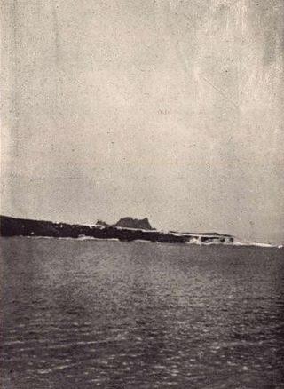
Gerlache Island is the largest of the Rosenthal Islands lying off Gerlache Point on the west coast of Anvers Island, in the Palmer Archipelago of Antarctica. It was first roughly charted and named "Pointe de Gerlache" by the French Antarctic Expedition, 1903–05, under Jean-Baptiste Charcot, for Lieutenant Adrien de Gerlache. As a result of surveys by the Falkland Islands Dependencies Survey in 1956–58, this island is considered to be the feature named by Charcot; there is no prominent point in this vicinity which would be visible from seaward.
McDonald Beach is an extensive beach lying west of Inclusion Hill and 6 nautical miles (11 km) southwest of Cape Bird on Ross Island, Antarctica. It was named by the New Zealand Geological Survey Antarctic Expedition (NZGSAE), 1958–59, after Captain Edwin A. McDonald, then Deputy Commander, US Naval Support Force, Antarctica, who provided extensive transport and other facilities to the NZGSAE in support of the survey of the Cape Bird area.
Mathewson Point is a steep, rocky point at the northern tip of Shepard Island, which lies on the seaward edge of the Getz Ice Shelf in Marie Byrd Land, Antarctica. The point, the site of an Adélie penguin rookery, was charted by personnel of the USS Glacier on February 4, 1962, and was named by the Advisory Committee on Antarctic Names for Lieutenant David S. Mathewson, U.S. Navy, then supply officer of the Glacier.
Kartografov Island is a small coastal island lying in the western part of the mouth of Harald Bay, Oates Land, Antarctica. It was photographed by U.S. Navy Operation Highjump (1946–47), the Soviet Antarctic Expedition (1957–58) and the Australian National Antarctic Research Expedition (1959). The island was named "Ostrov Kartografov" by the Soviet expedition.
