Clinton, New Zealand

Last updated

Clinton
Clinton township sign.jpg
Nickname: 
Our Five-Horse Town
Clinton, New Zealand
Coordinates: 46°12′9.4″S169°22′29.6″E / 46.202611°S 169.374889°E / -46.202611; 169.374889
Country New Zealand
Region Otago
District Clutha District
WardClinton
Electorates
Government
  Territorial authority Clutha District Council
  Regional council Otago Regional Council
   Mayor of Clutha Bryan Cadogan
   Southland MP Joseph Mooney
   Te Tai Tonga MP Tākuta Ferris
Area
[1]
  Total0.72 km2 (0.28 sq mi)
Elevation
[2]
122 m (400 ft)
Population
 (June 2023) [3]
  Total310
  Density430/km2 (1,100/sq mi)

Clinton is a small town in South Otago, in New Zealand's South Island. Handy to the Catlins, Dunedin, Lawrence, Central Otago and Tapanui. It is located on State Highway 1 approximately halfway between Balclutha and Gore (the section of State Highway 1 between Clinton and Gore is known as "The Presidential Highway", after Bill Clinton and Al Gore, though the names are a coincidence), and the Main South Line railway passes through the town.

Contents

Clinton was named for Henry Pelham-Clinton, 5th Duke of Newcastle, former British Secretary of State for the Colonies.

Demographics

Clinton town is described by Statistics New Zealand as a rural settlement. It covers 0.72 km2 (0.28 sq mi), [1] and had an estimated population of 310 as of June 2023, [3] with a population density of 431 people per km2. It is part of the much larger Clinton statistical area.

Historical population for the town
YearPop.±% p.a.
2006291    
2013285−0.30%
2018288+0.21%
Source: [4]

Clinton had a population of 288 at the 2018 New Zealand census, an increase of 3 people (1.1%) since the 2013 census, and a decrease of 3 people (−1.0%) since the 2006 census. There were 117 households, comprising 147 males and 141 females, giving a sex ratio of 1.04 males per female, with 48 people (16.7%) aged under 15 years, 51 (17.7%) aged 15 to 29, 120 (41.7%) aged 30 to 64, and 63 (21.9%) aged 65 or older.

Ethnicities were 83.3% European/Pākehā, 26.0% Māori, 2.1% Asian, and 4.2% other ethnicities. People may identify with more than one ethnicity.

Although some people chose not to answer the census's question about religious affiliation, 54.2% had no religion, 32.3% were Christian, 1.0% had Māori religious beliefs, 1.0% were Hindu, 1.0% were Buddhist and 1.0% had other religions.

Of those at least 15 years old, 15 (6.2%) people had a bachelor's or higher degree, and 93 (38.8%) people had no formal qualifications. 6 people (2.5%) earned over $70,000 compared to 17.2% nationally. The employment status of those at least 15 was that 99 (41.2%) people were employed full-time, 42 (17.5%) were part-time, and 12 (5.0%) were unemployed. [4]

Clinton statistical area

The Clinton statistical area, which also includes Waiwera South, covers 839.70 km2 (324.21 sq mi) [1] and had an estimated population of 1,360 as of June 2023, [5] with a population density of 1.6 people per km2.

Historical population for the statistical area
YearPop.±% p.a.
20061,170    
20131,200+0.36%
20181,230+0.50%
Source: [6]

Clinton statistical area had a population of 1,230 at the 2018 New Zealand census, an increase of 30 people (2.5%) since the 2013 census, and an increase of 60 people (5.1%) since the 2006 census. There were 465 households, comprising 648 males and 579 females, giving a sex ratio of 1.12 males per female. The median age was 33.8 years (compared with 37.4 years nationally), with 288 people (23.4%) aged under 15 years, 255 (20.7%) aged 15 to 29, 555 (45.1%) aged 30 to 64, and 132 (10.7%) aged 65 or older.

Ethnicities were 87.3% European/Pākehā, 11.5% Māori, 1.7% Pasifika, 5.4% Asian, and 3.4% other ethnicities. People may identify with more than one ethnicity.

The percentage of people born overseas was 12.2, compared with 27.1% nationally.

Although some people chose not to answer the census's question about religious affiliation, 52.2% had no religion, 35.9% were Christian, 0.5% had Māori religious beliefs, 0.5% were Hindu, 1.7% were Buddhist and 1.5% had other religions.

Of those at least 15 years old, 132 (14.0%) people had a bachelor's or higher degree, and 231 (24.5%) people had no formal qualifications. The median income was $35,200, compared with $31,800 nationally. 99 people (10.5%) earned over $70,000 compared to 17.2% nationally. The employment status of those at least 15 was that 564 (59.9%) people were employed full-time, 180 (19.1%) were part-time, and 21 (2.2%) were unemployed. [6]

Education

Display of five horses in Clinton, New Zealand (2023) Clinton New Zealand 27.jpg
Display of five horses in Clinton, New Zealand (2023)

Clinton School is a co-educational state primary school for Year 1 to 8 students, [7] [8] with a roll of 68 as of February 2024. [9] The school was established in 1874. [10]

Railway station

Clinton railway station opened on 1 November 1877 and closed for passengers on 1 December 1970 and for goods in October 1990. [11] It was 6.51 km (4.05 mi) east of Wairuna, [12] 9.75 km (6.06 mi) west of Waiwera, 73 mi 18 ch (117.8 km) from Dunedin and 65 mi 43 ch (105.5 km) from Invercargill. The 4th class station [13] had a refreshment room from 1880, [14] which, included a bar [15] and, like most rooms, had its marked crockery. [16] The station and refreshment room burnt down in 1900, [17] but was quickly rebuilt. [18] The engine shed burnt down in 1921 and the station was again damaged by fire in 1982. The turntable was lengthened in 1939 and removed in 1969. [13] In 1931 the station still had a refreshment room [19] and employed a stationmaster and two clerks. [20]

Related Research Articles

Waipukurau is the largest town in the Central Hawke's Bay District on the east coast of the North Island of New Zealand. It is located on the banks of the Tukituki River, 7 kilometres south of Waipawa and 50 kilometres southwest of Hastings.

<span class="mw-page-title-main">Te Awamutu</span> Town in Waikato, New Zealand

Te Awamutu is a town in the Waikato region in the North Island of New Zealand. It is the council seat of the Waipa District and serves as a service town for the farming communities which surround it. Te Awamutu is located some 30 kilometres (19 mi) south of Hamilton on State Highway 3, one of the two main routes south from Auckland and Hamilton.

<span class="mw-page-title-main">Tuakau</span> Place in Waikato, New Zealand

Tuakau is a town in the Waikato region at the foot of the Bombay Hills, formerly part of the Franklin District until 2010, when it became part of Waikato District in the North Island of New Zealand. The town serves to support local farming, and is the residence of many employees of New Zealand Steel at Glenbrook.

<span class="mw-page-title-main">Tangimoana</span> Settlement in Manawatū-Whanganui Region, New Zealand

Tangimoana is a community in the Manawatū-Whanganui Region of the North Island of New Zealand. It had a population of 303 permanent residents in 2018. It is located 15 kilometres southwest of Bulls, and 30 kilometres west of Palmerston North.

<span class="mw-page-title-main">Tīrau</span> Settlement in Waikato, New Zealand

Tīrau is a small town in the Waikato region of the North Island of New Zealand, 50 kilometres southeast of Hamilton. The town has a population of 804. In the Māori language, "Tīrau" means "place of many cabbage trees."

<span class="mw-page-title-main">Takapau</span> Settlement in Hawkes Bay Region, New Zealand

Takapau is a small rural community in the Central Hawkes Bay in New Zealand. It is located 20 kilometres west of Waipukurau, off State Highway 2, and has a population of more than 500.
<span class="mw-page-title-main">Waipawa</span> Town in Hawkes Bay, New Zealand

Waipawa is the second-largest town in Central Hawke's Bay in the east of the North Island of New Zealand. It has a population of 2,400.

<span class="mw-page-title-main">Milton, New Zealand</span> Town in New Zealand

Milton, formerly known as Tokomairiro or Tokomairaro, is a town of over 2,000 people, located on State Highway 1, 50 kilometres to the south of Dunedin in Otago, New Zealand. It lies on the floodplain of the Tokomairaro River, one branch of which loops past the north and south ends of the town. This river gives its name to many local features, notably the town's only secondary school, Tokomairiro High School.
<span class="mw-page-title-main">Kawhia Harbour</span> Harbour and settlement in Waikato, New Zealand

Kawhia Harbour is one of three large natural inlets in the Tasman Sea coast of the Waikato region of New Zealand's North Island. It is located to the south of Raglan Harbour, Ruapuke and Aotea Harbour, 40 kilometres southwest of Hamilton. Kawhia is part of the Ōtorohanga District and is in the King Country. It has a high-tide area of 68 km2 (26 sq mi) and a low-tide area of 18 km2 (6.9 sq mi). Te Motu Island is located in the harbour.

<span class="mw-page-title-main">Putāruru</span> Town in Waikato, New Zealand

Putāruru is a small town in the South Waikato District and the Waikato region of New Zealand's North Island. It lies on the western side of the Mamaku Ranges and in the upper basin of the Waihou River. It is on the Oraka Stream 65 kilometres south-east of Hamilton. State Highway 1 and the Kinleith Branch railway run through the town.

<span class="mw-page-title-main">Te Kauwhata</span> Town in Waikato, New Zealand

Te Kauwhata is a small town in the north of the Waikato region of New Zealand, situated close to the western shore of Lake Waikare, some 40 km north of Hamilton and approximately 58 km south of Manukau City. The township is surrounded by dairy farms, drystock holdings and horticulture. Its newest building is its Waikato District Council library. Originally known as Wairangi, Te Kauwhata grew around a railway station built in the late 1870s.
<span class="mw-page-title-main">Hunterville</span> Town in Manawatū-Whanganui, New Zealand

Hunterville is a small town in the Rangitikei district of the North Island of New Zealand. It is located halfway between Taupo and Wellington on State Highway 1, and as of the 2018 census has a population of 408.

<span class="mw-page-title-main">Ōhura</span> Settlement in Manawatū-Whanganui Region, New Zealand

Ōhura is a small town in the west of the North Island of New Zealand. It is located to the west of Taumarunui in the area known as the King Country, in inland Manawatū-Whanganui. It lies on the banks of the Mangaroa Stream, a tributary of the Ōhura River which is a tributary of the Whanganui River.

Ōtāne is a town in the Central Hawke's Bay District and the Hawke's Bay region, on the east coast of New Zealand's North Island. The small village, has a school, general store, cafe and pub, and is located just off State Highway 2.

<span class="mw-page-title-main">Matatoki</span> Place in Waikato, New Zealand

Matatoki is a locality on the Hauraki Plains of New Zealand. It lies on State Highway 26, south east of Thames and north of Paeroa. The Matatoki Stream runs from the Coromandel Range through the area to join the Waihou River.

<span class="mw-page-title-main">Rangataua</span> Settlement in Manawatū-Whanganui Region, New Zealand

Rangataua is a small village in the North Island of New Zealand. It is located at the southern end of both the Tongariro National Park and Rangataua State Forest, adjacent to the southwestern slopes of the active volcano Mount Ruapehu. Part of the Manawatū-Whanganui region, the town is 5 kilometres east of Ohakune, 75 kilometres northeast of Wanganui, and 20 kilometres west of Waiouru.
<span class="mw-page-title-main">Otautau</span> Place in South Island, New Zealand

Otautau is a small farming, forestry and milling town located inland on the western edge of the Southland Plains of New Zealand on the banks of the Aparima River. Otautau is located approximately 40 kilometres (25 mi) north west of Invercargill. The average elevation of Otautau is 60 metres.
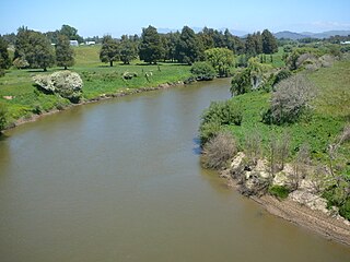
<span class="mw-page-title-main">Whatawhata</span> Town in Waikato, New Zealand

Whatawhata, previously also spelt Whata Whata, is a small town in the Waikato region on the east bank of the Waipā River, at the junction of State Highways 23 and 39, 12 km (7.5 mi) from Hamilton. Te Araroa tramping route passes through Whatawhata.
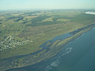
<span class="mw-page-title-main">Koitiata</span> Settlement in Manawatū-Whanganui Region, New Zealand

Koitiata is a settlement located in the southwestern part of Rangitikei District of the Manawatū-Whanganui region of New Zealand's North Island. At the time of the 2018 census, Koitiata had a population of 126. Marton is located 24 km to the east and Whanganui is located 29 km to the northwest. Nearby Koitiata is Lake Koitiata.
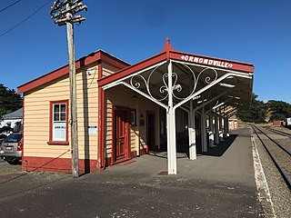
<span class="mw-page-title-main">Ormondville</span> Settlement in Manawatū-Whanganui Region, New Zealand

Ormondville is a locality in the Manawatū-Whanganui region of New Zealand's North Island. It is located inland, south of Waipukurau and west of Flemington, Hawke's Bay.

References

  1. 1 2 3 "ArcGIS Web Application". statsnz.maps.arcgis.com. Retrieved 17 January 2022.
  2. https://www.waymarking.com/waymarks/wm7VHX_Clinton_400_ft_South_Otago_New_Zealand [ bare URL ]
  3. 1 2 "Subnational population estimates (RC, SA2), by age and sex, at 30 June 1996-2023 (2023 boundaries)". Statistics New Zealand . Retrieved 25 October 2023. (regional councils); "Subnational population estimates (TA, SA2), by age and sex, at 30 June 1996-2023 (2023 boundaries)". Statistics New Zealand . Retrieved 25 October 2023. (territorial authorities); "Subnational population estimates (urban rural), by age and sex, at 30 June 1996-2023 (2023 boundaries)". Statistics New Zealand . Retrieved 25 October 2023. (urban areas)
  4. 1 2 "Statistical area 1 dataset for 2018 Census". Statistics New Zealand. March 2020. 7029038 and 7029039.
  5. "Population estimate tables - NZ.Stat". Statistics New Zealand . Retrieved 25 October 2023.
  6. 1 2 "Statistical area 1 dataset for 2018 Census". Statistics New Zealand. March 2020. Clinton (356000). 2018 Census place summary: Clinton
  7. "Clinton School Official School Website". clinton.school.nz.
  8. "Clinton School Ministry of Education School Profile". educationcounts.govt.nz. Ministry of Education.
  9. "Clinton School Education Review Office Report". ero.govt.nz. Education Review Office.
  10. White, Samuel (23 October 2015). "South Otago schools holding jubilees". Otago Daily Times.
  11. Names & Opening & Closing Dates of Railway Stations in New Zealand by Juliet Scoble (2012)
  12. New Zealand Railway and Tramway Atlas (First ed.). Quail Map Co. 1965. pp. 3 & 4.
  13. 1 2 "Stations" (PDF). NZR Rolling Stock Lists. Archived (PDF) from the original on 8 February 2013. Retrieved 10 August 2020.
  14. "Engineers". Built in Dunedin. 29 June 2013. Retrieved 28 February 2021.
  15. "Clinton Railway Refreshment Rooms". collections.tepapa.govt.nz. Retrieved 28 February 2021.
  16. NZR Clinton Railway Refreshment Rooms Crockery, 31 January 2013, retrieved 28 February 2021
  17. "RAILWAY AND POST OFFICES AND REFRESHMENT ROOMS DESTROYED. CLUTHA LEADER". paperspast.natlib.govt.nz. 9 January 1900. Retrieved 28 February 2021.
  18. "CLINTON'S NEW RAILWAY STATION. SOUTHLAND TIMES". paperspast.natlib.govt.nz. 28 November 1900. Retrieved 28 February 2021.
  19. "POPULAR SUNDAY EXCURSION. EVENING STAR". paperspast.natlib.govt.nz. 6 November 1933. Retrieved 28 February 2021.
  20. "NEW ZEALAND GAZETTE" (PDF). 3 September 1931.