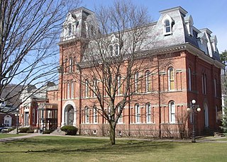
Delaware County is a county located in the US state of New York. As of the 2020 United States census, the population was 44,308. The county seat is Delhi. The county is named after the Delaware River, which was named in honor of Thomas West, 3rd Baron De La Warr, appointed governor of Virginia in 1609. The county is part of the Southern Tier region of the state.

Interstate 89 (I-89) is an Interstate Highway in the New England region of the United States traveling from Bow, New Hampshire, to the Canada–United States border between Highgate Springs, Vermont, and Saint-Armand, Quebec. As with all odd-numbered primary Interstates, I-89 is signed as a north–south highway. However, it follows a primarily northwest-to-southeast path. The route forms a major part of the main connection between the cities of Montreal and Boston. In Quebec, the route continues as Route 133. The eventual completion of Autoroute 35 will lead to a nonstop limited-access highway route between Boston and Montreal, following I-93 south from I-89's terminus. The largest cities directly served by I-89 are Concord, the state capital of New Hampshire; Montpelier, the state capital of Vermont; and Burlington, Vermont. I-89 is one of three main Interstate highways whose route is located entirely within New England, along with I-91 and I-93.

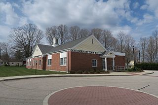
Marlborough is a town in Hartford County, Connecticut, United States. It contains the census-designated place (CDP) of Terramuggus. The town is part of the Capitol Planning Region. The town's population was 6,133 at the 2020 census. Marlborough is a suburban and rural community. The local high school is RHAM High School. In 2013, Marlborough ranked third in Connecticut Magazine's biannual ranking of Connecticut small towns. Educationally, RHAM High School, which serves Marlborough, Hebron, and Andover students, is one of the top-ranked regional high schools in the state on the SAT in 2017, and 11th highest-performing school in the state on the test. The town is home to Elmer Theines-Mary Hall elementary school which serves Pre-K through 6th grade. The school scores above state average on standardized testing and student progress.

Colchester is a town in New London County, Connecticut, United States. The town is part of the Southeastern Connecticut Planning Region. The population was 15,555 at the 2020 census. In 2010 Colchester became the first town in Connecticut, and the 36th in the country, to be certified with the National Wildlife Federation as a Community Wildlife Habitat.
Colchester is a town in Delaware County, New York, United States. The population was 1,782 at the 2020 census. The town is in the southwestern part of the county.

Colchester is a town in Chittenden County, Vermont, United States. As of the 2020 census, the population of Colchester was 17,524. It is the third-most populous municipality and most populous town in the state of Vermont. Colchester borders Burlington, Vermont's most populous municipality and is part of its metropolitan area. The town is directly to Burlington's north on the eastern shore of Lake Champlain, to the west of the Green Mountains. The Vermont National Guard is based in the town, and it is also home to Saint Michael's College and the Vermont campus of Southern New Hampshire University.

Walton is a town in Delaware County, New York, United States. The population was 5,270 at the 2020 census. The town is in the west-central part of the county and contains the village of Walton. The town claims to be the "Scarecrow Capital of the World."

Colchester United Football Club is a professional association football club based in the city of Colchester, Essex, England. The team competes in EFL League Two, the fourth level of the English football league system.

U.S. Route 7 (US 7) is a north–south United States Numbered Highway in western New England that runs for 308 miles (496 km) through the states of Connecticut, Massachusetts, and Vermont. The highway's southern terminus is at Interstate 95 (I-95) exit 15 in Norwalk, Connecticut. Its northern terminus is at I-89 exit 22 near the village of Highgate Springs, Vermont, immediately south of the Canada–United States border.

Agloe was originally a fictional hamlet in Colchester, Delaware County, New York, United States, that became an actual landmark after mapmakers made up the community as a phantom settlement, an example of a fictitious entry similar to a trap street, added to the map to catch plagiarism.

Heman Allen was an American lawyer, politician and ambassador from Colchester, Vermont. He served as a U.S. Representative and as America's first United States Minister Plenipotentiary to Chile.

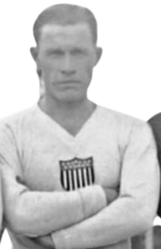
Alexander Lochian Wood was a Scottish American soccer defender. Wood began his club career in the United States before moving to England in the early 1930s. He also played in all three U.S. games at the 1930 FIFA World Cup. He is a member of the National Soccer Hall of Fame.
Downsville is a hamlet, census-designated place (CDP), and former village in the town of Colchester, Delaware County, New York, United States. The population was 617 at the 2010 census.
The 2001–02 season was Colchester United's 60th season in their history and their fourth successive season in the third tier of English football, the Second Division. Alongside competing in the Second Division, the club also participated in the FA Cup, the League Cup and the Football League Trophy.
The 1998–99 season was Colchester United's 57th season in their history and their first season back in the third tier of English football, the Second Division, following promotion via the play-offs in the previous season. Alongside competing in the Second Division, the club also participated in the FA Cup, the League Cup and the Football League Trophy.
The 1961–62 season was Colchester United's 20th season in their history and their first-ever season in the fourth tier of English football, the Fourth Division. Alongside competing in the Fourth Division, the club also participated in the FA Cup and the League Cup.
The Phoenix was a sidewheel paddle steamer operating on Lake Champlain between the United States states of New York and Vermont, and the British province of Lower Canada. Built in 1815, she grounded, burned and sank in 1819 off the shore of Colchester, Vermont. Her surviving wreckage is the oldest known example of a sidewheel steamer anywhere in the world. The wreck site is a Vermont State Historic Site, which may be visited by registered and qualified divers. It was listed on the National Register of Historic Places in 1998.
Brace Hill is a mountain located in the Catskill Mountains of New York east-southeast of Walton, New York. Money Point is located southeast of Brace Hill and Colchester Mountain is located northeast.
The Green Mountain Flyer was an international day train between Montreal, Quebec, Canada, and the Northeast United States, with sections to New York City and Boston. It was operated in cooperation between the Rutland Railroad, the Canadian National Railway and the New York Central Railroad. The train carried the number 65 running north, and number 64 running south. The Mount Royal was the night train counterpart to the Green Mountain Flyer. Following years of cutbacks, both trains were discontinued in 1953 when the Rutland Railway ended all passenger service.


