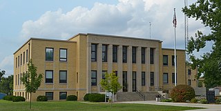
Eureka is a city located in St. Louis County, Missouri, United States, adjacent to the cities of Wildwood and Pacific, along Interstate 44. It is in the extreme southwest of the Greater St. Louis metro area. As of the 2020 census, the city had a population of 11,646. Since 1971, Eureka has been known as the home of the amusement park Six Flags St. Louis.

Montgomery County is a county in the east central part of the U.S. state of Missouri. As of the 2020 census, the population was 11,322. Its county seat is Montgomery City. The county was named in honor of Richard Montgomery, an American Revolutionary War general killed in 1775 while attempting to capture Quebec City, Canada.

Warren County is a county located in the eastern portion of the U.S. state of Missouri. As of the 2010 census, the population was 32,513. The county is located on the north side of the Missouri River. Its county seat is Warrenton. The county was established on January 5, 1833, and was named for General Joseph Warren, who died in the Battle of Bunker Hill during the American Revolutionary War.

Johnson County is a county located in western portion of the U.S. state of Missouri. As of the 2010 census, the population was 52,595 with a 2018 estimate of 53,652. Its county seat is Warrensburg. The county was formed December 13, 1834 from Lafayette County and named for Vice President Richard Mentor Johnson.

St. Clair County is the ninth most populous county in Illinois, located in the southwestern part of the state along the Mississippi River bordering Missouri. Located directly east of St. Louis, the county is part of the Metro East region of the Greater St. Louis metropolitan area in southern Illinois. As of the 2020 United States census, St. Clair County had a population of 257,400, making it the third most populous county in Illinois outside the Chicago metropolitan area. Belleville is the county’s seat and largest city.

Lauderdale Lakes, officially the City of Lauderdale Lakes, is a city in Broward County, Florida, United States. As of the 2020 United States Census, the city's population was 35,954. It is part of the Miami–Fort Lauderdale–West Palm Beach Metropolitan Statistical Area, which is home to 5,564,635 people.

Granite City is a city in Madison County, Illinois, United States, within the Greater St. Louis metropolitan area. The population was 27,549 at the 2020 census, making it the third-largest city in the Metro East and Southern Illinois regions, behind Belleville and O'Fallon. Officially founded in 1896, Granite City was named by the Niedringhaus brothers, William and Frederick, who established it as a steel making company town for the manufacture of graniteware kitchen utensils.

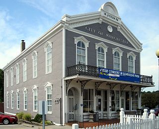
Manchester is a city in St. Louis County, Missouri, United States. The population was 18,333 at the 2020 census.

Richmond Heights is a city in St. Louis County, Missouri. It is an inner-ring suburb of St. Louis, Missouri, United States. The population was 8,603 at the 2010 census. According to Robert L. Ramsay, the name was suggested by Robert E. Lee, who thought the topography of the area resembled Richmond, Virginia.

Spanish Lake is a census-designated place (CDP) in St. Louis County, Missouri, United States. The population was 18,413 at the 2020 census.

St. Ann is a city in northwest St. Louis County, Missouri, United States. The population was 13,019 at the 2020 census.

Pacific is a city in the U.S. state of Missouri in eastern Franklin County and extending to the east into southwest St. Louis County. The population was 7,002 at the 2010 census.

Bangladeshi Americans are Americans of Bangladeshi descent. The majority of Bangladeshi Americans are Bengalis and form the largest group of Bengali Americans. Bangladeshi immigrants have arrived in the United States in large numbers since the early 1970s to become among the fastest growing ethnic communities since that decade. New York City, home to two-thirds of the Bangladeshi American population; Paterson, New Jersey; Atlantic City, New Jersey; Buffalo, New York; as well as Philadelphia, Pennsylvania, Los Angeles, Boston, Atlanta, San Francisco, Detroit, Chicago, Florida, Dallas, Houston, Charlotte, Austin, Hamtramck, Michigan, and Reno, Nevada are home to notable Bangladeshi communities.

Brightwood is a neighborhood in the northwestern quadrant of Washington, D.C. Brightwood is part of Ward 4.
The District of Columbia is a federal district with an ethnically diverse population. In 2020, the District had a population of 689,545 people, with a resident density of 11,515 people per square mile.

Dutchtown is a neighborhood of St. Louis, Missouri. It is called "Dutch" from Deutsch, i.e., "German", as it was the southern center of German-American settlement in St. Louis in the early 19th century. It was the original site of Concordia Seminary, Concordia Publishing House, Lutheran Hospital, and other German community organizations. The German Cultural Society still has its headquarters there. St Anthony of Padua Catholic Church towers over the neighborhood and is a symbol of the neighborhood.
Southside is a neighborhood in Louisville, Kentucky, United States. Its boundaries are Third Street to the west, Woodlawn Avenue, Allmond Avenue and Hiawatha Avenue to the north, the CSX railroad tracks to the east, and the southern boundary of the Greater Louisville Technology Park, Southside Drive and Kenwood Drive to the south.

College Hill is a residential neighborhood in Easton, Pennsylvania. The neighborhood is situated on the hill overlooking downtown Easton which was once known as Mount Lafayette, and before that, Mount Washington. Lafayette College borders the neighborhood on its southwest side. The northern boundary of the neighborhood is Forks Township. The boundary lies along Chestnut Ridge, a steep hill that rises to 700 feet. College Hill has a total of three historic religious institutional buildings, three parks, and the remains of Rinek Mansion grounds.

Lower Moyamensing is a neighborhood in South Philadelphia just south of the East Passyunk Crossing neighborhood and north of the stadium area. It is bounded by Snyder Avenue to the north, Oregon Avenue to the south, South 7th Street to the east, and South Broad Street to the west. The neighborhood was once part of Moyamensing Township before becoming part of Philadelphia in 1854. Lower Moyamensing is known for its 19th century row homes, factory buildings, and variety of restaurants. South Philadelphia High School is located in Lower Moyamensing, at the corner of Broad and Jackson Streets.

New York City has the largest population of Italian Americans in the United States of America as well as North America, many of whom inhabit ethnic enclaves in Brooklyn, the Bronx, Manhattan, Queens, and Staten Island. New York is home to the third largest Italian population outside of Italy, behind Buenos Aires, Argentina (first) and São Paulo, Brazil (second). Over 2.6 million Italians and Italian-Americans live in the greater New York metro area, with about 800,000 living within one of the five New York City boroughs. This makes Italian Americans the largest ethnic group in the New York metro area.


