Colwich, Kansas | |
---|---|
![]() Location within Sedgwick County and Kansas | |
![]() | |
Coordinates: 37°46′50″N97°32′26″W / 37.78056°N 97.54056°W [1] | |
Country | United States |
State | Kansas |
County | Sedgwick |
Founded | 1887 |
Incorporated | 1887 |
Area | |
• Total | 1.33 sq mi (3.46 km2) |
• Land | 1.33 sq mi (3.46 km2) |
• Water | 0.00 sq mi (0.00 km2) |
Elevation | 1,381 ft (421 m) |
Population | |
• Total | 1,455 |
• Density | 1,100/sq mi (420/km2) |
Time zone | UTC-6 (CST) |
• Summer (DST) | UTC-5 (CDT) |
ZIP code | 67030 |
Area code | 316 |
FIPS code | 20-15100 [1] |
GNIS ID | 473814 [1] |
Website | colwichks.org |
Colwich is a city in Sedgwick County, Kansas, United States, [1] located northwest of Wichita. As of the 2020 census, the population of the city was 1,455. [3]
Colwich was founded in 1887. [4] The name is a portmanteau of Colorado and Wichita, or the Colorado & Wichita Railroad. [5]
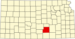
Colwich is northwest of Wichita and centered around the intersection of 53rd St North and 167th St West. According to the United States Census Bureau, the city has a total area of 1.33 square miles (3.44 km2), all of it land. [6]
Census | Pop. | Note | %± |
---|---|---|---|
1890 | 212 | — | |
1900 | 225 | 6.1% | |
1910 | 258 | 14.7% | |
1920 | 262 | 1.6% | |
1930 | 260 | −0.8% | |
1940 | 284 | 9.2% | |
1950 | 339 | 19.4% | |
1960 | 703 | 107.4% | |
1970 | 879 | 25.0% | |
1980 | 935 | 6.4% | |
1990 | 1,091 | 16.7% | |
2000 | 1,229 | 12.6% | |
2010 | 1,327 | 8.0% | |
2020 | 1,455 | 9.6% | |
U.S. Decennial Census |
Colwich is part of the Wichita, KS Metropolitan Statistical Area.
The 2020 United States census counted 1,455 people, 535 households, and 404 families in Colwich. [7] [8] The population density was 1,089.9 per square mile (420.8/km2). There were 561 housing units at an average density of 420.2 per square mile (162.2/km2). [8] [9] The racial makeup was 93.75% (1,364) white or European American (92.16% non-Hispanic white), 0.07% (1) black or African-American, 0.89% (13) Native American or Alaska Native, 0.07% (1) Asian, 0.0% (0) Pacific Islander or Native Hawaiian, 0.55% (8) from other races, and 4.67% (68) from two or more races. [10] Hispanic or Latino of any race was 3.37% (49) of the population. [11]
Of the 535 households, 40.2% had children under the age of 18; 59.1% were married couples living together; 19.3% had a female householder with no spouse or partner present. 22.1% of households consisted of individuals and 8.0% had someone living alone who was 65 years of age or older. [8] The average household size was 2.8 and the average family size was 3.2. [12] The percent of those with a bachelor’s degree or higher was estimated to be 20.6% of the population. [13]
27.2% of the population was under the age of 18, 8.7% from 18 to 24, 27.4% from 25 to 44, 22.8% from 45 to 64, and 13.8% who were 65 years of age or older. The median age was 33.9 years. For every 100 females, there were 99.0 males. [8] For every 100 females ages 18 and older, there were 100.6 males. [8]
The 2016-2020 5-year American Community Survey estimates show that the median household income was $79,250 (with a margin of error of +/- $11,321) and the median family income was $84,750 (+/- $18,572). [14] Males had a median income of $57,708 (+/- $8,052) versus $38,542 (+/- $10,000) for females. The median income for those above 16 years old was $45,707 (+/- $6,379). [15] Approximately, 0.0% of families and 0.3% of the population were below the poverty line, including 0.0% of those under the age of 18 and 1.8% of those ages 65 or over. [16] [17]
As of the census [18] of 2010, there were 1,327 people, 466 households, and 348 families living in the city. The population density was 997.7 inhabitants per square mile (385.2/km2). There were 480 housing units at an average density of 360.9 per square mile (139.3/km2). The racial makeup of the city was 97.4% White, 0.2% African American, 0.5% Native American, 1.1% from other races, and 0.9% from two or more races. Hispanic or Latino of any race were 2.5% of the population.
There were 466 households, of which 44.6% had children under the age of 18 living with them, 59.7% were married couples living together, 9.9% had a female householder with no husband present, 5.2% had a male householder with no wife present, and 25.3% were non-families. 22.3% of all households were made up of individuals, and 10.7% had someone living alone who was 65 years of age or older. The average household size was 2.85 and the average family size was 3.38.
The median age in the city was 32.7 years. 34.3% of residents were under the age of 18; 7.7% were between the ages of 18 and 24; 25.9% were from 25 to 44; 21.1% were from 45 to 64; and 11.1% were 65 years of age or older. The gender makeup of the city was 50.1% male and 49.9% female.
As of the census [19] of 2000, there were 1,229 people, 376 households, and 315 families living in the city. The population density was 1,652.5 inhabitants per square mile (638.0/km2). There were 392 housing units at an average density of 527.1 per square mile (203.5/km2). The racial makeup of the city was 98.62% White, 0.57% Asian, 0.24% from other races, and 0.57% from two or more races. Hispanic or Latino of any race were 0.81% of the population.
There were 376 households, out of which 47.3% had children under the age of 18 living with them, 69.9% were married couples living together, 9.0% had a female householder with no husband present, and 16.2% were non-families. 14.9% of all households were made up of individuals, and 8.0% had someone living alone who was 65 years of age or older. The average household size was 3.13 and the average family size was 3.49.
In the city, the population was spread out, with 34.9% under the age of 18, 6.8% from 18 to 24, 27.9% from 25 to 44, 14.5% from 45 to 64, and 15.9% who were 65 years of age or older. The median age was 32 years. For every 100 females, there were 99.2 males. For every 100 females age 18 and over, there were 91.8 males.
The median income for a household in the city was $51,346, and the median income for a family was $58,068. Males had a median income of $41,667 versus $28,676 for females. The per capita income for the city was $19,588. About 2.0% of families and 2.3% of the population were below the poverty line, including 2.9% of those under age 18 and 1.4% of those age 65 or over.
The community is served by Renwick USD 267 public school district.
Moran is a city in Allen County, Kansas, United States. As of the 2020 census, the population of the city was 466.
Benton is a city in Butler County, Kansas, United States. As of the 2020 census, the population of the city was 943. It is located northeast of Wichita along K-254 highway.
Eureka is a city in and the county seat of Greenwood County, Kansas, United States. As of the 2020 census, the population of the city was 2,332.
Kingman is a city in and the county seat of Kingman County, Kansas, United States. As of the 2020 census, the population of the city was 3,105.
Dighton is a city in and the county seat of Lane County, Kansas, United States. As of the 2020 census, the population of the city was 960. Dighton is named for Dick Dighton, a surveyor.
Beverly is a city in Lincoln County, Kansas, United States. As of the 2020 census, the population of the city was 135.
Cherryvale is a city in Montgomery County, Kansas, United States. As of the 2020 census, the population of the city was 2,192.
Alton is a city in Osborne County, Kansas, United States. As of the 2020 census, the population of the city was 100.
Andale is a city in Sedgwick County, Kansas, United States. As of the 2020 census, the population of the city was 941.
Bel Aire is a city in Sedgwick County, Kansas, United States, and a suburb of Wichita. As of the 2020 census, the population of the city was 8,262.
Bentley is a city in Sedgwick County, Kansas, United States. As of the 2020 census, the population of the city was 560. It is located northwest of Wichita, approximately 4 miles north of K-96 highway at the intersection of 151st W & 109th N.
Cheney is a city in Sedgwick County, Kansas, United States. As of the 2020 census, the population of the city was 2,181.
Eastborough is a city in Sedgwick County, Kansas, United States, and an enclave of the city of Wichita. As of the 2020 census, the population of the city was 756.
Haysville is a city in Sedgwick County, Kansas, United States, and a suburb of Wichita. As of the 2020 census, the population of the city was 11,262. Haysville is known as the "Peach Capital of Kansas".
Kechi is a city in Sedgwick County, Kansas, United States, and a suburb of Wichita. As of the 2020 census, the population of the city was 2,217.
Maize is a city in Sedgwick County, Kansas, United States, and a suburb of Wichita. As of the 2020 census, the population of the city was 5,735. The name Maize, derived from a Native American word for "corn", was so named because it is located within the Corn Belt.
Oaklawn-Sunview is a census-designated place (CDP) in Sedgwick County, Kansas, United States. As of the 2020 census, the population was 2,880. It is located on the south side of Wichita along the west side of K-15 and 47th Street South intersection.
Park City is a city in Sedgwick County, Kansas, United States and a suburb of Wichita. As of the 2020 census, the population of the city was 8,333.
Leoti is a city in and the county seat of Wichita County, Kansas, United States. As of the 2020 census, the population of the city was 1,475.
Mulvane is a city in Sedgwick and Sumner counties in the U.S. state of Kansas. As of the 2020 census, the population of the city was 6,286.