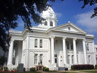
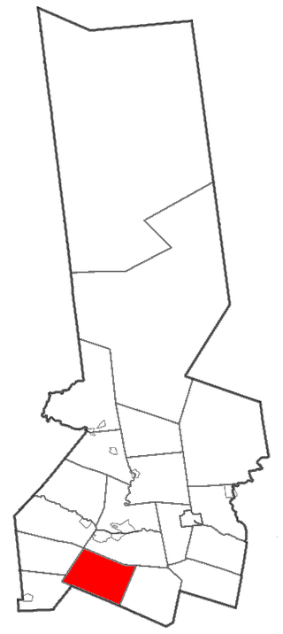
Colbert County is a county located in the northwestern part of the U.S. state of Alabama. As of the 2020 census the county's population was 57,227. The county seat is Tuscumbia. The largest city is Muscle Shoals.

Coon Rapids is a city in Carroll and Guthrie counties in the U.S. state of Iowa. The population was 1,300 at the 2020 census, which is a decrease of 5 from the 2000 census. The small portion of Coon Rapids that lies in Guthrie County is part of the Des Moines–West Des Moines Metropolitan Statistical Area.

Coon Rapids is a northern suburb of Minneapolis, and is the second-largest city by population in Anoka County, Minnesota, United States. The population was 63,599 at the 2020 census, making it the fifteenth largest city in Minnesota and the seventh largest Twin Cities suburb.
Columbia is a town in Herkimer County, New York, United States. As of the 2020 census, the town population was 1,569. The town is at the southern border of the county and is southeast of Utica.

Magna is a city in Salt Lake County, Utah, United States. The current population of the city stands at 29,251 according to the 2020 census, a 10.4% increase over 26,505 in 2010.

Coon Valley is a village in Vernon County, Wisconsin, United States. The population was 758 at the 2020 census. Coon Valley was hit by the floods ravaging Wisconsin in 2018.

Christopher Andrew Coons is an American lawyer and politician serving since 2010 as the junior United States senator from Delaware. A member of the Democratic Party, Coons served as the county executive of New Castle County from 2005 to 2010.

Franklin Mountains State Park is a state park in El Paso, Texas, United States. The park is named after the Franklin Mountains, a mountainous range that extends 23 mi (37 km) from El Paso to New Mexico. Its headquarters are located at an elevation of 5,426 feet (1,654 m) with the highest peak, North Franklin Mountain, reaching 7,192 feet (2,192 m). Covering 24,247.56 acres (9,813 ha), it is one of the largest urban parks in the U.S. lying completely within city limits. The park is open year-round for recreational activities such as hiking, mountain biking, picnicking, and scenic driving.

The Copper Mountains are a mountain range in Elko County, Nevada, United States.
Seth is an unincorporated community and coal town in Boone County, West Virginia, United States. Seth is located on West Virginia Route 3, 11 miles (18 km) east-northeast of Madison. Seth has a post office with ZIP code 25181.
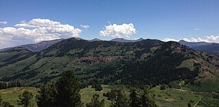
Coon Creek Peak is a mountain in northern Elko County, Nevada, about 4 miles southwest of the community of Jarbidge. It is considered to be the most northeasterly peak of the Copper Mountains. Located a few miles west of the main crest of the Jarbidge Mountains, it is located within the Jarbidge Ranger District of the Humboldt-Toiyabe National Forest. The main road entering Jarbidge from the south, Charleston-Jarbidge Road, runs along the western slopes of the mountain as it travels between Coon Creek Summit and Bear Creek Summit, providing close vehicular access to the summit of Coon Creek Peak.
Coon Butt is a summit in Blount County, Tennessee, in the United States. It is located within Great Smoky Mountains National Park. With an elevation of 2,326 feet (709 m), Coon Butt is the 422nd highest mountain of Tennessee.

Hawk Mountain is a mountain located in the Catskill Mountains of New York northeast of Hancock. Jehu Mountain is located southeast, Point Mountain is located southwest, and Coon Hill is located west of Hawk Mountain.
Point Mountain is a mountain located in the Catskill Mountains of New York south of Hancock. Hawk Mountain is located northeast, Jehu Mountain is located east, McCoys Knob is located south-southeast and Coon Hill is located north of Point Mountain.
Jehu Mountain is a mountain located in the Catskill Mountains of New York east of Hancock. Hawk Mountain is located northwest and Coon Hill is located northwest of Jehu Mountain.
Red Hill is a mountain located in the Catskill Mountains of New York east-south of Frost Valley. Woodhull Mountain is located northeast of Red Hill.
Gallis Hill is a 794-foot-tall (242 m) mountain in the Catskill Mountains region of New York. It is located northwest of Kingston in Ulster County. Jockey Hill is located north-northeast, and Morgan Hill is located west of Gallis Hill. In 1927, the Conservation Department built a steel fire lookout tower on the mountain. In 1950, the tower was closed and disassembled then moved to Overlook Mountain, where it still remains today.
Leonard Hill is a 2,592-foot-tall (790 m) mountain in Schoharie County, New York. It is located east-southeast of North Blenheim. Safford Hill is located northwest and Hubbard Hill is located southeast of Leonard Hill. In 1948, the Conservation Commission built an 80-foot-tall (24 m) steel fire lookout tower on the mountain. The tower ceased fire watching operations at the end of the 1988 season and was officially closed in early 1989. The tower remains on the summit, but is closed to the public. A local group is planning to restore the tower and reopen it to the public.
The Indid race was a supposed sub-race in the context of a now-outdated model of dividing humanity into different races which was developed originally by Europeans in support of colonialism. In 19th and early 20th century anthropological literature, the Indid type was classified as belonging to the Mediterranean type of the greater Caucasoid race.

