Coosha | |
Nearest city | Lizelia, Mississippi |
---|---|
Area | 14 acres (5.7 ha) |
NRHP reference No. | 78001608 [1] |
Added to NRHP | November 21, 1978 |
Coosha, also commonly known as Coosha Town, is a former settlement of the Choctaw Nation in Lauderdale County, Mississippi. It was a member of the larger community known commonly as the "Coosha towns," which made up part of the Eastern division of the Choctaw Nation in pre-colonial America. The village, which has been abandoned since the mid-nineteenth century, was listed on the National Register of Historic Places (NRHP) in 1978. [1]
The name "Coosha" is derived from the Choctaw "Kushak" or "Kusha", meaning "reed" or sometimes "reed-brake" because most of the area around the headwaters of the Chickasawhay River was covered in reed-brake before European settlers arrived. The reeds were so tall that the native Choctaw were able to and often would hide horses stolen from plantations by white thieves, prompting a creek nearby Coosha to be named "Issuba in Kannia bok" (English: "Lost Horse Creek"). [2] The most common English transliteration of the name is probably "Koonsha", but the town's name is sometimes also spelled "Coucha", "Kunshak", "Coonsha", "Conshaques", or "Concha". [2] [3] The National Register Information System, a database of listings on the National Register of Historic Places, uses the spelling "Coosha." [1]
Coosha is listed as "Concha" on Jean Baptiste Bourguignon d'Anville's map of 1732 [4] and Baron de Crenay's map of 1733 [5] and as "Coosha" on Bernard Romans's map of 1775. [2] On the 1820 map "Louisiana and Mississippi" by Henry Schenck Tanner, it is shown as "Koomsha Town." [6] On John R. Swanton's 1931 map included in his book Source Material for the Social and Ceremonial Life of the Choctaw Indians, the town's name is spelled "Kunshak."
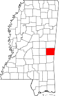
Though Coosha appears on many early maps, the precise location of the settlement is not well documented. Richelle Putnam states in Lauderdale County, Mississippi: A Brief History (2011) that the site is located near present-day Naval Air Station Meridian, close to Daleville, Mississippi. [3] The Publications of the Mississippi Historical Society in 1902 locates the settlement four miles southeast of "Old Daleville," now known as Lizelia, Mississippi. [2] Both sources claim the settlement was located near Lost Horse Creek, a tributary of Ponta Creek. The settlement extended along a bluff for approximately 1 mile (1.6 km) to 2.5 miles (4.0 km) along Lost Horse Creek. Two prongs of the creek–one from the west and one from the south–join "in the northeast corner of section 30, township 8, range 16, east"; [2] Coosha was located on the north side of the west prong. When the site was added to the National Register of Historic Places in 1978, it was listed with a restricted address to prevent looters from robbing the site of its archaeological artifacts. [1]
Some of the confusion around the naming and the location of the village may be attributed to the fact that there may have been multiple villages with the same name in the area. [7] Other towns located along the Ponta Creek were also called the "Coosha towns" or "Concha towns" in general, [2] so some early writers may have conflated the general term with the specific village.
Coosha dates back to at least the 18th century, possibly further. [3] When Henry B. Collins excavated the site in 1925, he found graves which he dated to the period between 1800 and 1830. [8] [9] Artifacts extracted from the site have been dated as far back as 500 BCE, but the Choctaw that lived here during Coosha's existence were likely the first humans to inhabit the area "since Alexander times," according to the site's NRHP nomination form. [8]
The Choctaws coalesced as a nation in the 16th and 17th centuries as a mixture of previous Mississippian cultures. According to Patricia Galloway, the Choctaw region of Mississippi was slowly occupied by Burial Urn people from the Bottle Creek Indian Mounds area in the Mobile, Alabama delta, along with remnants of people from the Moundville chiefdom (near present-day Tuscaloosa, Alabama), which had collapsed in the mid-14th century. Facing severe depopulation due to European diseases, the two groups fled westward, where they came upon the Plaquemines and a group of “prairie people” living near the area. In the space of several generations, the combination of these individual groups created a new society which became known as Choctaw. [10]
By the turn of the 18th century, the Choctaw had divided (politically) into three main districts. [11] The Burial Urn people were likely the first inhabitants of the Coosha and Chickasawhay towns, which together made up the Eastern District, and the Plaquemines and prairie people inhabited what is today considered the southern district, more commonly known as the Six Towns District. [12] A third collection of tribes, mostly Black Prairie Muskogeans, made up what would be called the Western District. [11]
The Coosha towns in the Eastern District numbered about forty or fifty. [13] At its peak, the Coosha village itself had a population of approximately 1200 people. [3] The village was home to orchards of peaches and plums and contained fauna such as bear, deer, turkey, squirrels, and wild cats. [2] Small gardens containing maize were dispersed throughout the hamlets of the village. [3]
Perhaps the most notable person to be associated with the village is the chief Pushmataha, who served as mingo of the Coosha towns for a short period. [2] [3] Oklahoma, the nephew of Pushmataha, succeeded Pushmataha as mingo, and upon his death in 1846, the town of Coosha seems to have been deserted. [3]
The Choctaw are a Native American people originally based in the Southeastern Woodlands, in what is now Alabama and Mississippi. Their Choctaw language is a Western Muskogean language. Today, Choctaw people are enrolled in three federally recognized tribes: the Choctaw Nation of Oklahoma, Mississippi Band of Choctaw Indians, and Jena Band of Choctaw Indians in Louisiana.
Choctaw County is a county located in the southwestern portion of the U.S. state of Alabama. As of the 2020 census, the population was 12,665. The county seat is Butler. The county was established on December 29, 1847, and named for the Choctaw tribe of Native Americans.
Lauderdale County is a county located on the eastern border of the U.S. state of Mississippi. As of the 2020 census, the population was 72,984. The county seat is Meridian. The county is named for Colonel James Lauderdale, who was killed at the Battle of New Orleans in the War of 1812. Lauderdale County is included in the Meridian, MS Micropolitan Statistical Area.
Shubuta is a town in Clarke County, Mississippi, United States, which is located on the eastern border of the state. The population was 441 as of the 2010 census, down from 651 at the 2000 census. Developed around an early 19th-century trading post on the Chickasawhay River, it was built near a Choctaw town. Shubuta is a Choctaw word meaning "smokey water".
Antlers is a city in and the county seat of Pushmataha County, Oklahoma, United States. The population was 2,453 at the 2010 census, a 3.9 percent decline from 2,552 in 2000. The town was named for a kind of tree that becomes festooned with antlers shed by deer, and is taken as a sign of the location of a spring frequented by deer.
Charley's Trace is a former Native American trail to the Mississippi River.
The Chunky River is a short tributary of the Chickasawhay River in east-central Mississippi. Via the Chickasawhay, it is part of the watershed of the Pascagoula River, which flows into the Gulf of Mexico.
Mushulatubbee was the chief of the Choctaw Okla Tannap, one of the three major Choctaw divisions during the early 19th century. When the Principal Chief Greenwood LeFlore stayed in Mississippi at the time of removal, Mushulatubbee was elected as principal chief, leading the tribe to Indian Territory.
The Chickasawhay River is a river, about 210 miles (340 km) long, in southeastern Mississippi in the United States. It is a principal tributary of the Pascagoula River, which flows to the Gulf of Mexico. The Chickasawhay's tributaries also drain a portion of western Alabama. The name "Chickasawhay" comes from the Choctaw word chikashsha-ahi, literally "Chickasaw potato".
Pushmataha, the "Indian General", was one of the three regional chiefs of the major divisions of the Choctaw in the 19th century. Many historians considered him the "greatest of all Choctaw chiefs". Pushmataha was highly regarded among Native Americans, Europeans, and white Americans, for his skill and cunning in both war and diplomacy.
Apuckshunubbee was one of three principal chiefs of the Choctaw Native American tribe in the early nineteenth century, from before 1800. He led the western or Okla Falaya District of the Choctaw, of which the eastern edge ran roughly southeast from modern Winston County to Lauderdale County, then roughly southwest to Scott County, then roughly south-southeast to the western edge of Perry County. His contemporaries were Pushmataha and Moshulatubbee, who respectively led the southern district Okla Hannali and the north-eastern district Okla Tannap.
The Plaquemine culture was an archaeological culture centered on the Lower Mississippi River valley. It had a deep history in the area stretching back through the earlier Coles Creek and Troyville cultures to the Marksville culture. The Natchez and related Taensa peoples were their historic period descendants. The type site for the culture is the Medora site in Louisiana; while other examples include the Anna, Emerald, Holly Bluff, and Winterville sites in Mississippi.
This is a list of the National Register of Historic Places listings in Choctaw County, Oklahoma.
This is a list of the National Register of Historic Places listings in Creek County, Oklahoma.
This is a list of the National Register of Historic Places listings in LeFlore County, Oklahoma.
This is a list of the National Register of Historic Places listings in Latimer County, Oklahoma.
The Pushmataha County Historical Society is a historical society devoted to collecting and preserving the history of Pushmataha County, Oklahoma, United States. It is headquartered in the historic Frisco Depot in Antlers, Oklahoma, which it operates as a public museum.
Foster's Mound is a Plaquemine culture archaeological site located in Adams County, Mississippi northeast of Natchez off US 61. It is the type site for the Foster Phase of the Natchez Bluffs Plaquemine culture chronology. It was added to the NRHP on September 2, 1982 as NRIS number 82003091. The mounds are listed on the Mississippi Mound Trail.
The Mazique Archeological Site, also known as White Apple Village, is a prehistoric Coles Creek culture archaeological site located in Adams County, Mississippi. It is also the location of the historic period White Apple Village of the Natchez people and the Mazique Plantation. It was added to the NRHP on October 23, 1991, as NRIS number 91001529.
Alamucha is an unincorporated community in Lauderdale County, Mississippi, United States.