
The Gemfields is a former locality in the Central Highlands Region, Queensland, Australia. In the 2016 census, The Gemfields had a population of 1,449 people.

Rubyvale is a rural town and locality in the Central Highlands Region, Queensland, Australia. In the 2016 census, the town of Rubyvale had a population of 640 people.
Sapphire Central is a rural locality in the Central Highlands Region, Queensland, Australia. The town of Sapphire is within the locality. Sapphires are mined extensively in the area. At the 2021 census, the locality had a population of 1214 people.
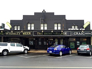
Emerald is a rural town and locality in the Central Highlands Region, Queensland, Australia. The locality had a population of 14,904 people at the 2021 census.

Clermont is a rural town and locality in the Isaac Region, Queensland, Australia. At the 2021 census, the locality of Clermont had a population of 2952 people.
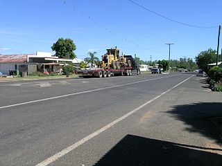
Rolleston is a rural town and locality in the Central Highlands Region, Queensland, Australia. In the 2016 census, the locality of Rolleston had a population of 309 people.
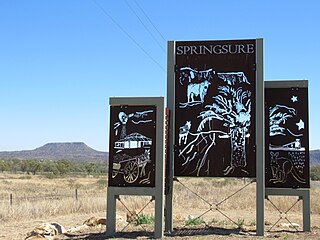
Springsure is a town and a locality in the Central Highlands Region, Queensland, Australia. It is 66 kilometres (41 mi) south of Emerald on the Gregory Highway. It is the southern terminus of the Gregory Highway and the northern terminus of the Dawson Highway. It is 765 kilometres (475 mi) northwest of Brisbane. At the 2021 census, Springsure had a population of 950 people.

Capella is a rural town and locality in the Central Highlands Region, Queensland, Australia. At the 2021 census the locality of Capella had a population of 974 people.
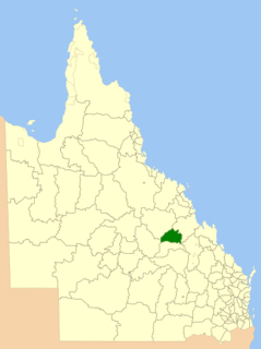
The Shire of Peak Downs was a local government area in the Central Highlands of Queensland, Australia, 320 km west of both Rockhampton and Mackay. On 15 March 2008 the shires of Duaringa, Emerald, Bauhinia and Peak Downs were amalgamated to form the Central Highlands Region.

Tieri is a small mining town and locality in the Central Highlands Region, Queensland, Australia. Established in 1983, the town like nearby Middlemount and Dysart, is a service centre for local coal mines. In the 2016 census, Tieri had a population of 1,129 people.
Mackenzie River is a locality in the Isaac Region, Queensland, Australia. In the 2016 census, Mackenzie River had a population of 71 people.
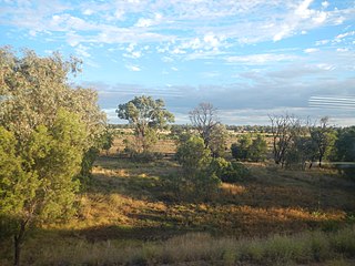
Comet is a historical rich rural town and locality in the Central Highlands Region, Queensland, Australia. In the 2016 census, the locality of Comet had a population of 498 people.
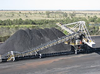
The Kestrel Coal Mine is an underground coal mine located in the Bowen Basin at Crinum, 51 km northeast of Emerald in Central Queensland, Australia. The mine has coal reserves amounting to 158 million tonnes of coking coal, one of the largest coal reserves in Asia and the world. The mine has an annual production capacity of 4 million tonnes of coal. Both hard/semi hard coking coal and thermal coal is mined.
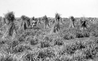
Gindie is a rural locality in the Central Highlands Region, Queensland, Australia. At the 2021 census, Gindie had a population of 232 people.

Lilyvale Stand Monument is a heritage-listed memorial at Lilyvale Road, Crinum, Central Highlands Region, Queensland, Australia. It was built in 1998. It was added to the Queensland Heritage Register on 2 April 2004.

Argyll is a rural locality in the Central Highlands Region, Queensland, Australia. At the 2021 census, Argyll had a population of 25 people,
Hibernia is a rural locality in the Central Highlands Region, Queensland, Australia. At the 2021 census, Hibernia had a population of 82 people.
Fork Lagoons is a rural locality in the Central Highlands Region, Queensland, Australia. At the 2021 census, Fork Lagoons had a population of 33 people.
Gordonstone is a rural locality in the Central Highlands Region, Queensland, Australia. At the 2021 census, Gordonstone had a population of 32 people.


