
The City of Port Adelaide Enfield, located across inner north and north-western suburbs of Adelaide, is one of the largest metropolitan councils within South Australia. It was established on 26 March 1996 by the amalgamation of the City of Port Adelaide and the City of Enfield.

The River Torrens, is the most significant river of the Adelaide Plains. It was one of the main reasons for the siting of the city of Adelaide, capital of South Australia. It flows 85 kilometres (53 mi) from its source in the Adelaide Hills near Mount Pleasant, across the Adelaide Plains, past the city centre and empties into Gulf St Vincent between Henley Beach South and West Beach. The upper stretches of the river and the reservoirs in its watershed supply a significant part of the city's water supply.

Yatala Labour Prison is a high-security men's prison located in the north-eastern part of the northern Adelaide suburb Northfield, South Australia. It was built in 1854 to enable prisoners to work at Dry Creek, quarrying rock for roads and construction. Originally known as The Stockade of Dry Creek or just The Stockade, it acquired its current name from a local Kaurna word relating to inundation by water, which was used for the Hundred of Yatala.

The Port River is part of a tidal estuary located north of the Adelaide city centre in the Australian state of South Australia. It has been used as a shipping channel since the beginning of European settlement of South Australia in 1836, when Colonel Light selected the site to use as a port. Before colonisation, the Port River region and the estuary area were known as Yerta Bulti by the Kaurna people, and used extensively as a source of food and plant materials to fashion artefacts used in daily life.
The Field River is an urban watercourse located in the southern suburbs of Adelaide in the Australian state of South Australia.
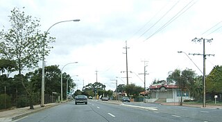
Northfield is a suburb of the greater Adelaide, South Australia area.

Dry Creek is a mostly industrial suburb north of Adelaide, containing significant wetlands. A substantial area was devoted to salt crystallisation pans until 2014, with plans to redevelop the site for housing.
Clearview is a suburb of Adelaide, South Australia about 8 km north of the Adelaide city centre. The rectangular suburb is bordered by Grand Junction Road on the north, Hampstead Road on the east, Collins Street, Broadview on the south, and the suburb of Enfield on the west.

The City of Enfield was a local government area of South Australia from 1868 to 1996. It was known as Yatala South up until 1933, which was named for its local government area predecessor, the District Council of Yatala, and known as Enfield thereafter.
Yatala Vale is an outer northeastern rural suburb of Adelaide, South Australia. It is located in the City of Tea Tree Gully local government area, and is adjacent to Golden Grove and Fairview Park, as well as the rural districts of Upper Hermitage and Gould Creek.
Upper Hermitage is an outer northeastern rural suburb of Adelaide, South Australia. It is located in the City of Tea Tree Gully and Adelaide Hills Council local government areas, and is adjacent to the rural districts of Yatala Vale and Gould Creek.

The Northfield railway line was a railway in northern Adelaide running Dry Creek and Northfield. The line branched east from the Gawler railway line just north of Dry Creek station. In earlier years, it saw mixed freight including livestock in and meat out of the Gepps Cross abattoirs and sale yards. In its later years, it was operated as part of the metropolitan passenger rail network and served three stations: Cavan, Pooraka, and Northfield.
Northfield railway station was located 14.3 km (9 mi) from Adelaide station.

Pooraka is a suburb in Adelaide, South Australia. It is 12 kilometres north of the central business district.
The District Council of Yatala was a local government area of South Australia established in 1853 and abolished in 1868.

The Hundred of Yatala is a cadastral unit of hundred in South Australia covering much of the Adelaide metropolitan area north of the River Torrens. It is one of the eleven hundreds of the County of Adelaide stretching from the Torrens in the south to the Little Para River in the north; and spanning from the coast in the west to the Adelaide foothills in the east. It is roughly bisected from east to west by Dry Creek. It was named in 1846 by Governor Frederick Robe, Yatala being likely derived from yartala, a Kaurna word referring to the flooded state of the plain either side of Dry Creek after heavy rain.
The District Council of Yatala North was a local government area of South Australia on the central Adelaide Plains from 1868 to 1933. It was split from the abolished District Council of Yatala on 18 June 1868. The council area ranged approximately from Dry Creek in the south to the Little Para River in the north.

The Hundred of Port Adelaide is a cadastral hundred covering the vicinity of Port Adelaide, Lefevre Peninsula and the coast of the central Adelaide Plains south of Gawler River and west of Port Wakefield Road. It is one of the eleven hundreds of the County of Adelaide and was named in 1846 by Governor Frederick Robe.
The Stockade railway station, the terminal station of the then Stockade railway line, was opened on 1 June 1857. It was built to service the colony's prisoner camp, and to transport bluestone mined by convicts to building projects in downtown Adelaide. After a century of service, it was closed in 1961, and the quarry area was later redeveloped as a park.
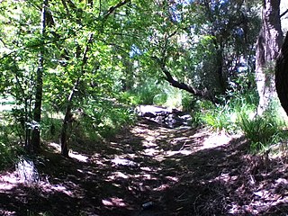
Stockade Botanic Park is a public reserve off Hoods Road in the City of Port Adelaide Enfield's suburb of Northfield. It was formerly associated with a prison quarry but has now been redesigned with water features, an amphitheatre, and picnic areas.


