
Tooele County is a county in the U.S. state of Utah. As of the 2020 United States Census, the population was 72,698. Its county seat and largest city is Tooele. The county was created in 1850 and organized the following year.

Wells is a town in Hamilton County, New York, United States. The population was 674 at the 2010 census. The town is named after Joshua Wells, a land agent, who built the first mills in the area. It is in the Adirondack Park and on the eastern border of the county. It is northwest of Schenectady.

Dugway is a census-designated place (CDP) in southeastern Tooele County, Utah, United States. The population was 2,016, at the 2000 census, a modest increase over the 1990 figure of 1,761. The town is located inside the United States Army's large weapons testing facility, Dugway Proving Ground, making it a closed city, as the only roads leading to the town pass through military checkpoints at the boundaries of the base. Non-resident civilians must request advance authorization to enter the town. The housing area designated for military and civilian personnel is referred to as "English Village."
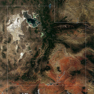
The Great Salt Lake Desert is a large dry lake in northern Utah, United States, between the Great Salt Lake and the Nevada border. It is a subregion of the larger Great Basin Desert, and noted for white evaporite Lake Bonneville salt deposits including the Bonneville Salt Flats.

Dugway Proving Ground (DPG) is a United States Army facility established in 1942 to test biological and chemical weapons, located about 85 miles (137 km) southwest of Salt Lake City, Utah and 13 miles (21 km) south of the 2,624-square-mile (6,800 km2) Utah Test and Training Range.

The Cedar Mountain Wilderness is located in northwestern Utah, United States, just south of Interstate 80. The vegetation on the upper elevations of the Cedar Mountains is dominated by junipers. The foothill and valley regions include mixed desert shrubs. Cheatgrass is prevalent over large areas burned by range fires. The remains of an aragonite mining camp can also be found in the foothills.
The Utah Test and Training Range (UTTR) is a Department of Defense military testing and training area located in Utah's West Desert, approximately 80 miles (130 km) west of Salt Lake City, Utah. UTTR is currently the largest contiguous block of over-land supersonic-authorized restricted airspace in the contiguous United States. The range, which has a footprint of 2,675 square miles (6,930 km2) of ground space and over 19,000 square miles (49,000 km2) of air space — about four-fifths the area of West Virginia—is divided into North and South ranges. Interstate 80 passes through a wide gap between the two sections of the range. The site is administered and maintained by the United States Air Force (USAF) HQ UTTR, formerly known as the 388th Range Squadron (388RANS) stationed at Hill Air Force Base, Utah. The East and West areas of the Dugway Proving Ground are contiguous with the South Area of the UTTR.
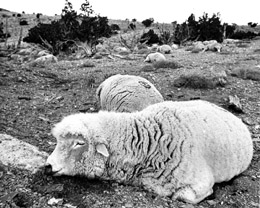
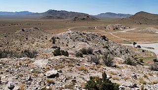
The Dugway sheep incident, also known as the Skull Valley sheep kill, was a March 1968 sheep kill that has been connected to United States Army chemical and biological warfare programs at Dugway Proving Ground in Utah. Six thousand sheep were killed on ranches near the base, and the popular explanation blamed Army testing of chemical weapons for the incident, though alternative explanations have been offered. A report, commissioned by Air Force Press Officer Jesse Stay and first made public in 1998, was called the "first documented admission" from the Army that a nerve agent killed the sheep at Skull Valley.

Michael Army Airfield (MAAF) is a military airport located at the Dugway Proving Ground and owned by the United States Army. It is 9 miles (14 km) west of the proving grounds barracks at Dugway, Tooele County, Utah, United States.
Bushnell Army Airfield is a former World War II United States Army Air Forces airfield located northeast of the intersection of Route 301 & Walker Avenue, one mile northeast of the town of Bushnell, Florida.
Simpson Springs is a spring, former Pony Express station, former Civilian Conservation Corps camp, and campground in southeast Tooele County, Utah, United States.

The Sevier Desert is a large arid section of central-west Utah, United States, and is located in the southeast of the Great Basin. It is bordered by deserts north, west, and south; its east border is along the mountain range and valley sequences at the perimeter of the Great Basin, with the large north–south Wasatch Range and its associated mountainous landforms. Its eastern border is specifically, the East Tintic, Gilson, and Canyon Mountains; also the massive Pahvant Range.

The Stansbury Mountains are a 28-mile (45 km) long mountain range located in eastern Tooele County, Utah. It is named for U.S. Army Major Howard Stansbury, a topographical engineer, who led an expedition that surveyed the region.
Skull Valley is a 40-mile (64 km) long valley located in east Tooele County, Utah, United States at the southwest of the Great Salt Lake. The valley trends north–south, but turns slightly northeast to meet Stansbury Bay,.
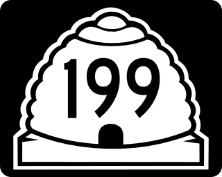
State Route 199 (SR-199) is a state highway in the U.S. state of Utah. Spanning 21.96 miles (35.34 km), it connects SR-196 and the Dugway Proving Ground with SR-36 between Rush Valley and the Deseret Chemical Depot.
The Sheeprock Mountains are a 24-mile (39 km) long mountain range located in extreme southeast Tooele County, Utah, and part of northeast Juab County. The range trends southeasterly and forms a section of the northeast perimeter of the large Sevier Desert, which lies southwest of the Sheeprock Mountains.
The Dugway Range is a 13-mile (21 km) long mountain range located in central-south Tooele County, Utah, on the Juab County north border.

The Newfoundland Mountains are a 20-mile (32 km) long mountain range located in southern Box Elder County, Utah, United States. The range is the only 'island' mountain range encircled by the Great Salt Lake Desert salt flat. Other ranges protrude into the desert salt flat, the Silver Island and Dugway Ranges being the premiere examples. Other individual mountains also arise as 'island' peaks, or mountains in the salt flat desert itself, most notably Granite Mountain in the south desert, and Wildcat Mountain to its north. Granite Mountain lies at the north of the Dugway Range.

West Branch Sacandaga River is a river in Hamilton County in the state of New York. It begins northwest of Benson and flows west then northward then eastward before converging with the Sacandaga River south of Wells.
Haystack Peak is a 12,020-foot elevation (3,664 m) mountain summit located in Juab County, Utah, United States.

