Elgin, Pennsylvania | |
|---|---|
 Town hall | |
 Location in Erie County and the U.S. state of Pennsylvania. | |
| Coordinates: 41°54′7″N79°44′41″W / 41.90194°N 79.74472°W | |
| Country | United States |
| State | Pennsylvania |
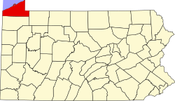
| County | Erie |
| Government | |
| • Mayor | Richard W. Patterson |
| Area | |
• Total | 1.47 sq mi (3.82 km2) |
| • Land | 1.47 sq mi (3.82 km2) |
| • Water | 0.00 sq mi (0.00 km2) |
| Elevation [2] (center of borough) | 1,388 ft (423 m) |
| Highest elevation [2] (western borough boundary) | 1,520 ft (460 m) |
| Lowest elevation [2] (Beaver Creek) | 1,360 ft (410 m) |
| Population | |
• Total | 204 |
| • Density | 138.40/sq mi (53.45/km2) |
| Time zone | UTC-4 (EST) |
| • Summer (DST) | UTC-5 (EDT) |
| ZIP code | 16407 |
| Area code | 814 |
Elgin is a borough in Erie County, Pennsylvania, United States. The population was 204 at the 2020 census. [4] It is part of the Erie Metropolitan Statistical Area. Places of recreation include Elgin Community Park. Elgin is home to the oldest borough building in Erie County.
Contents
The community most likely was named after Elgin, Scotland. [5]