Rampur is a town and the municipality headquarter of Rampur District in the Indian state of Uttar Pradesh. It was formerly known for its various industries, like sugar refining and cotton milling. Its library has more than 12,000 rare manuscripts and a fine collection of Mughal miniature paintings. It is located 322 kilometres north-west of the state capital Lucknow.

Bareilly is a city in Bareilly district in the Indian state of Uttar Pradesh. It is among the largest metropolises in Western Uttar Pradesh and is the centre of the Bareilly division as well as the historical region of Rohilkhand. The city lies in the Indo-Gangetic Plains, about 252 kilometres (157 mi) northwest of the state capital, Lucknow, and 265 kilometres (165 mi) east of the national capital, New Delhi. With a population of 903,668 in 2011, it is the eighth most populous city in the state, 17th in northern India and 54th in India. It is located on the bank of Ramganga River and is the site of the Ramganga Barrage built for canal irrigation.

The Bareilly district belongs to the state Uttar Pradesh in northern India. Its capital is Bareilly city and it is divided in six administrative division or tehsils: Aonla, Baheri, Bareilly city, Faridpur, Mirganj, and Nawabganj. The Bareilly district is a part of the Bareilly Division and occupies an area of 4120 km2 with a population of 4,448,359 people according to the census of 2011.

Shahjahanpur is a district of Uttar Pradesh India. It is a part of Bareilly division. It was established in 1813 by the British Government. Previously it was a part of district Bareilly. Geographically the main town is Shahjahanpur which is its headquarters. Its 4 Tehsils are: Powayan, Tilhar, Jalalabad and Sadar.

Moradabad district is one of the districts of Uttar Pradesh, India. The city of Moradabad is the district headquarters. Moradabad district is part of Moradabad division. It used to be the second most populous district of Uttar Pradesh out of 75 after Prayagraj till a new district Sambhal was carved out of it in 2011.
Nagina is a town and a municipal board in Bijnor district in the Indian state of Uttar Pradesh.
Kaimganj, also rendered as Qaimganj, is a town in Farrukhabad district in the Indian state of Uttar Pradesh. Kaimganj Railway Station is a major station between Farrukhabad and Kasganj on Rajputana railway link of North Eastern Railway.
Bilsi is a town and a municipal board in Badaun district in the state of Uttar Pradesh, India. It is located to the southwest of Bareilly and has its own tehsil. According to Census 2011 information the sub-district code of Bilsi block is 00780. Total area of Bilsi is 361 km2 including 332.13 km2 rural area and 28.60 km2 urban area. Bilsi has a population of 4,04,198 peoples. There are 67,758 houses in the sub-district. There are about 204 villages in Bilsi bloc
Patparganj is a locality situated in East Delhi District of the National Capital Territory of Delhi, India, and is located near the border with Uttar Pradesh.
Powayan or Pawayan is a town and a subdivisional headquarters in Shahjahanpur district in the Indian state of Uttar Pradesh, 27 km from Shahjahanpur, 47km from Tilhar. It is located in the fertile agricultural belt of Northern India and is 300 km from Delhi and 200 km from Lucknow.
Kargaina is a census town in Bareilly district in the Indian state of Uttar Pradesh.
Miranpur Katra is a Vidhan Sabha constituency in Tehsil Tilhar in the Indian state of Uttar Pradesh. The town is located 47 kilometres (30 mi) east of the Bareilly, on the main Lucknow–Delhi National Highway 24.Its situated at midpoint which is connecting 3 major cities Lucknow-Kanpur-Delhi Mr.Veer Vikram Singh is the current MLA from BJP. Mrs. Jamal Fatima is the current chairperson of Katra.

Kichha is oldest tehseel of Udham Singh Nagar district. It is older than Rudrapur city. It has its own municipal board, located in Udham Singh Nagar district, Uttarakhand, India.
Sahawar is a town and a nagar panchayat, as well as Tehsil in Kasganj district in the Indian State of Uttar Pradesh. Previously, it was part of district Etah. Ms. Nashi Khan D/o Mrs. Najeeba Khan Zeenat is the present chairperson of Sahawar Town. The Block Sahawar was established in 01/04/1958.
Faridpur is a town and a small Nagar Palika and tehsil in Bareilly district in the Indian state of Uttar Pradesh. Faridpur is known for zari work. It comes under 122 Legislative assembly. Current M.L.A. is Professor Shyam Bihari Lal and M.P. is Mr. Dharmendra Kashyap. Nagarpalika Chairman of Faridpur is Mr Sharaf Zari Wale
Shahi is a town and a nagar panchayat in Bareilly district in the Indian state of Uttar Pradesh.Shahi is the one of most old British town areas First Chairman of Town Shahi is Haji Nadir Shah khan in 1868 after him his Son Khan bahadur Mohammed Raza Khan is Chairman and M.L.A of bareilly he is also Chairman of district Board Bareilly, after Mohammed Raza Khan death his son Hamid Raza Khan is also became Chairman and M.L.A of Bhojipura Constituency he is a Famous politician after his death in 1989 Son of Hamid Raza Khan, Shahid Raza khan Became Chairman of Town Area Shahi for Almost 50 years

Auraiya district is one of the districts of Uttar Pradesh state of India, and Auraiya town is the district headquarters. It lies on the south-western portion of Uttar Pradesh and also forms a part of the Kanpur Division.
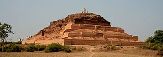
According to the epic Mahābhārata, Bareilly region (Panchala) is said to be the birthplace of Draupadi, who was also referred to as 'Panchali' by Kṛṣṇā. When Yudhishthira becomes the king of Hastinapura at the end of the Mahābhārata, Draupadi becomes his queen. The folklore says that Gautama Buddha had once visited the ancient fortress city of Ahicchattra in Bareilly. The Jain Tirthankara Parshva is said to have attained Kaivalya at Ahichhatra.

The Second Rohilla War was a conflict between the Kingdom of Awadh and East India Company, and the Rohillas of Rampur State in 1794.

Bareilly Cantonment is a cantonment town located in the Bareilly district of the north Indian state of Uttar Pradesh.


