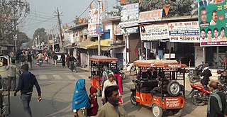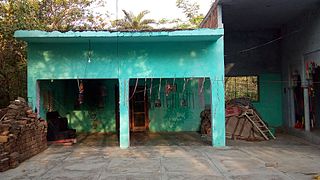
Baheri is a city and tehsil in Bareilly district in the northern Indian state of Uttar Pradesh. It is 48 kilometres (30 mi) from Bareilly city, district headquarter. It is geographically located near the lower reaches of Gaula river. The Town 300 kilometres (186 mi) north of the state capital, Lucknow, and 300 kilometres (186 mi) east of the national capital, New Delhi.
Barkhera is a town and a nagar panchayat in Pilibhit district in the Indian state of Uttar Pradesh.
Bilsanda is a town and nagar panchayat in the Pilibhit district of Uttar Pradesh, India.
Bilsi is a town and a municipal board in Badaun district in the state of Uttar Pradesh, India. It is located to the southwest of Bareilly and has its own tehsil. According to Census 2011 information the sub-district code of Bilsi block is 00780. Total area of Bilsi is 361 km2 including 332.13 km2 rural area and 28.60 km2 urban area. Bilsi has a population of 4,04,198 peoples. There are 67,758 houses in the sub-district. There are about 204 villages in Bilsi bloc
Deoranian is a town and a nagar panchayat in Bareilly district in the state of Uttar Pradesh, India.

Desur is a Town panchayat in Tiruvanamalai district in the Indian state of Tamil Nadu.
Fatehganj Purvi is a town and a nagar panchayat in Bareilly district in the state of Uttar Pradesh, India. It is situated on the NH-30 and is served by Bilpur railway station.

Gajraula is a city and municipal board in Amroha district in the state of Uttar Pradesh, India. Gajraula is also the headquarters of Gajraula block. It is located on NH 9, a four-lane highway connecting Uttarakhand and cities such as Bareilly and Lucknow via Delhi. It is a significant industrial hub in Uttar Pradesh and home to a number of multinational corporations, including Jubliant Life Sciences, RACL Geartech, and Israeli Pharma Teva API, as well as several engineering colleges. Moradabad, Meerut, Bulandsahar, Budaun, Hapur, and Delhi NCR are among the larger nearby cities.

Kichha is oldest tehseel of Udham Singh Nagar district. It is older than Rudrapur city. It has its own municipal board, located in Udham Singh Nagar district, Uttarakhand, India.

Milak is a city and a municipal board in Rampur district in the Indian state of Uttar Pradesh.In field of legal education there is one Law college at village Guladia Bhatt Milak–Bilaspur road in name of Rampur College of Law Milak imparting legal education among students in whole Rampur district. Also there are several inter college and 3 degree colleges nearby: Rambahadur Degree college, Shri Hansraj Degree College, Shri Hira Mahavidyalaya.
Mirganj is a town and a notified area in Gopalganj district in the Indian states of Bihar.
Rithora is a town and a nagar panchayat in Bareilly Tehsil of Bareilly district in the Indian state of Uttar Pradesh.
Sahawar is a town and a nagar panchayat, as well as Tehsil in Kasganj district in the Indian State of Uttar Pradesh. Previously, it was part of district Etah. Ms. Nashi Khan D/o Mrs. Najeeba Khan Zeenat is the present chairperson of Sahawar Town. The Block Sahawar was established in 01/04/1958.

Shaktifarm is a town and a nagar panchayat in Udham Singh Nagar district in the Indian state of Uttarakhand. Shaktifarm is the centre of many villages around here.
Shishgarh is a town and a nagar panchayat in Bareilly district in the Indian state of Uttar Pradesh.

Sitarganj is a city and a municipal board in Udham Singh Nagar district in the Indian state of Uttarakhand. Now it is home to the Integrated Industrial Estate Sitarganj (IIE) being developed by State Industrial Development Corporation of Uttarakhand Limited (SIDCUL).

Ujhani is an industry-based city and a municipal board in Badaun district in the Indian state of Uttar Pradesh.
Shahi is a town and a nagar panchayat in Bareilly district in the Indian state of Uttar Pradesh.Shahi is the one of most old British town areas First Chairman of Town Shahi is Haji Nadir Shah khan in 1868 after him his Son Khan bahadur Mohammed Raza Khan is Chairman and M.L.A of bareilly he is also Chairman of district Board Bareilly, after Mohammed Raza Khan death his son Hamid Raza Khan is also became Chairman and M.L.A of Bhojipura Constituency he is a Famous politician after his death in 1989 Son of Hamid Raza Khan, Shahid Raza khan Became Chairman of Town Area Shahi for Almost 50 years

Gaini is a village in Aonla tehsil, Bareilly district, Uttar Pradesh, India. Gaini is located at 28.21°N 79.16°E. Gaini is 22 kilometer west from the bareilly railway junction.

Sainthal is a nagar panchayat in Nawabganj tehsil, Bareilly district, Uttar Pradesh, India.


