Fedje Municipality Fedje kommune | |
---|---|
Coordinates: 60°46′08″N04°43′50″E / 60.76889°N 4.73056°E | |
Country | Norway |
County | Vestland |
District | Nordhordland |
Established | 1 Jan 1947 |
• Preceded by | Austrheim Municipality |
Administrative centre | Fedje |
Government | |
• Mayor (2015) | Stian Herøy (H) |
Area | |
• Total | 9.27 km2 (3.58 sq mi) |
• Land | 8.95 km2 (3.46 sq mi) |
• Water | 0.32 km2 (0.12 sq mi) 3.6% |
• Rank | #354 in Norway |
Population (2023) | |
• Total | 513 |
• Rank | #350 in Norway |
• Density | 57.3/km2 (148/sq mi) |
• Change (10 years) | −9.8% |
Demonym | Fedjing [1] |
Official language | |
• Norwegian form | Nynorsk |
Time zone | UTC+01:00 (CET) |
• Summer (DST) | UTC+02:00 (CEST) |
ISO 3166 code | NO-4633 [3] |
Website | Official website |
Fedje is an island municipality in the Nordhordland region of Vestland county, Norway. The administrative centre of the municipality is the village of Fedje. The traditional economic activity of the inhabitants is fishing.
The 9-square-kilometre (3.5 sq mi) municipality is the 354th largest by area out of the 356 municipalities in Norway. Fedje is the 350th most populous municipality in Norway with a population of 513. The municipality's population density is 57.3 inhabitants per square kilometre (148/sq mi) and its population has decreased by 9.8% over the previous 10-year period. [4] [5] The municipality consists of the main island of Fedje which is also surrounded by about 125 smaller islands and rocks mostly north of the main island. The name Fedje applies both to the main island, the main village, and to all the islands and rocks as a whole municipality.
In 2016, the chief of police for Vestlandet formally suggested a reconfiguration of police districts and stations. He proposed that the police station in Fedje be closed. [6]
Historically, the islands of Fedje belonged to the prestegjeld of Lindås. In 1910, the northwestern part of Lindås was separated to become the new Austrheim Municipality (which included Fedje). On 1 January 1947, all of Austrheim located west of the Fedjefjorden (population: 920) was separated to become the new municipality of Fedje. [7]
The municipality (originally the parish) is named after the old Fedje farm (Old Norse : Feðjar) since the first Fedje Church was built there. The name comes from the word faþa (Gothic : 𐍆𐌰𐌸𐌰) which means "fence" or "wall". The meaning here refers to a row of islands or archipelago, separating the inshore waters (now called the Fedjefjorden) from the ocean. [8]
The coat of arms was granted on 13 July 1990. The official blazon is "Azure, two oars argent in bend issuant from the base sinister" (Norwegian : På blå grunn to skrått framveksande sølv årar). This means the arms have a blue field (background) and the charge is a pair of oars aligned diagonally one above the other. The charge has a tincture of argent which means it is commonly colored white, but if it is made out of metal, then silver is used. This symbolizes the rich boating history of this island municipality. The arms were designed by DESIGNER. The municipal flag has the same design as the coat of arms. [9] [10] [11]
The Church of Norway has one parish (sokn) within the municipality of Fedje. It is part of the Nordhordland prosti (deanery) in the Diocese of Bjørgvin.
Parish (sokn) | Church name | Location of the church | Year built |
---|---|---|---|
Fedje | Fedje Church | Fedje | 1941 |
Fedje has an elementary school, and a junior high school, both of which are situated in the center of the island, and in the same building. The school is also used as a movie theater twice a week.
There are traces of human activity on Fedje from as long as 4,000 years ago. In the 18th century, the village of Fedje was an important trading place, with the small island of Kræmmerholmen being the location where the trading took place. Kræmmerholmen was reopened in 1991, and was a restaurant/hotel/museum area, but closed in September 2008. Fedje was previously a substantial producer of peat. The peat led to the construction of a railway. The railway was given up together with the peat industry in 1920.
During the Second World War Fedje was occupied by over 300 German soldiers. There are still remains of the German cannons and bunkers all over the island, especially in the western part close to the traffic station, which is actually built on the remains of a German radar station.
In February 1945, the German U-boat U-864 was sunk by the Royal Navy submarine HMS Venturer outside western Fedj, the only instance in history of a submarine being sunk by another submarine while both were submerged. The wreck of the U-boat was discovered in 2003 lying in 150 metres (490 ft) of water, 2 nmi (3.7 km; 2.3 mi) west of Fedje. [12] Its cargo included 67 short tons (61 t) of mercury which was being shipped to Japan. Contained in 1,857 rusting steel bottles in the vessel's keel, the mercury was discovered to be leaking out and currently poses a severe environmental threat. The rusting mercury bottles, the delicate condition of the wreck, and the presence of live torpedoes aboard it make the raising or salvage of U-864 extremely hazardous, and it has instead been proposed that the wreck be entombed. [13]
On 12 January 2007, M/V Server sunk outside Fedje. The ship leaked oil and caused major environmental damage. But due to intensive efforts to clean the coves and beaches, very few traces can be found today.
Historical population | ||||||||||
---|---|---|---|---|---|---|---|---|---|---|
Year | 1947 | 1951 | 1960 | 1970 | 1980 | 1990 | 2000 | 2010 | 2020 | 2023 |
Pop. | 920 | 940 | 932 | 873 | 849 | 730 | 682 | 594 | 548 | 513 |
±% p.a. | — | +0.54% | −0.09% | −0.65% | −0.28% | −1.50% | −0.68% | −1.37% | −0.80% | −2.18% |
Source: Statistics Norway [4] [14] and Norwegian Historical Data Centre [15] |
Fedje Municipality is responsible for primary education (through 10th grade), outpatient health services, senior citizen services, welfare and other social services, zoning, economic development, and municipal roads and utilities. The municipality is governed by a municipal council of directly elected representatives. The mayor is indirectly elected by a vote of the municipal council. [16] The municipality is under the jurisdiction of the Hordaland District Court and the Gulating Court of Appeal.
The municipal council (Kommunestyre) of Fedje is made up of 15 representatives that are elected to four year terms. The tables below show the current and historical composition of the council by political party.
Party name (in Nynorsk) | Number of representatives | |
---|---|---|
Labour Party (Arbeidarpartiet) | 6 | |
Progress Party (Framstegspartiet) | 2 | |
Conservative Party (Høgre) | 5 | |
Total number of members: | 15 |
Party name (in Nynorsk) | Number of representatives | |
---|---|---|
Labour Party (Arbeidarpartiet) | 6 | |
Progress Party (Framstegspartiet) | 3 | |
Conservative Party (Høgre) | 6 | |
Total number of members: | 15 |
Party name (in Nynorsk) | Number of representatives | |
---|---|---|
Labour Party (Arbeidarpartiet) | 3 | |
Progress Party (Framstegspartiet) | 2 | |
Conservative Party (Høgre) | 5 | |
Christian Democratic Party (Kristeleg Folkeparti) | 4 | |
The Democrats (Demokratane) | 1 | |
Total number of members: | 15 |
Party name (in Nynorsk) | Number of representatives | |
---|---|---|
Labour Party (Arbeidarpartiet) | 5 | |
Progress Party (Framstegspartiet) | 2 | |
Conservative Party (Høgre) | 4 | |
Christian Democratic Party (Kristeleg Folkeparti) | 3 | |
The Democrats (Demokratane) | 1 | |
Total number of members: | 15 |
Party name (in Nynorsk) | Number of representatives | |
---|---|---|
Labour Party (Arbeidarpartiet) | 6 | |
Progress Party (Framstegspartiet) | 3 | |
Conservative Party (Høgre) | 3 | |
Christian Democratic Party (Kristeleg Folkeparti) | 4 | |
The Democrats (Demokratane) | 1 | |
Total number of members: | 17 |
Party name (in Nynorsk) | Number of representatives | |
---|---|---|
Labour Party (Arbeidarpartiet) | 4 | |
Progress Party (Framstegspartiet) | 3 | |
Conservative Party (Høgre) | 4 | |
Christian Democratic Party (Kristeleg Folkeparti) | 4 | |
The Democrats (Demokratane) | 2 | |
Total number of members: | 17 |
Party name (in Nynorsk) | Number of representatives | |
---|---|---|
Labour Party (Arbeidarpartiet) | 4 | |
Progress Party (Framstegspartiet) | 3 | |
Conservative Party (Høgre) | 5 | |
Christian Democratic Party (Kristeleg Folkeparti) | 5 | |
Total number of members: | 17 |
Party name (in Nynorsk) | Number of representatives | |
---|---|---|
Labour Party (Arbeidarpartiet) | 5 | |
Progress Party (Framstegspartiet) | 3 | |
Conservative Party (Høgre) | 4 | |
Christian Democratic Party (Kristeleg Folkeparti) | 5 | |
Total number of members: | 17 |
Party name (in Nynorsk) | Number of representatives | |
---|---|---|
Labour Party (Arbeidarpartiet) | 5 | |
Progress Party (Framstegspartiet) | 2 | |
Conservative Party (Høgre) | 5 | |
Christian Democratic Party (Kristeleg Folkeparti) | 5 | |
Total number of members: | 17 |
Party name (in Nynorsk) | Number of representatives | |
---|---|---|
Labour Party (Arbeidarpartiet) | 6 | |
Conservative Party (Høgre) | 6 | |
Christian Democratic Party (Kristeleg Folkeparti) | 5 | |
Total number of members: | 17 |
Party name (in Nynorsk) | Number of representatives | |
---|---|---|
Labour Party (Arbeidarpartiet) | 6 | |
Conservative Party (Høgre) | 6 | |
Christian Democratic Party (Kristeleg Folkeparti) | 4 | |
Liberal People's Party (Liberale Folkepartiet) | 1 | |
Total number of members: | 17 |
Party name (in Nynorsk) | Number of representatives | |
---|---|---|
Labour Party (Arbeidarpartiet) | 6 | |
Conservative Party (Høgre) | 5 | |
Christian Democratic Party (Kristeleg Folkeparti) | 4 | |
New People's Party (Nye Folkepartiet) | 2 | |
Total number of members: | 17 |
Party name (in Nynorsk) | Number of representatives | |
---|---|---|
Labour Party (Arbeidarpartiet) | 4 | |
Conservative Party (Høgre) | 2 | |
Christian Democratic Party (Kristeleg Folkeparti) | 3 | |
New People's Party (Nye Folkepartiet) | 2 | |
Centre Party (Senterpartiet) | 1 | |
Non-party women's list (Upolitisk Kvinneliste) | 1 | |
Total number of members: | 13 |
Party name (in Nynorsk) | Number of representatives | |
---|---|---|
Labour Party (Arbeidarpartiet) | 3 | |
Liberal Party (Venstre) | 6 | |
Local List(s) (Lokale lister) | 4 | |
Total number of members: | 13 |
Party name (in Nynorsk) | Number of representatives | |
---|---|---|
Labour Party (Arbeidarpartiet) | 2 | |
Christian Democratic Party (Kristeleg Folkeparti) | 4 | |
Liberal Party (Venstre) | 4 | |
Local List(s) (Lokale lister) | 3 | |
Total number of members: | 13 |
Party name (in Nynorsk) | Number of representatives | |
---|---|---|
Local List(s) (Lokale lister) | 13 | |
Total number of members: | 13 |
Party name (in Nynorsk) | Number of representatives | |
---|---|---|
Local List(s) (Lokale lister) | 13 | |
Total number of members: | 13 |
Party name (in Nynorsk) | Number of representatives | |
---|---|---|
Local List(s) (Lokale lister) | 13 | |
Total number of members: | 13 |
Party name (in Nynorsk) | Number of representatives | |
---|---|---|
Local List(s) (Lokale lister) | 12 | |
Total number of members: | 12 |
Party name (in Nynorsk) | Number of representatives | |
---|---|---|
Local List(s) (Lokale lister) | 12 | |
Total number of members: | 12 |
The mayors (Nynorsk : ordførar) of Fedje: [34]
The highest point on Fedje is the 42-metre (138 ft) high hill called Fedjebjørnen. The largest lake is Storevatnet.
Other than the main island of Fedje, the best known smaller island is called Holmengrå . Holmengrå is the site of the 35-metre (115 ft) tall Holmengrå Lighthouse. In the southern part of Fedje which is called Stormark, there is a lighthouse called Hellisøy Lighthouse, maybe the most famous feature of Fedje. Hellisøy Lighthouse was built in 1855. The 32.3-metre (106 ft) tall tower is painted red and white. The islands of Fedje are all located on the western side of the Fedjefjorden.
The population of the island community is decreasing due to the high percentage of people over 60 years (25% as of 1 January 2003), and because many people decide to move from the island, many because of the lack of work.
Most of the people live on the lagoon-like northern part of the island in the village of Fedje where there is a grocery store, Fedje Church, and the ferry quay. Fedje used to be inhabited by fishermen and whalers. These days many are working on commercial ships or in the oil industry. By doing so they can still live on the island without having to work there.
The main sporting activity on Fedje is football, which can be played on the football grounds in the eastern part of the island. The football ground is also the home ground of the local football team called Fedje A-lag. The club is currently playing in the Norwegian 6th division. Swimming is also popular, as there is a beautiful beach located on Fedje, which is to be found in the centre of the island on the shoreline of Lake Husavatnet. The water is clean and brackish, as it has a small opening to the sea which makes the tide flush it with sea water from time to time.
Fedje Vessel Traffic Service Centre has been operating since 1 September 1992. It surveys the coast to allow safe passage to Mongstad and Sture. It also serves as a pilot station. [35] Next to the station is Fedje Heliport, Høgden.
The island is supplied with power, telephone, and internet cables from an underwater cordless router to the mainland. A ferry, crossing 20 times a day, connects Fedje to the mainland. The voyage lasts for about 30 minutes. Fedje is about a 1-hour 40 minute drive (including a 30-minute ferry voyage) from the city of Bergen.
Kvitsøy is an island municipality in Rogaland county, Norway. At only 6.29-square-kilometre (2.43 sq mi), it is the smallest municipality in Norway by area and one of the smallest by population. Kvitsøy is located in the traditional district of Ryfylke. The administrative centre of the municipality is the village of Ydstebøhamn on the island of Kvitsøy. The municipality is an archipelago located at the entrance to the large Boknafjorden. It sits about 2 nautical miles northwest of the mainland Stavanger peninsula.
Etne is a municipality in Vestland county, Norway. It is located in the traditional district of Sunnhordland, although it is also sometimes considered to be part of the district of Haugaland. The administrative centre of the municipality is the village of Etnesjøen. Other villages in the municipality include Skånevik and Fjæra. The two largest villages in the municipality are Etnesjøen with 1,159 residents and Skånevik with 594 residents.
Sveio is a municipality in Vestland county, Norway. Sveio is a border district that is sometimes considered to be located in the traditional district of Haugalandet since it is located on the Haugalandet peninsula, but it is also considered to be in the traditional district of Sunnhordland since it is located in southern Hordaland county. The administrative centre of the municipality is the village of Sveio. Other villages in the municipality include Auklandshamn, Førde, Våga, and Valevåg.
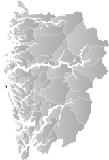
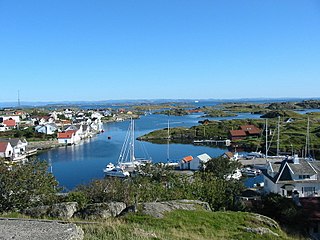
Fitjar is a municipality in Vestland county, Norway. The municipality is located in the traditional district of Sunnhordland. Fitjar municipality includes the northern part of the island of Stord and the hundreds of surrounding islands, mostly to the northwest of the main island. The administrative centre of the municipality is the village of Fitjar.
Tysnes is a municipality in Vestland county, Norway. It is located in the traditional district of Sunnhordland. The administrative centre is the village of Uggdal. Other population centres in Tysnes include the villages of Våge and Onarheim. The island municipality is located in a group of islands near the mouth of the Hardangerfjorden. The majority of the municipal population lives on the island of Tysnesøya, the largest island in the municipality.
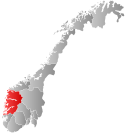
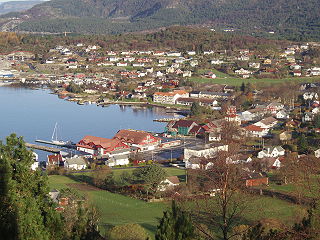
Eidfjord is a municipality in Vestland county, Norway. The municipality is located in the traditional district of Hardanger. The administrative centre of the municipality is the village of Eidfjord, where the majority of the municipal population lives. The other major population centre in the municipality is the village of Øvre Eidfjord.
Ulvik is a municipality in Vestland county, Norway. The municipality stretches from the Hardangerfjord to the mountains that reach 1,800 metres (5,900 ft) above sea level. The administrative centre of the municipality is the village of Ulvik. The villages of Osa and Finse are also located in Ulvik municipality.
Kvam is a municipality in Vestland county, Norway. The municipality is located along the Hardangerfjorden in the traditional district of Hardanger. The administrative centre of the municipality is the village of Norheimsund. Other larger settlements in the municipality include Øystese, Bru, Ålvik, Tørvikbygd, Omastranda, and Mundheim. Historically, the municipality was named Vikør.
Samnanger is a municipality in the Midhordland region of Vestland county, Norway. The administrative centre of the municipality is the village of Tysse. Other main villages in the municipality include Haga and Bjørkheim in Nordbygda. The municipality is located about 20 kilometres (12 mi) east of the city of Bergen, Norway's second largest city. It surrounds the inner part of the Samnangerfjorden and the surrounding valleys. There are mountains that surround the municipality. The development of hydroelectric power plants started here in 1909.
Austevoll is a municipality and an archipelago in Vestland county, Norway. It is located in the traditional district of Midthordland in Western Norway. The administrative centre is the village of Storebø on the island of Huftarøy. Other villages include Årland, Austevollshella, Bakkasund, Bekkjarvik, Birkeland, Haukanes, Husavik, Kolbeinsvik, Otterå, Våge, and Vinnes.
Fjell is a former municipality in the old Hordaland county, Norway. It is part of the traditional district of Midhordland. The municipality consisted of several islands west of the city of Bergen, the major ones being Litlesotra, the northern part of Store Sotra, Bildøy, Bjorøy, Misje, and Turøy. The administrative centre of Fjell is the village of Straume. Some of the villages in Fjell included Ågotnes, Fjell, Foldnes, Knappskog, Knarrevik, Kolltveit, Landro, and Sekkingstad. On 1 January 2020, the municipality became part of Øygarden Municipality in Vestland county.
Austrheim is a municipality in the Nordhordland region of Vestland county, Norway. The administrative centre of the municipality is the village of Årås. Other villages in the municipality include Austrheim and Kaland. The Mongstad industrial area lies along the border of Austrheim and neighboring Lindås municipality. The westernmost point of mainland Norway lies in the municipality at Vardetangen.
Masfjorden is a municipality in the central part of Vestland county in Norway. The municipality is located in the Nordhordland district of the county. The administrative centre of the municipality is the village of Masfjordnes. Other villages in the municipality include Frøyset, Hosteland, Matre, and Solheim.
Sande is a municipality in Møre og Romsdal county, Norway. It is part of the Sunnmøre region. The administrative centre is the village of Larsnes on the island of Gurskøya. Other villages in Sande include Gursken, Sandshamn, Bringsinghaug, and Voksa.
Herøy is a municipality in Møre og Romsdal county, Norway. It is part of the Sunnmøre region. The administrative centre is the town of Fosnavåg on the island of Bergsøya. The industrial area of Eggesbønes is located south of Fosnavåg on the same island. The Runde Environmental Centre is located in the northern part of the municipality on Runde island. Other population centres in Herøy include the villages of Leikong, Kvalsund, or Moltustranda.
Giske is an island municipality in Møre og Romsdal county, Norway. The municipality lies north-northwest of the town of Ålesund in the traditional district of Sunnmøre. The municipal centre is Valderhaugstrand. Other population centres include the villages of Roald and Alnes and Leitebakk. The municipality is part of the Ålesund Region.
Solund is a municipality in the county of Vestland, Norway. It is located in the traditional district of Sogn. Solund is the westernmost island municipality in Norway. Holmebåen on the island of Steinsøy is the westernmost point in all of Norway. Most residents of Solund live on the main islands of Sula and Ytre Sula. The administrative centre of Solund is the village of Hardbakke on Sula island. Some other villages in Solund include Kolgrov on Ytre Sula, Hersvikbygda on Sula, and Losnegard on Losna.
Hyllestad is a municipality in the county of Vestland, Norway. It is located in the traditional district of Sogn. The administrative center is the village of Hyllestad. Other villages in the municipality include Sørbøvågen and Leirvik. Hyllestad municipality has existed since 1862 when it was created from parts of the neighboring municipalities of Askvoll and Lavik. Hyllestad is located on the north side of the Sognefjorden, near the mouth of the fjord.
is a municipality in Vestland county, Norway. It is located in the traditional district of Sunnfjord. The administrative centre is the village of Askvoll. Other villages in the municipality include Holmedal, Kvammen, and Stongfjorden. The most important industries in Askvoll today are Helle Knivfabrikk, Bulandet Fiskeindustri, and Sigurd Løkeland Hermetikkfabrikk.
Fjaler is a municipality in the county of Vestland, Norway. It is located in the traditional district of Sunnfjord. The administrative centre is the village of Dale. Other places in Fjaler include Espedal, Flekke, Folkestad, Guddal, and Hellevika.