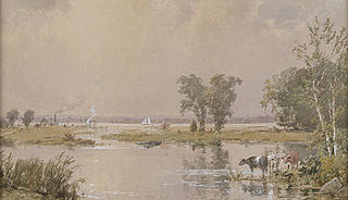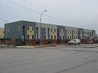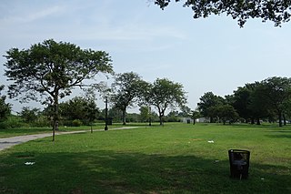
Collect Pond, or Fresh Water Pond, was a body of fresh water in what is now Chinatown in Lower Manhattan, New York City. For the first two centuries of European settlement in Manhattan, it was the main New York City water supply system for the growing city. A jail was later built on the former pond. In the 20th century, the site became Collect Pond Park, which includes a reflecting pool to acknowledge the historic importance of this body of water.

New Jersey Meadowlands, also known as the Hackensack Meadowlands after the primary river flowing through it, is a general name for a large ecosystem of wetlands in northeastern New Jersey in the United States, a few miles to the west of New York City. During the 20th century, much of the Meadowlands area was urbanized, and it became known for being the site of large landfills and decades of environmental abuse. A variety of projects began in the late 20th century to restore and conserve the remaining ecological resources in the Meadowlands.

The Arthur Kill is a tidal strait in the New York–New Jersey Harbor Estuary between Staten Island, New York and Union and Middlesex counties, New Jersey. It is a major navigational channel of the Port of New York and New Jersey.

Raritan Bay is a bay located at the southern portion of Lower New York Bay between the U.S. states of New York and New Jersey and is part of the New York Bight. The bay is bounded on the northwest by New York's Staten Island, on the west by Perth Amboy, New Jersey, on the south by the Raritan Bayshore communities in the New Jersey counties of Middlesex and Monmouth, and on the east by Sandy Hook Bay. The bay is named after the Raritans, a branch of the Lenape tribe who lived in the vicinity of the bay and its river for thousands of years, prior to the arrival of Dutch and English colonists in the 17th century.

The Fresh Kills Landfill was a landfill covering 2,200 acres (890 ha) in the borough of Staten Island in New York City, United States. The name comes from the landfill's location along the banks of the Fresh Kills estuary in western Staten Island.

The New York–New Jersey Harbor Estuary, also known as the Hudson-Raritan Estuary, is in the northeastern states of New Jersey and New York on the East Coast of the United States. The system of waterways of the Port of New York and New Jersey forms one of the most intricate natural harbors in the world and one of the busiest ports of the United States. The harbor opens onto the New York Bight in the Atlantic Ocean to the southeast and Long Island Sound to the northeast.

The Isle of Meadows is a 87-acre (0.35 km2) uninhabited island in the New York City borough of Staten Island in the United States. It is located along the western side of Staten Island, where Fresh Kills empties into the Arthur Kill. The island is owned by the city of New York. It is now a nature preserve providing important meadow and salt marsh nesting habitat for herons, ibises, and egrets, and is not open to the public.

Richmond Creek is a major stream in Staten Island, New York City. Its upper drainage basin includes the remote forested hills in the center of the island. It empties into the Fresh Kills.

Kissena Park is a 235-acre (95 ha) park located in the neighborhood of Flushing in Queens, New York City. It is located along the subterranean Kissena Creek, which flows into the Flushing River. It is bordered on the west by Kissena Boulevard; on the north by Rose, Oak, Underhill, and Lithonia Avenues; on the east by Fresh Meadow Lane; and on the south by Booth Memorial Avenue. The park contains the city's only remaining velodrome, a lake of the same name, two war memorials, and various playgrounds and sports fields.

The Flushing River, also known as Flushing Creek, is a waterway that flows northward through the borough of Queens in New York City, mostly within Flushing Meadows–Corona Park, emptying into the Flushing Bay and the East River. The river runs through a valley that may have been a larger riverbed before the last Ice Age, and it divides Queens into western and eastern halves. Until the 20th century, the Flushing Creek was fed by three tributaries: Mill Creek and Kissena Creek on the eastern bank, and Horse Brook on the western bank.

Spring Creek, previously called Spring Creek Basin, is a neighborhood within the East New York section of Brooklyn in New York City. It roughly comprises the southern portions of East New York between Flatlands Avenue to the north, and Jamaica Bay and the Gateway National Recreation Area to the south, with the Brooklyn neighborhood of Canarsie to the west and the Queens neighborhood of Howard Beach to the east. It is named after Spring Creek, one of several creeks that formerly ran through the area and drained into Jamaica Bay.
The New Creek is an urban stream on the East Shore of Staten Island, New York City. The creek is fed by many natural springs in the area, which were used by the Lenape Indians before the arrival of European colonists in the 17th century. Many of the springs have been channeled underground by urban development as the population expanded throughout New York City and Staten Island.

Freshkills Park is a public park being built atop a former landfill on Staten Island. At about 2,200 acres (8.9 km2), it will be the largest park developed in New York City since the 19th century. Its construction began in October 2008 and is slated to continue in phases for approximately 30 years. When fully developed by 2035–2037, Freshkills Park will be the second-largest park in New York City, after Pelham Bay Park in the Bronx, and almost three times the size of Central Park in Manhattan. The park is envisioned as a regional destination that integrates open grasslands, waterways and engineered structures into a cohesive and dynamic unit for social, cultural and physical activity, learning and play. Sections of the park will be connected by a circulation system for vehicles and a network of paths for bicyclists and pedestrians. The New York City Department of Parks and Recreation is managing the project with the New York City Department of Sanitation.

The Kittatinny Valley is a section of the Great Appalachian Valley in Sussex and Warren counties in northwestern New Jersey that is bounded on the northwest by Kittatinny Mountain, and in the southeast by the New Jersey Highlands region. The valley is roughly 40 miles (64 km) long, with a breadth of 10 to 13 miles.

Kissena Creek is a buried stream located in the neighborhoods of Flushing, Fresh Meadows, Hillcrest, and Kew Gardens Hills in the New York City borough of Queens. Kissena Creek originates in a now-filled swamp within Kew Gardens Hills and Pomonok in central Queens, flowing east to Hillcrest. The creek then travels mostly north and west, largely flowing beneath Kissena Park Golf Course, Kissena Park, Kissena Corridor Park, and Queens Botanical Garden, before merging with the Flushing River in Flushing Meadows–Corona Park.

Tibbetts Brook, originally Tippett's Brook or Tibbitt's Brook, is a stream in the southern portion of mainland New York, flowing north to south from the city of Yonkers in Westchester County into the borough of the Bronx within New York City. Originally emptying into Spuyten Duyvil Creek as part of the Harlem River system, the stream is now partially subterranean, ending above ground at the south end of Van Cortlandt Lake within Van Cortlandt Park. There it proceeds into city sewers, draining into either the northern end of the Harlem River or the Wards Island Water Pollution Control Plant. The brook provides significant watershed to both Van Cortlandt Park at its south end and Tibbetts Brook Park at its north end. There have been modern proposals to daylight the southern portion of the brook back onto the surface.

Spring Creek Park is a public park along the Jamaica Bay shoreline between the neighborhoods of Howard Beach, Queens, and Spring Creek, Brooklyn, in New York City. Created on landfilled former marshland, the park is mostly an undeveloped nature preserve, with only small portions accessible to the public for recreation.

Edgemere Landfill is a former municipal landfill located in Edgemere on the Rockaway peninsula in Queens, New York City. It is located on a man-made peninsula on the Jamaica Bay shoreline, at the eastern end of the Rockaway peninsula. A portion of the site is open to the public as Rockaway Community Park. The entire site is owned by the New York City Department of Parks and Recreation.

Sunswick Creek is a buried stream located in Astoria and Long Island City, in the northwestern portion of Queens in New York City. It originated to the north of Queensboro Bridge and Queens Plaza in Long Island City, flowing north to the present-day site of the Socrates Sculpture Park in Astoria, and emptying into the East River. The creek was named for a term in the Algonquin language that likely means "Woman Chief" or "Sachem’s Wife."

Rattlesnake Creek is an underground waterway in the northeast Bronx, New York City. It flowed above ground level until the mid-20th century, with a waterfall and a pond over its course. Rattlesnake Creek has since been mostly covered over, but a small portion of it is still visible in Seton Falls Park.


