Germantown, Ohio | |
---|---|
Nicknames: Jewel of the Twin Valley; Spoke and Wheel City | |
Coordinates: 39°37′38″N84°22′27″W / 39.62722°N 84.37417°W | |
Country | United States |
State | Ohio |
County | Montgomery |
Established | 1804 |
Founded | 1814 |
Incorporated | 1833 |
Founded by | Philip Gunckel |
Government | |
• Mayor | Terry Johnson |
Area | |
• Total | 4.22 sq mi (10.93 km2) |
• Land | 4.22 sq mi (10.93 km2) |
• Water | 0.00 sq mi (0.00 km2) |
Elevation | 771 ft (235 m) |
Population (2020) | |
• Total | 5,796 |
• Estimate (2023) [3] | 5,809 |
• Density | 1,372.81/sq mi (530.10/km2) |
Time zone | UTC-5 (Eastern (EST)) |
• Summer (DST) | UTC-4 (EDT) |
ZIP codes | 45325, 45327 |
Area code(s) | 937, 326 |
FIPS code | 39-29932 [4] |
GNIS feature ID | 2398954 [2] |
Website | http://www.germantown.oh.us/ |
Germantown is a city in Montgomery County, Ohio, United States. The population was 5,796 at the 2020 census. A part of the Dayton metropolitan area, Germantown was founded by German Americans from Pennsylvania and was once home to a cigar industry.
Germantown was established in 1804 by German-speaking settlers from Berks County, Pennsylvania. Philip Gunckel, the only member of the group who spoke English, is recognized as Germantown's founder, who chose the site for a grist mill and laid out the original town plan in 1814. The Gunckel Town Plan, maintaining many of its original 19th and early 20th century buildings, has been recognized as a Historic District and has been placed on the National Register of Historic Places. [5]
Germantown underwent many economic changes as distilleries, and the cigar industry, both came and went. In 1847 the Mudlick Distillery was established and, with an output of 30 barrels of whiskey a day, was considered the largest in the country for many years. At one time the Municipality housed up to 12 cigar warehouses and five factories, with the tobacco industry employing many residents up until the 1970s. [6]
Germantown is situated within German Township, in the south-western part of Montgomery County, Ohio. The town is in an area known as the Twin Valley, due to the Little Twin Creek on its east side, and Big Twin on its west and south sides, being in the forks of these streams. [7]
According to the United States Census Bureau, the village has a total area of 4.26 square miles (11.03 km2), all land. [8]
Census | Pop. | Note | %± |
---|---|---|---|
1830 | 501 | — | |
1860 | 1,438 | — | |
1870 | 1,440 | 0.1% | |
1880 | 1,618 | 12.4% | |
1890 | 1,437 | −11.2% | |
1900 | 1,702 | 18.4% | |
1910 | 1,778 | 4.5% | |
1920 | 1,827 | 2.8% | |
1930 | 2,029 | 11.1% | |
1940 | 2,095 | 3.3% | |
1950 | 2,478 | 18.3% | |
1960 | 3,399 | 37.2% | |
1970 | 4,088 | 20.3% | |
1980 | 5,015 | 22.7% | |
1990 | 4,916 | −2.0% | |
2000 | 4,884 | −0.7% | |
2010 | 5,547 | 13.6% | |
2020 | 5,796 | 4.5% | |
2023 (est.) | 5,809 | [3] | 0.2% |
Sources: [4] [9] [10] [11] [12] [13] [14] [15] |
As of the census [16] of 2010, there were 5,547 people, 2,142 households, and 1,584 families residing in the village. The population density was 1,302.1 inhabitants per square mile (502.7/km2). There were 2,328 housing units at an average density of 546.5 per square mile (211.0/km2). The racial makeup of the village was 97.5% White, 0.8% African American, 0.2% Native American, 0.5% Asian, 0.1% from other races, and 0.8% from two or more races. Hispanic or Latino of any race were 1.2% of the population.
There were 2,142 households, of which 38.1% had children under the age of 18 living with them, 55.5% were married couples living together, 13.0% had a female householder with no husband present, 5.5% had a male householder with no wife present, and 26.1% were non-families. 22.6% of all households were made up of individuals, and 9.4% had someone living alone who was 65 years of age or older. The average household size was 2.57 and the average family size was 3.00.
The median age in the village was 37.5 years. 27.3% of residents were under the age of 18; 7% were between the ages of 18 and 24; 27% were from 25 to 44; 25.6% were from 45 to 64; and 13.1% were 65 years of age or older. The gender makeup of the village was 48.0% male and 52.0% female.
As of the census [4] of 2000, Germantown was a village, and there were 4,884 people, 1,898 households, and 1,412 families residing there. The population density was 1,361.2 inhabitants per square mile (525.6/km2). There were 1,994 housing units at an average density of 555.7 per square mile (214.6/km2). The racial makeup of the village was 98.53% White, 0.37% African American, 0.10% Native American, 0.31% Asian, 0.08% from other races, and 0.61% from two or more races. Hispanic or Latino of any race were 0.78% of the population.
There were 1,898 households, out of which 36.2% had children under the age of 18 living with them, 59.8% were married couples living together, 10.5% had a female householder with no husband present, and 25.6% were non-families. 22.8% of all households were made up of individuals, and 9.3% had someone living alone who was 65 years of age or older. The average household size was 2.55 and the average family size was 3.00.
In the village the population was spread out, with 27.1% under the age of 18, 7.4% from 18 to 24, 29.6% from 25 to 44, 23.4% from 45 to 64, and 12.5% who were 65 years of age or older. The median age was 37 years. For every 100 females, there were 97.9 males. For every 100 females age 18 and over, there were 92.5 males.
The median income for a household in the village was $47,179, and the median income for a family was $54,617. Males had a median income of $40,156 versus $28,622 for females. The per capita income for the village was $23,287. About 4.0% of families and 5.8% of the population were below the poverty line, including 11.0% of those under age 18 and 1.3% of those age 65 or over.
Germantown adopted a council-manager form of government on June 8, 1976. The Municipality is governed by a mayor and six council members, all elected at large. The municipal manager supervises the daily operation of the government. Departments include the Street & Storm Sewer Department, Water & Sanitary Sewer Department, Planning & Zoning, Police, Fire, and Finance. [17]
Germantown is known for its historic downtown area and the unique wagon-wheel design of its alley system, which was originally laid out by Philip Gunckel when he settled in Germantown. The system is roughly bounded by Mulberry and Walnut Streets, and Warren and Market Streets. The downtown area was added to the National Historic Register in 1976. [18]
The By-Jo is an active historic theater in Germantown, opened in 1926. [19] [20]
Germantown Public Schools are part of the Valley View School District. [21]
Montgomery County is in the southwestern part of the U.S. state of Ohio. At the 2020 census, the population was 537,309, making it the fifth-most populous county in Ohio. The county seat is Dayton. The county was named in honor of Richard Montgomery, an American Revolutionary War general, who was killed in 1775 while attempting to capture Quebec City, Canada. Montgomery County is part of the Dayton, Ohio, Metropolitan Statistical Area.
Flushing is a village in Belmont County, Ohio, United States. The population was 830 at the 2020 census.
Ithaca is a village in Darke County, Ohio, United States. The population was 81 at the 2020 census.
Ostrander is a village in Delaware County, Ohio, United States. The population was 1,094 at the 2020 census.
Amberley, locally known as Amberley Village, is a village in Hamilton County, Ohio, United States. The population was 3,840 at the 2020 census.
Freeport is a village in southwestern Harrison County, Ohio, United States. The population was 321 at the 2020 census.
Greenwich is a village in Huron County, Ohio, United States. The population was 1,409 at the 2020 census. It is served by a branch of the Willard Memorial Library.
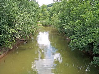
Brinkhaven, once known as Mount Holly and Gann, is a village in Knox County, Ohio, United States. The population was 114 at the 2020 census.
Athalia is a village in Lawrence County, Ohio, United States, along the Ohio River. The population was 279 at the 2020 census.
Chesapeake is a village in Lawrence County, Ohio, United States. The population was 765 as of the 2020 census. It lies across the Ohio River from Huntington, West Virginia, at the mouth of Symmes Creek.
Hanging Rock is a village in Lawrence County, Ohio, United States, along the Ohio River. The population was 204 at the 2020 census.
Hanover is a village in Licking County, Ohio, United States. The population was 1,270 at the 2020 census. The village lies along Ohio State Route 16.
Beloit is a village in southwestern Mahoning County, Ohio, United States. The population was 903 at the 2020 census. It is part of the Youngstown–Warren metropolitan area.
New Concord is a village in Muskingum County, Ohio, United States. The population was 2,361 as of the 2020 census. It is part of the Zanesville micropolitan area. New Concord is the home of Muskingum University and is served by a branch of the Muskingum County Library System.
Philo is a village in Muskingum County, Ohio, United States, along the Muskingum River. The population was 720 at the 2020 census. It is part of the Zanesville micropolitan area. Philo is the closest municipality to Blue Rock State Park.
Darbyville is a village in Pickaway County, Ohio, United States. The population was 186 at the 2020 census.
Clinton is a village in southwestern Summit County, Ohio, United States. The population was 1,197 at the 2020 Census. It is part of the Akron metropolitan area.
Bolivar is a village in Tuscarawas County, Ohio, United States. The population was 1,000 at the 2020 census. Bolivar is also home to Fort Laurens, the only American Revolutionary War-era fort in what is now Ohio.
Gratiot is a village in Licking and Muskingum counties in the U.S. state of Ohio. The population was 215 at the 2020 census.
Carlisle is a city in northwestern Warren and southern Montgomery counties in the southwestern part of the U.S. state of Ohio. The city is in Franklin Township, Warren County, Ohio and German Township, Montgomery County, Ohio.