Grajevce

Last updated
Grajevce
Village
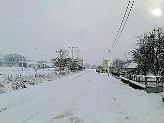
Grajevce, Leskovac 04.jpg
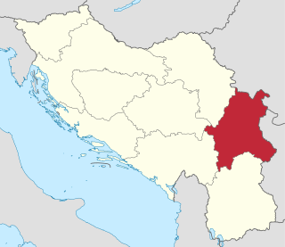
Serbia adm location map.svg
Red pog.svg
Grajevce
Coordinates: 43°02′48″N21°59′42″E / 43.04667°N 21.99500°E / 43.04667; 21.99500
CountryFlag of Serbia.svg  Serbia
District Jablanica District
Municipality Leskovac
Elevation
833 ft (254 m)
Population
(2002)
  Total404
Time zone UTC+1 (CET)
  Summer (DST) UTC+2 (CEST)

Grajevce is a village in the municipality of Leskovac, Serbia. According to the 2002 census, the village has a population of 404 people. [1]

Village Small clustered human settlement smaller than a town

A village is a clustered human settlement or community, larger than a hamlet but smaller than a town, with a population ranging from a few hundred to a few thousand. Though villages are often located in rural areas, the term urban village is also applied to certain urban neighborhoods. Villages are normally permanent, with fixed dwellings; however, transient villages can occur. Further, the dwellings of a village are fairly close to one another, not scattered broadly over the landscape, as a dispersed settlement.
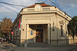
Leskovac City in Southern and Eastern Serbia, Serbia

Leskovac is a city and the administrative center of the Jablanica District in southern Serbia. According to the 2011 census, the city urban area has 60,288 inhabitants, while the city administrative area has 144,206.

Serbia Republic in Southeastern Europe

Serbia, officially the Republic of Serbia, is a country situated at the crossroads of Central and Southeast Europe in the southern Pannonian Plain and the central Balkans. The sovereign state borders Hungary to the north, Romania to the northeast, Bulgaria to the southeast, North Macedonia to the south, Croatia and Bosnia and Herzegovina to the west, and Montenegro to the southwest. The country claims a border with Albania through the disputed territory of Kosovo. Serbia's population is about seven million. Its capital, Belgrade, ranks among the oldest and largest citiеs in southeastern Europe.

Related Research Articles

Great Morava river in Serbia

The Great Morava is the final section of the Morava, a major river system in Serbia.

Morava may refer to:

Nišava river in Serbia

The Nišava or Nishava is a river in Bulgaria and Serbia, a right tributary, and with a length of 218 km also the longest one, of the South Morava.

Morava Banovina

The Morava Banovina or Morava Banate, was a province (banovina) of the Kingdom of Yugoslavia between 1929 and 1941. This province consisted of parts of present-day Central Serbia and it was named for the Morava Rivers. The capital city of the Morava Banovina was Niš.

Toplica (river) river in Serbia

The Toplica is a river in southern Serbia. The river is 130 km long and gives its name to the region it flows through, which constitutes most of the modern Toplica District of Serbia.

The Jablanica is an 85-kilometre-long (53 mi) river in southern Serbia. A left tributary of the South Morava river, it gives its name to the region of Jablanica and to modern Serbia's Jablanica District, with the region contributing about one third of the district's area.

Veternica river in Serbia

The Veternica is a river in southern Serbia, a 75 km long left tributary to the Južna Morava, which gives the name to the region surrounding its valley.

Vlasina (river) river in Serbia

The Vlasina, is a river in southeastern Serbia, a 70 km-long outflow of the Vlasina Lake and a right tributary to the Južna Morava, which also gives its name to the surrounding Vlasina region.

Sokobanjska Moravica river in Serbia

The Sokobanjska Moravica or simply Moravica is a river in central eastern Serbia, a 58 km-long right tributary to the Južna Morava river.

Šanac Village in Serbia

Šanac is a municipality where the town of Kruševac is located in, located along the left bank of the river Zapadna Morava. A typical megalopolis of Serbian Pomoravlje, mostly stretched along the main road, expanding into the valley and, in some places, into the hill above.

Vlasina

Vlasina is a mountainous region of southeastern Serbia. It is a border area to Bulgaria, a region of the Rhodopian Serbia, with old rocks and mountains. Its most prominent landforms are eponymous Vlasina River and Vlasina Lake. It corresponds to the territories of municipalities of Crna Trava, Vlasotince and Surdulica.

Čitluk is a settlement in Serbia near the city of Kruševac. It is often referred to as a village, since agriculture is still widespread, but the official status of the settlement is that it is a suburban area.

Moravac Place in Serbia

Moravac is a locality in Serbia situated in the municipality of Aleksinac, in the Nišava District. It had a population of 1,785 in the 2002 census.

Pridvorica, Bojnik Village in Jablanica District, Serbia

Pridvorica is a village in Serbia located in the municipality of Bojnik and the district of Jablanica. In 2002, it had 951 inhabitants, of which 919 were Serbs (96.63%) and 30 Romani (3.15%).

Bučje is a village located in the Trstenik Municipality, Serbia. It is on the south side of Zapadna Morava river. The population is 455.

Rogajny, Elbląg County Village in Warmian-Masurian, Poland

Rogajny is a village in the administrative district of Gmina Pasłęk, within Elbląg County, Warmian-Masurian Voivodeship, in northern Poland. It lies approximately 5 kilometres (3 mi) east of Pasłęk, 22 km (14 mi) east of Elbląg, and 59 km (37 mi) north-west of the regional capital Olsztyn.

Toplica (Srebrenica) Village in Srebrenica, Bosnia and Herzegovina

Toplica is a village in the municipality of Srebrenica, Bosnia and Herzegovina.

Oplanići Village in Raška District, Serbia

Oplanići are populated city of Kraljevo in Raska district. According to the census of 2011, there were 899 inhabitants.

References

  1. Popis stanovništva, domaćinstava i Stanova 2002. Knjiga 1: Nacionalna ili etnička pripadnost po naseljima. Republika Srbija, Republički zavod za statistiku Beograd 2003. ISBN   86-84433-00-9

Coordinates: 43°02′48″N21°59′42″E / 43.04667°N 21.99500°E / 43.04667; 21.99500

Geographic coordinate system Coordinate system

A geographic coordinate system is a coordinate system that enables every location on Earth to be specified by a set of numbers, letters or symbols. The coordinates are often chosen such that one of the numbers represents a vertical position and two or three of the numbers represent a horizontal position; alternatively, a geographic position may be expressed in a combined three-dimensional Cartesian vector. A common choice of coordinates is latitude, longitude and elevation. To specify a location on a plane requires a map projection.