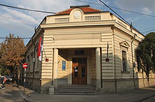
Udayamperoor is a town situated in Ernakulam district, Kerala, in India.

Ilgın is a town and district of Konya Province in the Central Anatolia region of Turkey. According to 2000 census, population of the district is 75,681 of which 26,698 live in the town of Hadim.

Sant Joan de Labritja is a village and municipality of the Balearic Islands on northern Ibiza. Among others, the resorts of Portinatx and Cala de Sant Vicent are located there. The actual village of Sant Joan is a quiet street, dominated by an imposing Christian church, and is the meeting point of Sant Joan de Labritja Municipal Council. One may find several small cafés and restaurants (including the locally well-known Vista Alegre, as well as a taxi rank,outside the Municipal Council building and the local office of the Guardia Civil, the Spanish Civil Guard. Towards the west of the village is the origin of the Torrent de Labritja, a tributary of the Riu de Santa Eulária, the Balearic Island's only constant-flowing river, although the Torrent only contains water during the winter months; throughout the tourist season, the stream is a dry river bed full of green vegetation.

Ľubovec is a village and municipality in Prešov District in the Prešov Region of eastern Slovakia.
E.A. Vaughn Wildlife Management Area is a state wildlife management area (WMA) of Maryland that consists of two separate parcels of land on Chincoteague Bay in Worcester County, between the villages of Girdletree and Stockton.

Sobienie Kiełczewskie Pierwsze is a village in Otwock County, Gmina Sobienie-Jeziory.The population is near 200. In the village is Voivodship Road 801. It lies approximately 3 kilometres (2 mi) south-east of Sobienie-Jeziory, 23 km (14 mi) south of Otwock, and 41 km (25 mi) south-east of Warsaw.

Zülfüqarlı is a village in the Kalbajar Rayon of Azerbaijan.

Busina is a village in the administrative district of Gmina Poddębice, within Poddębice County, Łódź Voivodeship, in central Poland. It lies approximately 7 kilometres (4 mi) south-west of Poddębice and 39 km (24 mi) west of the regional capital Łódź.
Tarnawka Pierwsza is a village in the administrative district of Gmina Zakrzew, within Lublin County, Lublin Voivodeship, in eastern Poland.

Bukowiec is a former village, located in the administrative district of Gmina Solina, within Bieszczady County, Subcarpathian Voivodeship, in south-eastern Poland, close to the border with Ukraine. It lies approximately 23 kilometres (14 mi) south-east of Lutowiska, 44 km (27 mi) south-east of Ustrzyki Dolne, and 123 km (76 mi) south-east of the regional capital Rzeszów.

Psary-Stara Wieś is a village in the administrative district of Gmina Bodzentyn, within Kielce County, Świętokrzyskie Voivodeship, in south-central Poland. It lies approximately 4 kilometres (2 mi) west of Bodzentyn and 22 km (14 mi) east of the regional capital Kielce.

Zamkowa Wola is a village in the administrative district of Gmina Łagów, within Kielce County, Świętokrzyskie Voivodeship, in south-central Poland. It lies approximately 5 kilometres (3 mi) north of Łagów and 34 km (21 mi) east of the regional capital Kielce.
Grudusk-Olszak is a village in the administrative district of Gmina Grudusk, within Ciechanów County, Masovian Voivodeship, in east-central Poland.
Łoziska is a village in the administrative district of Gmina Lesznowola, within Piaseczno County, Masovian Voivodeship, in east-central Poland.
Śnice is a village in the administrative district of Gmina Liw, within Węgrów County, Masovian Voivodeship, in east-central Poland.

Skowarnki is a village in the administrative district of Gmina Debrzno, within Człuchów County, Pomeranian Voivodeship, in northern Poland. It is approximately 13 kilometres (8 mi) northwest of Debrzno, 20 km (12 mi) west of Człuchów, and 133 km (83 mi) southwest of the regional capital Gdańsk.

Stara Maszyna is a village in the administrative district of Gmina Sierakowice, within Kartuzy County, Pomeranian Voivodeship, in northern Poland. It lies approximately 2 kilometres (1 mi) south-east of Sierakowice, 19 km (12 mi) west of Kartuzy, and 47 km (29 mi) west of the regional capital Gdańsk. Kashubian vetch is native to the village.

Szczecinki is a village in the administrative district of Gmina Olecko, within Olecko County, Warmian-Masurian Voivodeship, in northern Poland. It lies approximately 8 kilometres (5 mi) north-east of Olecko and 141 km (88 mi) east of the regional capital Olsztyn.

Leishan is a county in the east of Guizhou province, China. It is under the administration of the Qiandongnan Miao and Dong Autonomous Prefecture.

Erk is a village in Heves County, Northern Hungary Region, Hungary.


