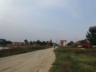
Donja Bunuša | |
---|---|
Village | |
Country | |
District | Jablanica District |
Municipality | Leskovac |
Population (2002) | |
• Total | 306 |
Time zone | CET (UTC+1) |
• Summer (DST) | CEST (UTC+2) |
Donja Bunuša is a village in the municipality of Leskovac, Serbia. According to the 2002 census, the village has a population of 306 people. [1]
A village is a clustered human settlement or community, larger than a hamlet but smaller than a town, with a population ranging from a few hundred to a few thousand. Though villages are often located in rural areas, the term urban village is also applied to certain urban neighborhoods. Villages are normally permanent, with fixed dwellings; however, transient villages can occur. Further, the dwellings of a village are fairly close to one another, not scattered broadly over the landscape, as a dispersed settlement.
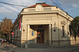
Leskovac is a city and the administrative center of the Jablanica District in southern Serbia. According to the 2011 census, the city urban area has 60,288 inhabitants, while the city administrative area has 144,206.
Serbia, officially the Republic of Serbia, is a country situated at the crossroads of Central and Southeast Europe in the southern Pannonian Plain and the central Balkans. The sovereign state borders Hungary to the north, Romania to the northeast, Bulgaria to the southeast, North Macedonia to the south, Croatia and Bosnia and Herzegovina to the west, and Montenegro to the southwest. The country claims a border with Albania through the disputed territory of Kosovo. Serbia's population is about seven million. Its capital, Belgrade, ranks among the oldest and largest citiеs in southeastern Europe.
In the geologic timescale, the Asselian is the earliest geochronologic age or lowermost chronostratigraphic stage of the Permian. It is a subdivision of the Cisuralian epoch or series. The Asselian lasted between 298.9 and 295 million years ago (Ma). It was preceded by the Gzhelian and followed by the Sakmarian.
Raja Alang Mosque is a historical mosque in Selangor, Malaysia. It is located in Beranang, near the Selangor-Negeri Sembilan border. It was named after Raja Alang, who was the son of Tengku Panglima Besar Selangor who ruled Kajang during Almarhum Sultan Sir Abdul Samad's reign. He was from Sumatra, Indonesia.
Tongliang District is a district of Chongqing Municipality, China. On 6 June 2014 Tongliang was upgraded from a county into a district within Chongqing.
Marawara is a village and the center of Marawara district, Kunar Province, Afghanistan. It is located at 34.8914°N 71.1808°E at 914 m altitude in a river valley in the most western end of the district.
Brza is a village in the municipality of Leskovac, Serbia. According to the 2002 census, the village has a population of 1211 people.
Bunuški Čifluk is a village in the municipality of Leskovac, Serbia. According to the 2002 census, the village has a population of 505 people.
Drvodelja is a village in the municipality of Leskovac, Serbia. According to the 2002 census, the village has a population of 245 people.
Gagince is a village in the municipality of Leskovac, Serbia. According to the 2002 census, the village has a population of 132 people.
Gornja Bunuša is a village in the municipality of Leskovac, Serbia. According to the 2002 census, the village has a population of 633 people.
Gornje Trnjane is a village in the municipality of Leskovac, Serbia. According to the 2002 census, the village has a population of 250 people.
Karađorđevac is a village in the municipality of Leskovac, Serbia. According to the 2002 census, the village has a population of 417 people.
Kukulovce is a village in the municipality of Leskovac, Serbia. According to the 2002 census, the village had a population of 298 people.
Melovo is a village in the municipality of Leskovac, Serbia. According to the 2002 census, the village has a population of 63 people.
Palikuća is a village in the municipality of Leskovac, Serbia. According to the 2002 census, the village has a population of 387 people.
Mrštane is a village in the municipality of Leskovac, Serbia. According to the 2002 census, the village has a population of 1431 people.
Nakrivanj is a village in the municipality of Leskovac, Serbia. According to the 2002 census, the village has a population of 1315 people.
Strojkovce is a village in the municipality of Leskovac, Serbia. According to the 2002 census, the village has a population of 1344 people.
Svirce is a village in the municipality of Leskovac, Serbia. According to the 2002 census, the village has a population of 436 people.
Vina is a village in the municipality of Leskovac, Serbia. According to the 2002 census, the village has a population of 232 people.
Ormancık is a village in the District of Feke, Adana Province, Turkey.
Coordinates: 42°53′29″N21°52′14″E / 42.8914°N 21.8706°E
A geographic coordinate system is a coordinate system that enables every location on Earth to be specified by a set of numbers, letters or symbols. The coordinates are often chosen such that one of the numbers represents a vertical position and two or three of the numbers represent a horizontal position; alternatively, a geographic position may be expressed in a combined three-dimensional Cartesian vector. A common choice of coordinates is latitude, longitude and elevation. To specify a location on a plane requires a map projection.
This Jablanica District, Serbia location article is a stub. You can help Wikipedia by expanding it. |