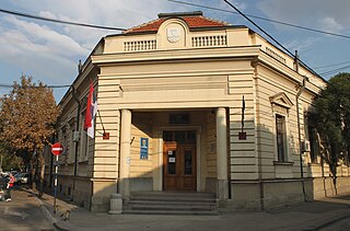
Białe Błota is a village in the administrative district of Gmina Aleksandrów Kujawski, within Aleksandrów County, Kuyavian-Pomeranian Voivodeship, in north-central Poland. It lies 4 kilometres (2 mi) north of Aleksandrów Kujawski and 17 km (11 mi) south of Toruń.

Huta is a village in the administrative district of Gmina Annopol, within Kraśnik County, Lublin Voivodeship, in eastern Poland. It lies approximately 4 kilometres (2 mi) east of Annopol, 22 km (14 mi) west of Kraśnik, and 61 km (38 mi) south-west of the regional capital Lublin.

Derzili is a village in the Jabrayil Rayon of Azerbaijan.

Chełmce is a village in the administrative district of Gmina Kowiesy, within Skierniewice County, Łódź Voivodeship, in central Poland. It lies approximately 5 kilometres (3 mi) west of Kowiesy, 17 km (11 mi) south-east of Skierniewice, and 63 km (39 mi) east of the regional capital Łódź.

Pokrzywianka is a village in the administrative district of Gmina Nowa Słupia, within Kielce County, Świętokrzyskie Voivodeship, in south-central Poland. It lies approximately 5 kilometres (3 mi) north-east of Nowa Słupia and 37 km (23 mi) east of the regional capital Kielce.

Polesie Mikułowskie is a village in the administrative district of Gmina Ożarów, within Opatów County, Świętokrzyskie Voivodeship, in south-central Poland. It lies approximately 6 kilometres (4 mi) west of Ożarów, 16 km (10 mi) north-east of Opatów, and 69 km (43 mi) east of the regional capital Kielce.

Brzóstowa is a village in the administrative district of Gmina Ćmielów, within Ostrowiec County, Świętokrzyskie Voivodeship, in south-central Poland. It lies approximately 3 kilometres (2 mi) west of Ćmielów, 8 km (5 mi) south-east of Ostrowiec Świętokrzyski, and 62 km (39 mi) east of the regional capital Kielce.

Niwa is a village in the administrative district of Gmina Grębów, within Tarnobrzeg County, Subcarpathian Voivodeship, in south-eastern Poland. It lies approximately 3 kilometres (2 mi) south-east of Grębów, 16 km (10 mi) east of Tarnobrzeg, and 59 km (37 mi) north of the regional capital Rzeszów.

Wilczoruda-Parcela is a village in the administrative district of Gmina Pniewy, within Grójec County, Masovian Voivodeship, in east-central Poland. It lies approximately 14 kilometres (9 mi) west of Grójec and 43 km (27 mi) south-west of Warsaw.
Sulęcin Włościański is a village in the administrative district of Gmina Stary Lubotyń, within Ostrów Mazowiecka County, Masovian Voivodeship, in east-central Poland.
Nowy Zamość is a village in the administrative district of Gmina Rościszewo, within Sierpc County, Masovian Voivodeship, in east-central Poland.
Rumunki-Chwały is a village in the administrative district of Gmina Rościszewo, within Sierpc County, Masovian Voivodeship, in east-central Poland.
Jerzykowo is a village in the administrative district of Gmina Trzemeszno, within Gniezno County, Greater Poland Voivodeship, in west-central Poland.
Kosin is a village in the administrative district of Gmina Drezdenko, within Strzelce-Drezdenko County, Lubusz Voivodeship, in western Poland.

Wojtal is a village in the administrative district of Gmina Czersk, within Chojnice County, Pomeranian Voivodeship, in northern Poland. It lies approximately 12 kilometres (7 mi) north of Czersk, 39 km (24 mi) north-east of Chojnice, and 66 km (41 mi) south-west of the regional capital Gdańsk.
Kondrac is the municipality and village in Benešov District in the Central Bohemian Region of the Czech Republic.
Porto, Piauí is a municipality in the state of Piauí in the Northeast region of Brazil.
Kõrve is a village in Mustvee Parish, Jõgeva County in northeastern Estonia.
Seljaküla is a village in Lääne-Nigula Parish, Lääne County, in western Estonia.

The Castillet is a fortification and city door located in Perpignan.


