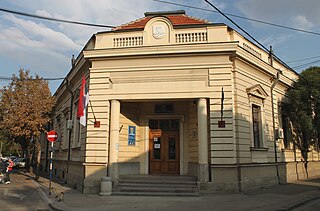
Esparza is a town and municipality located in the province and autonomous community of Navarre, northern Spain.

Nippon Institute of Technology is a private university in Miyashiro, Saitama, Japan, established in 1967.

Kujawy is a village in the administrative district of Gmina Skępe, within Lipno County, Kuyavian-Pomeranian Voivodeship, in north-central Poland.
Platanorrevma is a village located alongside the Pieria Mountains in Servia municipal unit, Kozani regional unit, in the Greek region of Macedonia. It is situated at an altitude of 490 meters. The postal code is 50500, while the telephone code is +30 24640. At the 2011 census the population was 1,004.

Małyń is a village in the administrative district of Gmina Zadzim, within Poddębice County, Łódź Voivodeship, in central Poland. It lies approximately 13 kilometres (8 mi) east of Zadzim, 14 km (9 mi) south of Poddębice, and 31 km (19 mi) west of the regional capital Łódź.

Siedliska is a village in the administrative district of Gmina Miechów, within Miechów County, Lesser Poland Voivodeship, in southern Poland. It lies approximately 3 kilometres (2 mi) north of Miechów and 36 km (22 mi) north of the regional capital Kraków.

Rząśnik Włościański is a village in the administrative district of Gmina Wąsewo, within Ostrów Mazowiecka County, Masovian Voivodeship, in east-central Poland. It lies approximately 14 kilometres (9 mi) north-west of Ostrów Mazowiecka and 87 km (54 mi) north-east of Warsaw.
Olszyc Szlachecki is a village in the administrative district of Gmina Domanice, within Siedlce County, Masovian Voivodeship, in east-central Poland.

Znakowo is a village in Gmina Miastko, Bytów County, Pomeranian Voivodeship, in northern Poland. It lies approximately 15 kilometres (9 mi) south-west of Bytów and 62 km (39 mi) south-west of Gdańsk.

Gutowiec is a village in the administrative district of Gmina Czersk, within Chojnice County, Pomeranian Voivodeship, in northern Poland. It lies approximately 9 kilometres (6 mi) west of Czersk, 22 km (14 mi) east of Chojnice, and 84 km (52 mi) south-west of the regional capital Gdańsk.

Niemieńsko is a village in the administrative district of Gmina Drawno, within Choszczno County, West Pomeranian Voivodeship, in north-western Poland. It lies approximately 9 kilometres (6 mi) south-east of Drawno, 31 km (19 mi) east of Choszczno, and 89 km (55 mi) east of the regional capital Szczecin.

Budzieszewice is a village in the administrative district of Gmina Przybiernów, within Goleniów County, West Pomeranian Voivodeship, in north-western Poland. It lies approximately 9 kilometres (6 mi) south-east of Przybiernów, 17 km (11 mi) north of Goleniów, and 36 km (22 mi) north-east of the regional capital Szczecin.

Všechlapy is a village and municipality in Nymburk District in the Central Bohemian Region of the Czech Republic.

The Surami Pass is a mountain pass in the Likhi Range of Georgia with an altitude of 949 metres (3,114 ft).
Amarante, Piauí is a municipality in the state of Piauí in the Northeast region of Brazil.

Gradac is a village in the municipality of Batočina, Serbia. According to the 2011 census, the village has a population of 206 people. The Gradac Cave located in the village is part of the Cultural Heritage of Serbia list, inscribed in 1979.
Küti is a village in Järva Parish, Järva County in northern-central Estonia.
Jalukse is a village in Lääne-Nigula Parish, Lääne County, in western Estonia.
Luuska is a village in Orava Parish, Põlva County in southeastern Estonia.
Kihelkonna-Liiva is a village in Saaremaa Parish, Saare County in western Estonia.


