České Lhotice is very small village in the Pardubice Region of the Czech Republic. It has around 100 inhabitants.

Lukavice is a village in the Pardubice Region of the Czech Republic. It has around 800 inhabitants.

Heer is a neighbourhood of Maastricht, in the Dutch province of Limburg. Heer is a former municipality and village, incorporated into Maastricht in 1970 and, until 1828, this municipality was called "Heer en Keer". The municipality covered the former villages of Heer and Scharn. It is located on the right bank of the River Meuse.
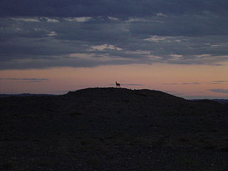
Nomgon is a sum (district) of Ömnögovi Province in southern Mongolia.

Avshar is a major village in the Ararat Province of Armenia. It hosted the 1993 and 1995 CYMA – Canadian Youth Mission to Armenia led by Archbishop Hovnan Derderian and Ronald Alepian.

Plebanka is a village in the administrative district of Gmina Aleksandrów Kujawski, within Aleksandrów County, Kuyavian-Pomeranian Voivodeship, in north-central Poland. It lies 3 kilometres (2 mi) south of Aleksandrów Kujawski and 23 km (14 mi) south of Toruń.
Palędzie Kościelne is a village in the administrative district of Gmina Mogilno, within Mogilno County, Kuyavian-Pomeranian Voivodeship, in north-central Poland. It lies approximately 8 kilometres (5 mi) west of Mogilno and 52 km (32 mi) south of Bydgoszcz.
Nowosiółki is a village in the administrative district of Gmina Hrubieszów, within Hrubieszów County, Lublin Voivodeship, in eastern Poland, close to the border with Ukraine. It lies approximately 5 kilometres (3 mi) north-west of Hrubieszów and 100 km (62 mi) south-east of the regional capital Lublin.
Wyrębów is a village in the administrative district of Gmina Zadzim, within Poddębice County, Łódź Voivodeship, in central Poland. It lies approximately 8 kilometres (5 mi) north of Zadzim, 10 km (6 mi) south-west of Poddębice, and 42 km (26 mi) west of the regional capital Łódź.
Lgota Wielka is a village in the administrative district of Gmina Wolbrom, within Olkusz County, Lesser Poland Voivodeship, in southern Poland.
Kamionka is a village in the administrative district of Gmina Glinojeck, within Ciechanów County, Masovian Voivodeship, in east-central Poland.
Górzno is a village in Garwolin County, Masovian Voivodeship, in east-central Poland. It is the seat of the gmina called Gmina Górzno. It lies approximately 9 kilometres (6 mi) south-east of Garwolin and 64 km (40 mi) south-east of Warsaw.
Kobyla Wola is a village in the administrative district of Gmina Górzno, within Garwolin County, Masovian Voivodeship, in east-central Poland. It lies approximately 5 kilometres (3 mi) west of Górzno, 7 km (4 mi) south of Garwolin, and 62 km (39 mi) south-east of Warsaw.
Czyżew is a village in the administrative district of Gmina Sanniki, within Gostynin County, Masovian Voivodeship, in east-central Poland. It lies approximately 3 kilometres (2 mi) north-west of Sanniki, 27 km (17 mi) east of Gostynin, and 81 km (50 mi) west of Warsaw.
Janków is a village in the administrative district of Gmina Pleszew, within Pleszew County, Greater Poland Voivodeship, in west-central Poland.

Wręczyca Wielka is a village in Kłobuck County, Silesian Voivodeship, in southern Poland. It is the seat of the gmina called Gmina Wręczyca Wielka. It lies approximately 8 kilometres (5 mi) south of Kłobuck and 67 km (42 mi) north of the regional capital Katowice.
Skrzeszewo is a village in the administrative district of Gmina Sierakowice, within Kartuzy County, Pomeranian Voivodeship, in northern Poland. It lies approximately 8 kilometres (5 mi) north-west of Sierakowice, 25 km (16 mi) west of Kartuzy, and 52 km (32 mi) west of the regional capital Gdańsk.
Dowiaty is a village in the administrative district of Gmina Budry, within Węgorzewo County, Warmian-Masurian Voivodeship, in northern Poland, close to the border with the Kaliningrad Oblast of Russia. It lies approximately 3 kilometres (2 mi) west of Budry, 8 km (5 mi) north-east of Węgorzewo, and 102 km (63 mi) north-east of the regional capital Olsztyn.
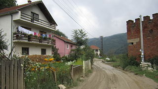
Koraćevac is a village in the municipality of Leskovac, Serbia. According to the 2002 census, the village has a population of 192 people.

Nézsa is a village in Nógrád County, Hungary with 1,093 inhabitants (2014).


