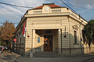
Kila Raipur is a noted village of Ludhiana district in Punjab, India as it hosts the annual Kila Raipur Sports Festival, known as the Rural Olympics. The events played often demonstrate the physical strength and valor of the Punjabi men and women.

Líbeznice is a village in the Central Bohemian Region of the Czech Republic. As of 1 January 2013, the village had 2000 inhabitants. The first written record of the village is in a document issued by the Bohemian king Wenceslaus I of Bohemia in 1236. The village is a member of the Povodí Mratínského potoka microregion.

Sörenberg is a village in the Swiss Alps, located in the southern part of the canton of Lucerne. The village lies in the municipality of Flühli in the Entlebuch region, near the upper end of the Waldemme valley.

Erazmów is a village in the administrative district of Gmina Koluszki, within Łódź East County, Łódź Voivodeship, in central Poland. It lies approximately 3 kilometres (2 mi) north-east of Koluszki and 25 km (16 mi) east of the regional capital Łódź.

Moloja is a village in the Lankaran Rayon of Azerbaijan. The village forms part of the municipality of Osakücə.

Çaylı is a village in the Tartar Rayon of Azerbaijan. The village is on the cease-fire line between the armed forces of the self-proclaimed Nagorno-Karabakh and those of Azerbaijan.

Harov is a village in the Khojali Rayon of Azerbaijan. Since the Nagorno-Karabakh war the town has been administered by the de facto Nagorno-Karabakh Republic as part of Askeran Province.

Góra Świętego Jana is a village in the administrative district of Gmina Jodłownik, within Limanowa County, Lesser Poland Voivodeship, in southern Poland.

Podkoszyce is a village in the administrative district of Gmina Wojciechowice, within Opatów County, Świętokrzyskie Voivodeship, in south-central Poland. It lies approximately 3 kilometres (2 mi) south of Wojciechowice, 12 km (7 mi) east of Opatów, and 69 km (43 mi) east of the regional capital Kielce.

Wolica is a village in the administrative district of Gmina Ożarów Mazowiecki, within Warsaw West County, Masovian Voivodeship, in east-central Poland. It lies approximately 8 kilometres (5 mi) west of Ożarów Mazowiecki and 22 km (14 mi) west of Warsaw.

Lipno is a village in the administrative district of Gmina Drezdenko, within Strzelce-Drezdenko County, Lubusz Voivodeship, in western Poland. It lies approximately 4 kilometres (2 mi) east of Drezdenko, 25 km (16 mi) east of Strzelce Krajeńskie, and 44 km (27 mi) east of Gorzów Wielkopolski.

Wysoka is a village in the administrative district of Gmina Branice, within Głubczyce County, Opole Voivodeship, in south-western Poland, close to the Czech border. It lies approximately 4 kilometres (2 mi) south-east of Branice, 20 km (12 mi) south of Głubczyce, and 72 km (45 mi) south of the regional capital Opole.

Konarzyny is a village in Chojnice County, Pomeranian Voivodeship, in northern Poland. It is the seat of the gmina called Gmina Konarzyny. It lies approximately 18 kilometres (11 mi) north-west of Chojnice and 102 km (63 mi) south-west of the regional capital Gdańsk.

Aplinki is a village in the administrative district of Gmina Gniew, within Tczew County, Pomeranian Voivodeship, in northern Poland. It lies approximately 9 kilometres (6 mi) south of Gniew, 40 km (25 mi) south of Tczew, and 70 km (43 mi) south of the regional capital Gdańsk.

Książ is a village in the administrative district of Gmina Golczewo, within Kamień County, West Pomeranian Voivodeship, in north-western Poland. It lies approximately 11 kilometres (7 mi) west of Golczewo, 14 km (9 mi) south of Kamień Pomorski, and 51 km (32 mi) north of the regional capital Szczecin.

Donji Krupac is a village in the municipality of Aleksinac, Serbia. According to the 2002 census, the village has a population of 364 people.
Medjebar is a town and commune in Médéa Province, Algeria. According to the 1998 census it has a population of 5686.
Keskvere is a village in Lääne-Nigula Parish, Lääne County, in western Estonia.

Staré Těchanovice is a village in the Moravian-Silesian Region of the Czech Republic. The population is about 150.

Polchishte is a village in Municipality of Prilep.


