
Bozkurt is a town and district of the Kastamonu Province in the Black Sea region of Turkey. According to the 2010 census, population of the district is 8,945 of which 5,074 live in the town of Bozkurt. The district covers an area of 286 km2 (110 sq mi), and the town lies at an elevation of 239 m (784 ft).
Kosivka is a village in Kirovohrad Oblast, Ukraine, located at 48°49′00″N033°01′00″E.
Olpuch Wdzydze is a PKP railway station in Olpuch, Poland.

Lugo is a comarca in the Galician Province of Lugo.
The Alkali Lake Indian Band, also known as the Esketemc First Nation, is a First Nations government of the Secwepemc (Shuswap) people, located at Alkali Lake in the Cariboo region of the Central Interior of the Canadian province of British Columbia. It was created when the government of the then-Colony of British Columbia established an Indian Reserve system in the 1860s. It is one of three Secwepemc bands that is not a member of either the Shuswap Nation Tribal Council or the Northern Shuswap Tribal Council.

The French submarine Rubis was a Saphir-class minelaying submarine which first served in the French submarine pavilion, then the Free French Naval Forces (FNFL) during the Second World War and back with the French Navy. The boat was awarded numerous awards. Accordingly, as a result of Rubis's service with the FNFL, the boat was made a companion of the Ordre de la Libération by a decree issued by General Charles de Gaulle on 14 October 1941.
Saint-Denis is a village near the Belgian town Mons in the province of Hainaut.
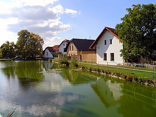
Doubek is a village in the Central Bohemian Region of the Czech Republic. On the date August 28, 2006 it has 201 inhabitants. First written notice about village is from year 1413. The municipality lies at an altitude of 406 metres and covers an area of 3.67 km².

Hafar Al-Batin, also frequently spelled Hafr Al-Batin, is a Saudi Arabian city in the Eastern Province. It is located 430 km north of Riyadh, 94.2 km from the Kuwait border, and about 74.3 from the Iraq border. The city lies in the dry valley of the Wadi al-Batin, which is part of the longer valley of the river Wadi al-Rummah, which leads inland toward Medina and formerly emptied into the Persian Gulf.

Karmravan is a village in the Shirak Province of Armenia.
Cosmești is a commune in Galați County, Romania with a population of 6,475 people. It is composed of six villages: Băltăreți, Cosmești, Cosmeștii-Vale, Furcenii Noi, Furcenii Vechi and Satu Nou.

Kamienny Dwór is a village in the administrative district of Gmina Wyszki, within Bielsk County, Podlaskie Voivodeship, in north-eastern Poland. It lies approximately 24 kilometres (15 mi) north-west of Bielsk Podlaski and 34 km (21 mi) south-west of the regional capital Białystok.

Vanq is a village in the Khojavend Rayon of Azerbaijan.
Kobiele Małe is a village in the administrative district of Gmina Kobiele Wielkie, within Radomsko County, Łódź Voivodeship, in central Poland. It lies approximately 2 kilometres (1 mi) south of Kobiele Wielkie, 14 km (9 mi) south-east of Radomsko, and 86 km (53 mi) south of the regional capital Łódź.
Nowy Dwór is a village in the administrative district of Gmina Złotów, within Złotów County, Greater Poland Voivodeship, in west-central Poland.
Górawino is a village in the administrative district of Gmina Bobolice, within Koszalin County, West Pomeranian Voivodeship, in north-western Poland.
Kollo is a large town and urban communein southwestern Niger, where NGOs work, as well as, missionaries and Peace Corps volunteers.
Mõisaküla is a village in Lääne-Nigula Parish, Lääne County, in western Estonia.

Kostolomci is a village in the municipality of Srebrenica, Bosnia and Herzegovina.

Bweremana (Bweremane) is a village in Masisi Territory, North Kivu, Democratic Republic of the Congo. It is on Lake Kivu 4 kilometres (2.5 mi) north of Minova via Route N-2.


