Crkovnica | |
---|---|
Village | |
Coordinates: 43°07′20″N22°01′07″E / 43.12222°N 22.01861°E | |
Country | |
District | Jablanica District |
Municipality | Leskovac |
Population (2002) | |
• Total | 133 |
Time zone | CET (UTC+1) |
• Summer (DST) | CEST (UTC+2) |
Crkovnica is a village in the municipality of Leskovac, Serbia. According to the 2002 census, the village has a population of 133 people. [1]
A village is a clustered human settlement or community, larger than a hamlet but smaller than a town, with a population ranging from a few hundred to a few thousand. Though villages are often located in rural areas, the term urban village is also applied to certain urban neighborhoods. Villages are normally permanent, with fixed dwellings; however, transient villages can occur. Further, the dwellings of a village are fairly close to one another, not scattered broadly over the landscape, as a dispersed settlement.
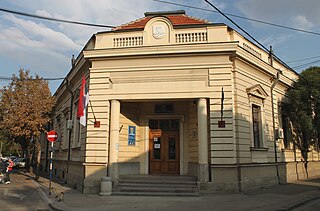
Leskovac is a city and the administrative center of the Jablanica District in southern Serbia. According to the 2011 census, the city urban area has 60,288 inhabitants, while the city administrative area has 144,206.
Serbia, officially the Republic of Serbia, is a country situated at the crossroads of Central and Southeast Europe in the southern Pannonian Plain and the central Balkans. The sovereign state borders Hungary to the north, Romania to the northeast, Bulgaria to the southeast, North Macedonia to the south, Croatia and Bosnia and Herzegovina to the west, and Montenegro to the southwest. The country claims a border with Albania through the disputed territory of Kosovo. Serbia's population is about seven million. Its capital, Belgrade, ranks among the oldest and largest citiеs in southeastern Europe.
Blękwit is a village in the administrative district of Gmina Złotów, within Złotów County, Greater Poland Voivodeship, in west-central Poland.
Abia de la Obispalía is a municipality in Cuenca, Castile-La Mancha, Spain. It has a population of 85.
Lukashin, is a village in the Armavir Province of Armenia.
Chwaliszewo is a village in the administrative district of Gmina Kcynia, within Nakło County, Kuyavian-Pomeranian Voivodeship, in north-central Poland.
Pokr Sariar is a village in the Shirak Province of Armenia.
Wierzchowiska Dolne is a village in the administrative district of Gmina Bełżyce, within Lublin County, Lublin Voivodeship, in eastern Poland.
Mazew-Kolonia is a village in the administrative district of Gmina Daszyna, within Łęczyca County, Łódź Voivodeship, in central Poland.
Mollakənd is a village and municipality in the Kurdamir Rayon of Azerbaijan.
Nowe Gajęcice is a village in the administrative district of Gmina Pajęczno, within Pajęczno County, Łódź Voivodeship, in central Poland.
Góry Opolskie is a village in the administrative district of Gmina Opole Lubelskie, within Opole Lubelskie County, Lublin Voivodeship, in eastern Poland.
Urbanów is a village in the administrative district of Gmina Jedlińsk, within Radom County, Masovian Voivodeship, in east-central Poland.
Seyidlər is a village in the Zardab Rayon of Azerbaijan.
Nowy Młyn is a village in the administrative district of Gmina Kwilcz, within Międzychód County, Greater Poland Voivodeship, in west-central Poland.
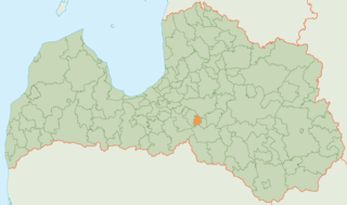
Skrīveri Municipality is a municipality in Vidzeme, Latvia. The municipality was formed in 2009 by reorganization of Skrīveri parish; the administrative centre being Skrīveri.
Donje Stopanje is a village in the municipality of Leskovac, Serbia. According to the 2002 census, the village has a population of 1136 people.
Smedovac is a village in the municipality of Negotin, Serbia. According to the 2002 census, the village has a population of 163 people.
Kazaginac is a village in the municipality of Tomislavgrad in Canton 10 of the Federation of Bosnia and Herzegovina in Bosnia and Herzegovina. The village is also part of the smaller Buško Blato micro-region, consisting of those villages and settlements surrounding the lake known as Buško jezero. According to the 2013 census, there were 277 inhabitants.
Bjelasovići is a village in the municipality of Sokolac, Bosnia and Herzegovina.
Hej is a village in Jörns socken in the north-west part of Skellefteå Municipality, Västerbotten County, Sweden.
Coordinates: 43°07′20″N22°01′07″E / 43.12222°N 22.01861°E
A geographic coordinate system is a coordinate system that enables every location on Earth to be specified by a set of numbers, letters or symbols. The coordinates are often chosen such that one of the numbers represents a vertical position and two or three of the numbers represent a horizontal position; alternatively, a geographic position may be expressed in a combined three-dimensional Cartesian vector. A common choice of coordinates is latitude, longitude and elevation. To specify a location on a plane requires a map projection.
This Jablanica District, Serbia location article is a stub. You can help Wikipedia by expanding it. |