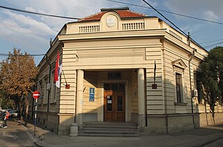
Staré Jesenčany is a village in the Pardubice Region of the Czech Republic, very near to the city of Pardubice. It has cca 230 inhabitants.

Mutiloa is a town and municipality located in the Goierri region of the province of Gipuzkoa, in the autonomous community of the Basque Country, northern Spain.

Osieczna is a village in the administrative district of Gmina Kostomłoty, within Środa Śląska County, Lower Silesian Voivodeship, in south-western Poland. Prior to 1945 it was in Germany.

Xaşı is a village in the Quba Rayon of Azerbaijan. The village forms part of the municipality of Qonaqkənd.

Bór Kunowski is a village in the administrative district of Gmina Brody, within Starachowice County, Świętokrzyskie Voivodeship, in south-central Poland. It lies approximately 4 kilometres (2 mi) east of Brody, 15 km (9 mi) east of Starachowice, and 49 km (30 mi) east of the regional capital Kielce.

Lisówek is a village in the administrative district of Gmina Żabia Wola, within Grodzisk Mazowiecki County, Masovian Voivodeship, in east-central Poland.

Michałów-Grabina is a village in the administrative district of Gmina Nieporęt, within Legionowo County, Masovian Voivodeship, in east-central Poland. It lies approximately 7 kilometres (4 mi) south of Nieporęt, 9 km (6 mi) south-east of Legionowo, and 17 km (11 mi) north of Warsaw.

Gilówka Górna is a village in the administrative district of Gmina Iłów, within Sochaczew County, Masovian Voivodeship, in east-central Poland. It lies approximately 2 kilometres (1 mi) north of Iłów, 21 km (13 mi) north-west of Sochaczew, and 69 km (43 mi) west of Warsaw.
Helenów is a village in the administrative district of Gmina Orońsko, within Szydłowiec County, Masovian Voivodeship, in east-central Poland.

Lipe Trzecie is a village in the administrative district of Gmina Blizanów, within Kalisz County, Greater Poland Voivodeship, in west-central Poland. It lies approximately 5 kilometres (3 mi) north of Blizanów, 21 km (13 mi) north of Kalisz, and 92 km (57 mi) south-east of the regional capital Poznań.

Dolsko is a village in Gmina Miastko, Bytów County, Pomeranian Voivodeship, in northern Poland, on the border with West Pomeranian Voivodeship. It lies approximately 29 kilometres (18 mi) south-west of Bytów and 106 km (66 mi) south-west of Gdańsk.

Przymuszewo is a village in the administrative district of Gmina Brusy, within Chojnice County, Pomeranian Voivodeship, in northern Poland. It lies approximately 14 kilometres (9 mi) north of Brusy, 35 km (22 mi) north of Chojnice, and 76 km (47 mi) south-west of the regional capital Gdańsk.

Dźwierzeński Młyn is a former settlement in the administrative district of Gmina Koczała, within Człuchów County, Pomeranian Voivodeship, in northern Poland. It lies approximately 9 kilometres (6 mi) north of Koczała, 43 km (27 mi) north-west of Człuchów, and 114 km (71 mi) south-west of the regional capital Gdańsk. For details of the history of the region, see History of Pomerania.

Bocianowo is a village in the administrative district of Gmina Kolno, within Olsztyn County, Warmian-Masurian Voivodeship, in northern Poland. It lies approximately 5 kilometres (3 mi) south of Kolno and 40 km (25 mi) north-east of the regional capital Olsztyn.

Tallac Village is an unincorporated community in El Dorado County, California. It lies at an elevation of 6263 feet.

Donje Krajince is a village in the municipality of Leskovac, Serbia. According to the 2002 census, the village has a population of 764 people.
Oandu is a village in Lüganuse Parish, Ida-Viru County in northeastern Estonia.

Bučkovići na Bezujanci is a village in the municipality of Čajniče, Bosnia and Herzegovina.

Širijevići is a village in the municipality of Sokolac, Bosnia and Herzegovina.

Grasmere, originally known as "Goffstown Centre", is an unincorporated community within the town of Goffstown, New Hampshire, in the United States. It straddles the Piscataquog River in the eastern part of Goffstown.


