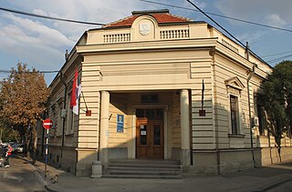
Margahovit, is a major village in the Lori Province of Armenia.

Wybudowanie Raciąskie is a village in the administrative district of Gmina Tuchola, within Tuchola County, Kuyavian-Pomeranian Voivodeship, in north-central Poland. It lies approximately 8 kilometres (5 mi) north-west of Tuchola and 61 km (38 mi) north of Bydgoszcz.

Jeziora is a village in the administrative district of Gmina Rogowo, within Żnin County, Kuyavian-Pomeranian Voivodeship, in north-central Poland. It lies approximately 11 kilometres (7 mi) south-east of Rogowo, 22 km (14 mi) south of Żnin, and 53 km (33 mi) south of Bydgoszcz.

Grodzisk is a village in Siemiatycze County, Podlaskie Voivodeship, in north-eastern Poland. It is the seat of the gmina called Gmina Grodzisk. It lies approximately 20 kilometres (12 mi) north-west of Siemiatycze and 66 km (41 mi) south-west of the regional capital Białystok.

Fingə is a village in the Lachin Rayon of Azerbaijan.

Błogoszów is a village in the administrative district of Gmina Oksa, within Jędrzejów County, Świętokrzyskie Voivodeship, in south-central Poland. It lies approximately 4 kilometres (2 mi) north of Oksa, 21 km (13 mi) north-west of Jędrzejów, and 40 km (25 mi) west of the regional capital Kielce.

Wyspa is a village in the administrative district of Gmina Zawichost, within Sandomierz County, Świętokrzyskie Voivodeship, in south-central Poland. It lies approximately 9 kilometres (6 mi) west of Zawichost, 13 km (8 mi) north of Sandomierz, and 80 km (50 mi) east of the regional capital Kielce.

Czerwin is a village in Ostrołęka County, Masovian Voivodeship, in east-central Poland. It is the seat of the gmina called Gmina Czerwin. It lies approximately 19 kilometres (12 mi) south-east of Ostrołęka and 96 km (60 mi) north-east of Warsaw.
Rudno Kmiece is a village in the administrative district of Gmina Krzynowłoga Mała, within Przasnysz County, Masovian Voivodeship, in east-central Poland.

Tocznabiel is a village in the administrative district of Gmina Obryte, within Pułtusk County, Masovian Voivodeship, in east-central Poland. It lies approximately 6 kilometres (4 mi) north-west of Obryte, 8 km (5 mi) north-east of Pułtusk, and 60 km (37 mi) north of Warsaw.

Górne Grądy is a village in the administrative district of Gmina Pyzdry, within Września County, Greater Poland Voivodeship, in west-central Poland. It lies approximately 9 kilometres (6 mi) south-east of Pyzdry, 29 km (18 mi) south-east of Września, and 67 km (42 mi) south-east of the regional capital Poznań.

Atma Singh is a village in the Punjab province of Pakistan.

Pikus (German: Picus is a village in the administrative district of Gmina Iława, within Iława County, Warmian-Masurian Voivodeship, in northern Poland. It lies approximately 14 kilometres north-east of Iława and 53 km west of the regional capital Olsztyn.
Colelia is a commune located in Ialomița County, Romania. It is composed of a single village, Colelia, part of Cocora Commune until 2005.

Skorkov is a village and municipality in Mladá Boleslav District in the Central Bohemian Region of the Czech Republic. It is located 26 kilometres (16 mi) northeast of Prague.

Andreevca is a commune in Transnistria, Moldova. It is composed of three villages: Andreevca, Pîcalova and Șmalena (Шмалена). It is currently under the administration of the breakaway government of the Transnistrian Moldovan Republic.

Krivača is a village in the municipality of Lučani, Serbia. According to the 2011 census, the village has a population of 157 people.

Jasen is a village in the municipality of Trebinje, Republika Srpska, Bosnia and Herzegovina.
Metsaküla is a village in Põhja-Pärnumaa Parish, Pärnu County in western-central Estonia.

The Ga East Municipal is one of the ten (10) districts in the Greater Accra Region of Ghana. Its capital is Abokobi.


