Nakrivanj

Last updated
Nakrivanj
Village
Nakrivanj, Leskovac 11.jpg
Serbia adm location map.svg
Red pog.svg
Nakrivanj
Coordinates: 42°52′58″N21°56′36″E / 42.88278°N 21.94333°E / 42.88278; 21.94333
CountryFlag of Serbia.svg  Serbia
District Jablanica District
Municipality Leskovac
Population
(2002)
  Total1,315
Time zone UTC+1 (CET)
  Summer (DST) UTC+2 (CEST)

Nakrivanj is a village in the municipality of Leskovac, Serbia. According to the 2002 census, the village has a population of 1315 people. [1]

Village Small clustered human settlement smaller than a town

A village is a clustered human settlement or community, larger than a hamlet but smaller than a town, with a population ranging from a few hundred to a few thousand. Though villages are often located in rural areas, the term urban village is also applied to certain urban neighborhoods. Villages are normally permanent, with fixed dwellings; however, transient villages can occur. Further, the dwellings of a village are fairly close to one another, not scattered broadly over the landscape, as a dispersed settlement.

Leskovac City in Southern and Eastern Serbia, Serbia

Leskovac is a city and the administrative center of the Jablanica District in southern Serbia. According to the 2011 census, the city urban area has 60,288 inhabitants, while the city administrative area has 144,206.

Serbia Republic in Southeastern Europe

Serbia, officially the Republic of Serbia, is a country situated at the crossroads of Central and Southeast Europe in the southern Pannonian Plain and the central Balkans. It borders Hungary to the north, Romania to the northeast, Bulgaria to the southeast, North Macedonia to the south, Croatia and Bosnia and Herzegovina to the west, and Montenegro to the southwest. The country claims a border with Albania through the disputed territory of Kosovo. Serbia's population numbers approximately seven million, most of whom are Orthodox Christians. Its capital, Belgrade, ranks among the oldest and largest citiеs in southeastern Europe.

Related Research Articles

Svídnice (Chrudim District) Village in Chrudim District of Pardubice region

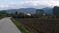
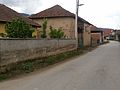
Svídnice is a village in Pardubice Region of the Czech Republic. It has around 420 inhabitants.

Dorimcheon station train station in South Korea

Dorimcheon Station is a station on the Sinjeong Branch of the Seoul Subway Line 2. It is the least-used station on Line 2. This station is located in Sindorim-dong, Guro-gu, Seoul.

Jamník, Spišská Nová Ves District municipality in the Spišská Nová Ves District in the Košice Region of east central Slovakia

Jamník is a village and municipality in the Spišská Nová Ves District in the Košice Region of east central Slovakia.

Căbești Commune in Bihor County, Romania

Căbești is a commune in Bihor County, Romania, around 13 kilometers north of the town of Beiuș.

Xaxa, Botswana village in Botswana

Xaxa is a village in North-West District of Botswana. It is close to the Namibian border and has a primary school. The population was 280 in 2001 census.

Sungai Kebun is a mukim in the Brunei-Muara district of Brunei. It is one of the six water village mukims. All the water village mukims are quite small in size and area and are water-bound. It is located in the heart of Brunei's capital, Bandar Seri Begawan on the waters of the Brunei river. Sungai Kebun is a part of the water village collective though it is actually considered as a mukim itself. It is adjacent to the other six water village mukims. It borders Mukim Peramu and Mukim Saba to the north, Mukim Kota Batu to the east, Mukim Lumapas to the south and west and Mukim Burong Pingai Ayer to the west and north. Awang Semaun Secondary School is located in Kampong Sungai Kebun.

Łazisko, Łódź Voivodeship Village in Łódź, Poland

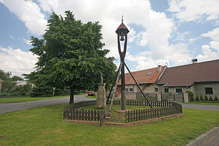
Łazisko is a village in the administrative district of Gmina Tomaszów Mazowiecki, within Tomaszów Mazowiecki County, Łódź Voivodeship, in central Poland. It lies approximately 7 kilometres (4 mi) north-west of Tomaszów Mazowiecki and 42 km (26 mi) south-east of the regional capital Łódź.

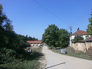
Dragovita is a village in the municipality of Dimitrovgrad, Serbia. According to the 2002 census, the village has a population of 81 people.

Borince Village in Jablanica District, Serbia

Borince is a village in the municipality of Bojnik, Serbia. According to the 2002 census, the village has a population of 45 people.

Đinđuša Village in Jablanica District, Serbia

Đinđuša is a village in the municipality of Bojnik, Serbia. According to the 2002 census, the village has a population of 675 people.

Belanovce (Leskovac) Village in Jablanica District, Serbia

Belanovce is a village in the municipality of Leskovac, Serbia. According to the 2002 census, the village has a population of 600 people.

Beli Potok (Leskovac) Village in Jablanica District, Serbia

Beli Potok is a village in the municipality of Leskovac, Serbia. According to the 2002 census, the village has a population of 629 people.

Čukljenik (Leskovac) Village in Jablanica District, Serbia

Čukljenik is a village in the municipality of Leskovac, Serbia. According to the 2002 census, the village has a population of 636 people.

Kumarevo (Leskovac) Village in Jablanica District, Serbia

Kumarevo is a village in the municipality of Leskovac, Serbia. According to the 2002 census, the village has a population of 825 people.

Orašac (Leskovac) Village in Jablanica District, Serbia

Orašac is a village in the municipality of Leskovac, Serbia. According to the 2002 census, the village has a population of 582 people.

Žižavica Village in Jablanica District, Serbia

Žižavica is a village in the municipality of Leskovac, Serbia. According to the 2002 census, the village has a population of 189 people.

Šarbanovac (Sokobanja) Village in Zaječar District, Serbia

Šarbanovac is a village in the municipality of Sokobanja, Serbia. According to the 2002 census, the village has a population of 514 people.

South Toe River river in the United States of America

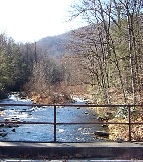
The South Toe River is a river in Mitchell, Yancey and McDowell counties in Western North Carolina. The name Toe is taken from its original name Estatoe, pronounced 'S - ta - toe', a native American name associated with the Estatoe trade route leading down from the NC mountains through Brevard where there is a historical plaque with information that affirms the route, on into South Carolina where a village of the same name was located.

Vlasina Rid Village in Pčinja District, Serbia

Vlasina Rid is a village in the municipality of Surdulica, Serbia. According to the 2002 census, the village has a population of 276 people.

Podmočani Village in Resen Municipality, North Macedonia

Podmočani is a village in the Resen Municipality of the Republic of North Macedonia, north of Lake Prespa. The village is roughly 8 kilometres (5.0 mi) from the municipal centre of Resen.

References

  1. Popis stanovništva, domaćinstava i Stanova 2002. Knjiga 1: Nacionalna ili etnička pripadnost po naseljima. Republika Srbija, Republički zavod za statistiku Beograd 2003. ISBN   86-84433-00-9

Coordinates: 42°52′58″N21°56′36″E / 42.88278°N 21.94333°E / 42.88278; 21.94333

Geographic coordinate system Coordinate system

A geographic coordinate system is a coordinate system that enables every location on Earth to be specified by a set of numbers, letters or symbols. The coordinates are often chosen such that one of the numbers represents a vertical position and two or three of the numbers represent a horizontal position; alternatively, a geographic position may be expressed in a combined three-dimensional Cartesian vector. A common choice of coordinates is latitude, longitude and elevation. To specify a location on a plane requires a map projection.