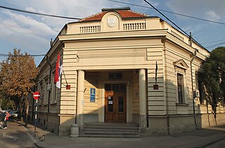
Rebild municipality is a municipality in North Jutland Region in Denmark. It covers an area of 628 km² and a total population of 28,753 (2008).
Daronice is a village in the administrative district of Gmina Żnin, within Żnin County, Kuyavian-Pomeranian Voivodeship, in north-central Poland.
Pteleonas, known before 1927 as Harbino (Χαρμπίνας), is a village located 16 km east/southeast of Ptolemaida, in Kozani regional unit, within the Greek region of Macedonia. It is situated at an altitude of 780 meters. The postal code is 50200, while the telephone code is +30 24630. At the 2011 census, the population was 36.

Qarqay is a village in the Zaqatala Rayon of Azerbaijan. The village forms part of the municipality of Əli Bayramlı.

Grotniki is a village in the administrative district of Gmina Zgierz, within Zgierz County, Łódź Voivodeship, in central Poland. It lies approximately 9 kilometres (6 mi) north-west of Zgierz and 17 km (11 mi) north-west of the regional capital Łódź.

Podole is a village in the administrative district of Gmina Zgierz, within Zgierz County, Łódź Voivodeship, in central Poland. It lies approximately 8 kilometres (5 mi) north-east of Zgierz and 13 km (8 mi) north of the regional capital Łódź.

Pieńki-Żaki is a village in the administrative district of Gmina Andrzejewo, within Ostrów Mazowiecka County, Masovian Voivodeship, in east-central Poland. It lies approximately 3 kilometres (2 mi) south-east of Andrzejewo, 24 km (15 mi) east of Ostrów Mazowiecka, and 108 km (67 mi) north-east of Warsaw.
Borowice is a village in the administrative district of Gmina Bodzanów, within Płock County, Masovian Voivodeship, in east-central Poland.

Rachocin is a village in the administrative district of Gmina Sierpc, within Sierpc County, Masovian Voivodeship, in east-central Poland. It lies approximately 1 kilometre (1 mi) north of Sierpc and 118 km (73 mi) north-west of Warsaw.

Kosemin is a village in the administrative district of Gmina Zawidz, within Sierpc County, Masovian Voivodeship, in east-central Poland. It lies approximately 6 kilometres (4 mi) north of Zawidz, 16 km (10 mi) east of Sierpc, and 104 km (65 mi) north-west of Warsaw.

Kamionka is a village in the administrative district of Gmina Witkowo, within Gniezno County, Greater Poland Voivodeship, in west-central Poland. It lies approximately 5 kilometres (3 mi) north-east of Witkowo, 17 km (11 mi) south-east of Gniezno, and 62 km (39 mi) east of the regional capital Poznań.
Pierzwin is a village in the administrative district of Gmina Nowogród Bobrzański, within Zielona Góra County, Lubusz Voivodeship, in western Poland.

Osowo is a village in the administrative district of Gmina Karsin, within Kościerzyna County, Pomeranian Voivodeship, in northern Poland. It lies approximately 5 kilometres (3 mi) south-west of Karsin, 28 km (17 mi) south of Kościerzyna, and 74 km (46 mi) south-west of the regional capital Gdańsk.

Wrząca is a village in the administrative district of Gmina Kobylnica, within Słupsk County, Pomeranian Voivodeship, in northern Poland. It lies approximately 13 kilometres (8 mi) south-west of Kobylnica, 16 km (10 mi) south-west of Słupsk, and 114 km (71 mi) west of the regional capital Gdańsk.

Lędowo-Osiedle is a village in the administrative district of Gmina Ustka, within Słupsk County, Pomeranian Voivodeship, in northern Poland. It lies approximately 3 kilometres (2 mi) south-west of Ustka, 18 km (11 mi) north-west of Słupsk, and 120 km (75 mi) west of the regional capital Gdańsk.

Gniazdowo is a village in the administrative district of Gmina Mrągowo, within Mrągowo County, Warmian-Masurian Voivodeship, in northern Poland. It lies approximately 6 kilometres (4 mi) south of Mrągowo and 52 km (32 mi) east of the regional capital Olsztyn.

Szarłaty is a village in the administrative district of Gmina Sorkwity, within Mrągowo County, Warmian-Masurian Voivodeship, in northern Poland. It lies approximately 4 kilometres (2 mi) south-west of Sorkwity, 14 km (9 mi) south-west of Mrągowo, and 41 km (25 mi) east of the regional capital Olsztyn.

Košarno is a village in the municipality of Bujanovac, Serbia. According to the 2002 census, the town has a population of 105 people.
Montevite is a village in Álava, Basque Country, Spain. With just 53 inhabitants in 2015, it is the less populated village of Iruña de Oca municipality, where it is included.

Kapelludden is a wetland on the east coast of the island of Öland, Sweden, some four kilometers from the village of Bredsättra in Bredsättra socken, Borgholm Municipality. The area is rich in birdlife, and has important cultural remains and a functioning Kapelludden lighthouse.


