Solinki is a village in the administrative district of Gmina Konstantynów, within Biała Podlaska County, Lublin Voivodeship, in eastern Poland.
Myszkowiec is a village in the administrative district of Gmina Dorohusk, within Chełm County, Lublin Voivodeship, in eastern Poland, close to the border with Ukraine.
Brzozowo-Chrzczonki is a village in the administrative district of Gmina Poświętne, within Białystok County, Podlaskie Voivodeship, in north-eastern Poland.

Strzelce Wielkie is a village in Pajęczno County, Łódź Voivodeship, in central Poland. It is the seat of the gmina called Gmina Strzelce Wielkie. It lies approximately 11 kilometres (7 mi) east of Pajęczno and 75 km (47 mi) south of the regional capital Łódź.

Wincentów is a village in the administrative district of Gmina Końskie, within Końskie County, Świętokrzyskie Voivodeship, in south-central Poland. It lies approximately 8 kilometres (5 mi) south-west of Końskie and 35 km (22 mi) north-west of the regional capital Kielce.
Prusy is a village in the administrative district of Gmina Mińsk Mazowiecki, within Mińsk County, Masovian Voivodeship, in east-central Poland.
Uniszki-Cegielnia is a village in the administrative district of Gmina Wieczfnia Kościelna, within Mława County, Masovian Voivodeship, in east-central Poland.
Dąbrówka-Niwka is a village in the administrative district of Gmina Skórzec, within Siedlce County, Masovian Voivodeship, in east-central Poland.
Wikcinek is a village in the administrative district of Gmina Nowa Sucha, within Sochaczew County, Masovian Voivodeship, in east-central Poland.

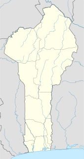
Tori-Bossito is a town, arrondissement, and commune in the Atlantique Department of southern Benin. The commune covers an area of 263 square kilometres and as of 2002 had a population of 44,569 people.
Stary Sielec is a village in the administrative district of Gmina Jutrosin, within Rawicz County, Greater Poland Voivodeship, in west-central Poland.

Józefów is a village in the administrative district of Gmina Władysławów, within Turek County, Greater Poland Voivodeship, in west-central Poland. It lies approximately 6 kilometres (4 mi) north-west of Władysławów, 15 km (9 mi) north of Turek, and 108 km (67 mi) east of the regional capital Poznań.

Załęże is a village in the administrative district of Gmina Koczała, within Człuchów County, Pomeranian Voivodeship, in northern Poland. It lies approximately 6 kilometres (4 mi) north-east of Koczała, 34 km (21 mi) north-west of Człuchów, and 109 km (68 mi) south-west of the regional capital Gdańsk.
Malinówka Mała is a village in the administrative district of Gmina Ełk, within Ełk County, Warmian-Masurian Voivodeship, in northern Poland.

Korzystno is a village in the administrative district of Gmina Kołobrzeg, within Kołobrzeg County, West Pomeranian Voivodeship, in north-western Poland. It lies approximately 4 kilometres (2 mi) south-west of Kołobrzeg and 102 km (63 mi) north-east of the regional capital Szczecin.
Kluky is a village and municipality in Kutná Hora District in the Central Bohemian Region of the Czech Republic.
Samūniškės is a village in Varėna district municipality, in Alytus County, in southeastern Lithuania. According to the 2001 census, the village has a population of 41 people.
Mazgoš is a village in the municipality of Dimitrovgrad, Serbia. According to the 2002 census, the village has a population of 27 people.

Sagonjevo is a village in the municipality of Kuršumlija, Serbia. According to the 2002 census, the village has a population of 118 people.
Järvajõe is a village in Tapa Parish, Lääne-Viru County, in northeastern Estonia. It lies on the left bank of the Valgejõgi River.


