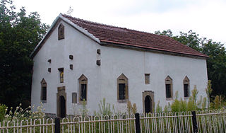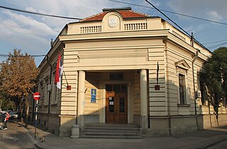
Śliwno is a village in the administrative district of Gmina Choroszcz, within Białystok County, Podlaskie Voivodeship, in north-eastern Poland. It lies approximately 11 kilometres (7 mi) south-west of Choroszcz and 23 km (14 mi) west of the regional capital Białystok.

Bənövşələr is a village in the Agdam Rayon of Azerbaijan. The village forms part of the municipality of Əhmədağalı.
Budy-Szreniawa is a village in the administrative district of Gmina Fałków, within Końskie County, Świętokrzyskie Voivodeship, in south-central Poland.

Grodzisko is a village in the administrative district of Gmina Radoszyce, within Końskie County, Świętokrzyskie Voivodeship, in south-central Poland. It lies approximately 3 kilometres (2 mi) south-west of Radoszyce, 21 km (13 mi) south-west of Końskie, and 35 km (22 mi) north-west of the regional capital Kielce.

Sonina is a village in the administrative district of Gmina Łańcut, within Łańcut County, Subcarpathian Voivodeship, in south-eastern Poland. It lies approximately 3 kilometres (2 mi) east of Łańcut and 20 km (12 mi) east of the regional capital Rzeszów.

Gwizdaj is a village in the administrative district of Gmina Przeworsk, within Przeworsk County, Subcarpathian Voivodeship, in south-eastern Poland.

Borki-Paduchy is a village in the administrative district of Gmina Wiśniew, within Siedlce County, Masovian Voivodeship, in east-central Poland. It lies approximately 5 kilometres (3 mi) north-east of Wiśniew, 11 km (7 mi) south-east of Siedlce, and 94 km (58 mi) east of Warsaw.

Trzcinno is a village in Gmina Miastko, Bytów County, Pomeranian Voivodeship, in northern Poland. It lies approximately 28 kilometres (17 mi) south-west of Bytów and 106 km (66 mi) south-west of Gdańsk.

Niedamowo is a village in the administrative district of Gmina Kościerzyna, within Kościerzyna County, Pomeranian Voivodeship, in northern Poland. It lies approximately 10 kilometres (6 mi) south-east of Kościerzyna and 49 km (30 mi) south-west of the regional capital Gdańsk.

Nowy Dwór is a village in the administrative district of Gmina Elbląg, within Elbląg County, Warmian-Masurian Voivodeship, in northern Poland. It lies approximately 10 kilometres (6 mi) south-east of Elbląg and 71 km (44 mi) north-west of the regional capital Olsztyn.
Sajna Mała is a village in the administrative district of Gmina Korsze, within Kętrzyn County, Warmian-Masurian Voivodeship, in northern Poland.

Hảo Nghĩa is a commune (xã) and village in Na Rì District, Bắc Kạn Province, in Vietnam.

Svárov is a village and municipality in Kladno District in the Central Bohemian Region of the Czech Republic.

Gavril Genovo is a village in northwestern Bulgaria, part of Georgi Damyanovo Municipality, Montana Province. It was formed in 1955 through the merger of Sotochino and Ilitsa. It was named after September Uprising leader Gavril Genov.

Gornji Prisjan is a village in the municipality of Vlasotince, Serbia. According to the 2012 census, the village has a population of 335 people.

Bačevica is a village in the municipality of Boljevac, Serbia. According to the 2002 census, the village has a population of 409 people.

Nakučani is a village in the municipality of Gornji Milanovac, Serbia. According to the 2002 census, the village has a population of 123 people.

Ozrem is a village in the municipality of Gornji Milanovac, Serbia. According to the 2002 census, the village has a population of 343 people.

Kazanci is a village in the municipality of Gacko, Republika Srpska, Bosnia and Herzegovina.

Čukote is a village in the municipality of Tutin, Serbia. According to the 2002 census, the village has a population of 136 people.


