Greensboro, Maryland | |
---|---|
Coordinates: 38°58′32″N75°48′25″W / 38.97556°N 75.80694°W | |
Country | United States of America |
State | Maryland |
County | Caroline |
Incorporated | 1826 [1] |
Area | |
• Total | 1.07 sq mi (2.78 km2) |
• Land | 1.07 sq mi (2.78 km2) |
• Water | 0.00 sq mi (0.00 km2) |
Elevation | 16 ft (5 m) |
Population (2020) | |
• Total | 1,919 |
• Density | 1,786.78/sq mi (689.73/km2) |
Time zone | UTC-5 (Eastern (EST)) |
• Summer (DST) | UTC-4 (EDT) |
ZIP code | 21639 |
Area code | 410 |
FIPS code | 24-35200 |
GNIS feature ID | 0590381 |
Website | www |
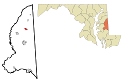
Greensboro is a town located on the banks of the Choptank River in Caroline County, Maryland, United States. The population was 1,931 at the 2010 United States Census. The ZIP code is 21639. The primary phone exchange is 482 and the area code is 410. The town is served by Maryland Routes 480 and 313.
Greensboro hosted the Caroline County Softball League, which produced both state and national champions.
Willow Grove was listed on the National Register of Historic Places in 1972. [3] Leonard House was listed in 1988 and Brick House Farm in 2009. [3]
Greensboro is located at 38°58′32″N75°48′25″W / 38.975441°N 75.806982°W . [4]
According to the United States Census Bureau, the town has a total area of 1.05 square miles (2.72 km2), all land. [5]
Census | Pop. | Note | %± |
---|---|---|---|
1860 | 406 | — | |
1870 | 561 | 38.2% | |
1880 | 684 | 21.9% | |
1890 | 902 | 31.9% | |
1900 | 641 | −28.9% | |
1910 | 609 | −5.0% | |
1920 | 668 | 9.7% | |
1930 | 760 | 13.8% | |
1940 | 737 | −3.0% | |
1950 | 1,181 | 60.2% | |
1960 | 1,160 | −1.8% | |
1970 | 1,173 | 1.1% | |
1980 | 1,253 | 6.8% | |
1990 | 1,441 | 15.0% | |
2000 | 1,632 | 13.3% | |
2010 | 1,931 | 18.3% | |
2020 | 1,919 | −0.6% | |
U.S. Decennial Census [6] |
As of the census [7] of 2010, there were 1,931 people, 703 households, and 477 families living in the town. The population density was 1,839.0 inhabitants per square mile (710.0/km2). There were 798 housing units at an average density of 760.0 per square mile (293.4/km2). The racial makeup of the town was 75.8% White, 13.6% African American, 0.9% Native American, 0.8% Asian, 1.4% Pacific Islander, 4.0% from other races, and 3.6% from two or more races. Hispanic or Latino of any race were 9.4% of the population.
There were 703 households, of which 42.4% had children under the age of 18 living with them, 42.0% were married couples living together, 18.3% had a female householder with no husband present, 7.5% had a male householder with no wife present, and 32.1% were non-families. 27.3% of all households were made up of individuals, and 12.4% had someone living alone who was 65 years of age or older. The average household size was 2.74 and the average family size was 3.30.
The median age in the town was 30.2 years. 30% of residents were under the age of 18; 10.5% were between the ages of 18 and 24; 30.2% were from 25 to 44; 19.5% were from 45 to 64; and 9.8% were 65 years of age or older. The gender makeup of the town was 46.5% male and 53.5% female.
As of the census [8] of 2000, there were 1,632 people, 616 households, and 407 families living in the town. The population density was 2,451.3 inhabitants per square mile (946.5/km2). There were 674 housing units at an average density of 1,012.4 per square mile (390.9/km2). The racial makeup of the town was 78.86% White, 16.91% African American, 0.06% Native American, 0.67% Asian, 1.78% from other races, and 1.72% from two or more races. Hispanic or Latino of any race were 2.63% of the population.
There were 616 households, out of which 40.6% had children under the age of 18 living with them, 41.7% were married couples living together, 19.6% had a female householder with no husband present, and 33.9% were non-families. 29.1% of all households were made up of individuals, and 13.6% had someone living alone who was 65 years of age or older. The average household size was 2.64 and the average family size was 3.28.
In the town, the population was spread out, with 32.4% under the age of 18, 9.4% from 18 to 24, 29.4% from 25 to 44, 16.5% from 45 to 64, and 12.3% who were 65 years of age or older. The median age was 31 years. For every 100 females, there were 85.0 males. For every 100 females age 18 and over, there were 80.8 males.
The median income for a household in the town was $31,397, and the median income for a family was $36,083. Males had a median income of $27,092 versus $20,729 for females. The per capita income for the town was $13,787. About 15.6% of families and 16.5% of the population were below the poverty line, including 21.6% of those under age 18 and 17.1% of those age 65 or over.
The primary means of travel to and from Greensboro is by road. The town lies at the junction of three state highways: Maryland Route 313, which travels north-south through the town, Maryland Route 314, which travels east from the town, and Maryland Route 480, which heads southwest from the town.
Caroline County is a rural county located in the U.S. state of Maryland on its Eastern Shore. As of the 2020 census, the population was 33,293. Its county seat is Denton.
Greensboro is a town in Greensboro Township, Henry County, Indiana, United States. The population was 143 at the 2010 census. The town was a 'station' on the Underground Railroad and was recognized for its active abolitionists.
Clear Lake is a town located in the northeast corner of Steuben County, Indiana, in Clear Lake Township. As such, is the northeasternmost community in the State of Indiana. The population was 339 at the 2010 census.
Briarwood is a home rule-class city in Jefferson County, Kentucky, United States. The population was 435 at the 2010 census, down from 554 at the 2000 census.
Denton is a town in Caroline County, Maryland, United States. The population of Denton was 4,418 as of the 2010 United States Census, and it is the county seat of Caroline County.
Algonquin is a census-designated place (CDP) in Dorchester County, Maryland, United States. The population was 1,241 at the 2010 census. The community was named for the Algonquin people, one of the Native American tribes in the East.
Myersville is a town in Frederick County, Maryland, United States. The population was 1,626 at the 2010 United States Census.
Walkersville is a town in Frederick County, Maryland, United States. The population was 5,800 at the 2010 census.
Cordova is a census-designated place (CDP) in Talbot County, Maryland, United States. The population was 551 at the 2020 census, down from 592 at the 2000 census.
Oxford is a waterfront town and former colonial port in Talbot County, Maryland, United States. The population was 651 at the 2010 census.
Pulaski Township is a civil township of Jackson County in the southern portion of the U.S. state of Michigan. As of the 2020 census, the township population was 1,883.
Stuyvesant is a town in Columbia County, New York, United States. The population was 1,931 at the 2020 census, down from 2,027 at the 2010 census. The town is in the northwest corner of Columbia County. U.S. Route 9 crosses the southeastern corner of the town.
Cowanshannock Township is a township in Armstrong County, Pennsylvania, United States. The population was 2,742 at the 2020 census, a decrease from the figure of 2,899 tabulated in 2010.
Kiskiminetas Township is a township in Armstrong County, Pennsylvania, United States. The population was 4,604 at the 2020 census, a decrease from the figure of 4,800 tabulated in 2010, making it the most populous township or borough in the county.
Redbank Township is a township in Armstrong County, Pennsylvania, United States. The population was 975 at the 2020 census, a decrease from the figure of 1,064 tabulated in 2010.
Herrick Township is a township in Susquehanna County, Pennsylvania. The population was 711 at the 2020 census.
Mendon is a town in Rutland County, Vermont, United States. The population was 1,149 at the 2020 census.
Evergreen is a town in Langlade County, Wisconsin, United States. The population was 495 as of the 2010 census. The unincorporated communities of Elton and Four Corners are located in the town.
Queen Anne is a town in Queen Anne's and Talbot counties in the U.S. state of Maryland. The population was 222 at the 2010 census.
Gainesville is an incorporated town in Wyoming County, New York. The population was 2,333 at the 2000 census. The town is named after General Edmund P. Gaines.