Greentop, Missouri | |
---|---|
Coordinates: 40°21′03″N92°33′56″W / 40.35083°N 92.56556°W Coordinates: 40°21′03″N92°33′56″W / 40.35083°N 92.56556°W | |
Country | United States |
State | Missouri |
Counties | Schuyler, Adair |
Area | |
• Total | 0.82 sq mi (2.12 km2) |
• Land | 0.82 sq mi (2.12 km2) |
• Water | 0.00 sq mi (0.00 km2) |
Elevation | 984 ft (300 m) |
Population (2020) | |
• Total | 388 |
• Density | 474.91/sq mi (183.36/km2) |
Time zone | UTC-6 (Central (CST)) |
• Summer (DST) | UTC-5 (CDT) |
ZIP code | 63546 |
Area code | 660 |
FIPS code | 29-29422 [3] |
GNIS feature ID | 2394993 [2] |
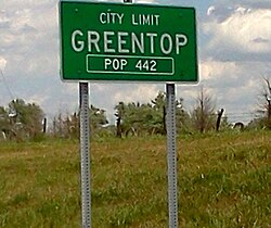
Greentop is a city in Adair and Schuyler counties, Missouri, United States. As of the 2020 census, its population was 388. [4]
Greentop is considered one of the oldest communities in Schuyler County, with its first settlement in the early 1840s. However, the town layout was not documented until 1855. A U.S. Post Office was established in 1857, and the town was finally incorporated in February 1867. [5]
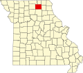
Greentop is located at 40°20′54″N92°34′2″W / 40.34833°N 92.56722°W (40.348360, -92.567281). [6] According to the United States Census Bureau, the city has a total area of 0.82 square miles (2.12 km2), all land. [7] A residential portion lies in Adair County while the majority of the town, including the business district, is in Schuyler County.
Census | Pop. | Note | %± |
---|---|---|---|
1880 | 220 | — | |
1890 | 263 | 19.5% | |
1900 | 284 | 8.0% | |
1910 | 275 | −3.2% | |
1920 | 289 | 5.1% | |
1930 | 268 | −7.3% | |
1940 | 254 | −5.2% | |
1950 | 281 | 10.6% | |
1960 | 311 | 10.7% | |
1970 | 351 | 12.9% | |
1980 | 538 | 53.3% | |
1990 | 425 | −21.0% | |
2000 | 427 | 0.5% | |
2010 | 442 | 3.5% | |
2020 | 388 | −12.2% | |
U.S. Decennial Census [8] |
Greentop is part of the Kirksville Micropolitan Statistical Area.
As of the census [9] of 2010, there were 442 people, 199 households, and 130 families living in the city. The population density was 539.0 inhabitants per square mile (208.1/km2). There were 222 housing units at an average density of 270.7 per square mile (104.5/km2). The racial makeup of the city was 98.9% White, 0.7% Asian, 0.2% from other races, and 0.2% from two or more races. Hispanic or Latino of any race were 0.9% of the population.
There were 199 households, of which 26.6% had children under the age of 18 living with them, 51.3% were married couples living together, 11.1% had a female householder with no husband present, 3.0% had a male householder with no wife present, and 34.7% were non-families. 30.7% of all households were made up of individuals, and 11% had someone living alone who was 65 years of age or older. The average household size was 2.22 and the average family size was 2.75.
The median age in the city was 41.5 years. 22.4% of residents were under the age of 18; 7.8% were between the ages of 18 and 24; 23.2% were from 25 to 44; 28.8% were from 45 to 64; and 18.1% were 65 years of age or older. The gender makeup of the city was 48.0% male and 52.0% female.
As of the census [3] of 2000, there were 427 people, 190 households, and 126 families living in the city. The population density was 521.4 inhabitants per square mile (201.3/km2). There were 221 housing units at an average density of 269.9 per square mile (104.2/km2). The racial makeup of the city was 97.89% White, 0.23% Native American, 0.94% Asian, and 0.94% from two or more races. Hispanic or Latino of any race were 0.94% of the population.
There were 190 households, out of which 31.1% had children under the age of 18 living with them, 55.3% were married couples living together, 9.5% had a female householder with no husband present, and 33.2% were non-families. 31.1% of all households were made up of individuals, and 16.8% had someone living alone who was 65 years of age or older. The average household size was 2.25 and the average family size was 2.76.
In the city, the population was spread out, with 21.8% under the age of 18, 7.7% from 18 to 24, 25.5% from 25 to 44, 28.6% from 45 to 64, and 16.4% who were 65 years of age or older. The median age was 42 years. For every 100 females, there were 91.5 males. For every 100 females age 18 and over, there were 88.7 males.
The median income for a household in the city was $21,953, and the median income for a family was $37,750. Males had a median income of $21,875 versus $19,250 for females. The per capita income for the city was $15,757. About 13.9% of families and 17.5% of the population were below the poverty line, including 18.8% of those under age 18 and 27.7% of those age 65 or over.
Schuyler County is a county located in the northeastern portion of the U.S. state of Missouri. As of the 2020 census, its population was 4,032, making it the fourth-least populous county in Missouri. Its county seat is Lancaster. The county was organized February 14, 1845, from Adair County, and named for General Philip Schuyler, delegate to the Continental Congress and U.S. Senator from New York.
Mineral is a boundaried but unincorporated forest village in Tehama County, California, United States. It has been part of a much larger census-designated place since 1980, for which the population was 123 at the 2010 census, down from 143 at the 2000 census.
Rushville is a city in Schuyler County, Illinois, United States. The population was 3,192 at the 2010 census and 2,902 in 2018. It is the county seat of Schuyler County. It was first settled by Euro-Americans in 1823.
Worthington is a village in southeast Putnam County, Missouri, United States. The population was 47 at the 2020 census.
Lancaster is a city in Schuyler County, Missouri, United States. As of the 2020 census, its population was 675. It is the county seat of Schuyler County.
For the place nicknamed "the Queen City of the Ozarks", see Springfield, Missouri.
Marlborough is a village in St. Louis County, Missouri, United States. The population was 2,179 at the 2010 census.
Schuyler is a city in Colfax County, Nebraska, United States. The population was 6,211 at the 2010 census. It is the county seat of Colfax County. The city is named after former Vice President of the United States, Schuyler Colfax.
Valley is a city in Douglas County, Nebraska, United States. The population was 1,875 at the 2010 census.
Fort Calhoun is a city in Washington County, Nebraska, United States. The population was 908 at the 2010 census. The city includes Fort Atkinson, the first fort built west of the Missouri River.
Manzano is a census-designated place (CDP) in Torrance County, New Mexico, United States. The population was 54 at the 2000 census. The Quarai Ruins of Salinas Pueblo Missions National Monument are located near the town. The center of population of New Mexico is located in Manzano.
Morrisonville is a hamlet and census-designated place in Clinton County, New York, United States. The population was 1,545 at the 2010 census.
Schuyler is a town in Herkimer County, New York, United States. The population was 3,420 at the 2010 census. The town is in the western part of Herkimer County and is east of Utica.
Hornby is a town in Steuben County, New York, United States. The population was 1,682 at the 2020 census. The name is from John Hornby, a land owner of the Pulteney Tract.
Ingold is a census-designated place (CDP) in Sampson County, North Carolina, United States. The population was 484 at the 2000 census.
Indiana Township is a township in Allegheny County, Pennsylvania and a Pittsburgh suburb located in the United States. The population was 7,254 at the 2020 census.
White City is a metro township in Salt Lake County, Utah, United States. The township is an enclave of the City of Sandy. The population was 5,407 at the 2010 census, a modest decrease from the 2000 population of 5,988.
Lumberport is a town in Harrison County, located in northern West Virginia, United States. The population was 720 at the 2020 census.
Palisade is a village in Hayes and Hitchcock counties in the U.S. state of Nebraska. The population was 294 at the 2020 census.
Colfax is a village in Dunn County, Wisconsin, United States. The population was 1,158 at the 2010 census. The village is surrounded by the Town of Colfax.