
Hanover is a town located along the Connecticut River in Grafton County, New Hampshire, United States. As of the 2020 census, its population was 11,870. The town is home to the Ivy League university Dartmouth College, the U.S. Army Corps of Engineers Cold Regions Research and Engineering Laboratory, and Hanover High School. The Appalachian Trail crosses the town, connecting with a number of trails and nature preserves.

Hanover County is a county in the Commonwealth of Virginia. As of the 2020 census, the population was 109,979. Its county seat is Hanover.

Grafton County is a county in the U.S. state of New Hampshire. As of the 2020 census, the population was 91,118. Its county seat is the town of Haverhill. In 1972, the county courthouse and other offices were moved from Woodsville, a larger village within the town of Haverhill, to North Haverhill.

Hanover Park is a village in Cook and DuPage counties in the U.S. state of Illinois. A suburb of Chicago, the population was 37,470 at the 2020 census. Ontarioville is a neighborhood within the village.

Hanover is a town in Hanover Township, Jefferson County, Indiana, United States. Located along the Ohio River, the town's population was 3,546 at the 2010 census. Hanover is the home of Hanover College, a small Presbyterian liberal arts college. The tallest waterfall in Indiana, Fremont Falls, is located in Hanover.

Hanover is a town in Plymouth County, Massachusetts, United States. The population was 14,833 at the 2020 census.
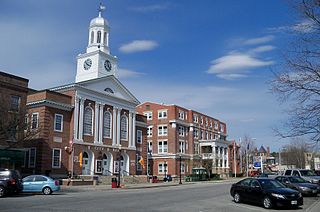
Lebanon is the only city in Grafton County, New Hampshire, United States. The population was 14,282 at the 2020 census, up from 13,151 at the 2010 census. Lebanon is in western New Hampshire, south of Hanover, near the Connecticut River. It is the home to Dartmouth–Hitchcock Medical Center and Dartmouth College's Geisel School of Medicine, together comprising the largest medical facility between Boston, Massachusetts, and Burlington, Vermont.

East Hanover Township is a township in Dauphin County, Pennsylvania, United States. The population was 6,009 at the 2020 census.

Lower Paxton is a township in Dauphin County, Pennsylvania, United States. The population was 53,501 at the 2020 census. It is the most populous municipality in Dauphin County and the 17th-most populated municipality in the state.

West Hanover Township is a township in Dauphin County, Pennsylvania, United States. The population was 10,693 at the 2020 census, an increase over the figure of 9,343 tabulated in 2010.

Hanover Township is a township in Northampton County, Pennsylvania, United States. The population of Hanover Township was 11,785 at the 2020 census.

Hallam is a borough in York County, Pennsylvania, United States. The population was 2,774 at the 2020 census. It is part of the York–Hanover metropolitan area.

The Kingdom of Hanover was established in October 1814 by the Congress of Vienna, with the restoration of George III to his Hanoverian territories after the Napoleonic era. It succeeded the former Electorate of Hanover, and joined 38 other sovereign states in the German Confederation in June 1815. The kingdom was ruled by the House of Hanover, a cadet branch of the House of Welf, in personal union with Great Britain between 1714 and 1837. Since its monarch resided in London, a viceroy, usually a younger member of the British royal family, handled the administration of the Kingdom of Hanover.
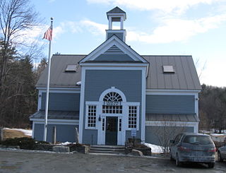
Etna, originally named "Mill Village", is a small community within the town of Hanover, New Hampshire, United States. It is located in southwestern Grafton County, approximately 3 miles (4.8 km) east of Hanover's downtown and 2.5 mi (4.0 km) south of the village of Hanover Center, on Mink Brook. Etna has a separate ZIP code 03750 from the rest of Hanover, as well as its own fire station, general store, ball field, playground, church, and library with adjacent conserved land and bird sanctuary. The population within Etna's ZIP Code area was 870 at the 2010 census.

Mink Brook is a 9.5-mile-long (15.3 km) stream in western New Hampshire in the United States. It is a tributary of the Connecticut River, which flows to Long Island Sound.

Hanover is an unincorporated community and census-designated place (CDP) in Hanover County, Virginia, United States. It is the county seat and is located at the junction of U.S. Route 301 and State Route 54 south of the Pamunkey River. While historically known as Hanover Courthouse, the U.S. Geological Survey, Census Bureau, Postal Service and residents refer to it as "Hanover". The population as of the 2010 census was 252.
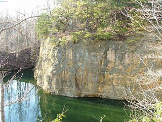
Hanover Township is one of the 25 townships of Licking County, Ohio, United States. As of the 2020 census the population was 3,036.

Manada Creek is a 17.0-mile-long (27.4 km) tributary of Swatara Creek in Dauphin County, Pennsylvania in the United States. The watershed drains approximately 32 sq mi (83 km). The name is derived the Lenape word "menatey", meaning "island".

Moose Mountain is an 8-mile (13 km)-long ridge located in the eastern part of the town of Hanover in Grafton County, New Hampshire. The mountain is flanked to the north by Holts Ledge, at 2,110 feet (640 m), and to the south by Shaker Mountain, at 1,690 feet (520 m). It is traversed by the Appalachian Trail, a 2,170-mile (3,490 km) National Scenic Trail from Georgia to Maine. Moose Mountain is outside the White Mountain National Forest, but the trail runs through a narrow corridor along the ridge which is administered by the U.S. Forest Service. The trail can be accessed from the south along Three Mile Road in Hanover, and from the north along Goose Pond Road in Lyme, New Hampshire.
Little Rocky is a mountain located in the Catskill Mountains of New York. It is part of a massif that includes Ashokan High Point, Mombaccus Mountain and South Mountain in West Shokan. Hanover Mountain is located north, Breath Hill is located northwest, and Big Rosy Bone Knob is located southwest of Little Rocky.


