
Indian Lake is a town in Hamilton County, New York, United States. The population was 1,352 at the 2010 census. The name is from a lake of the same name that is largely inside the town. There are no permanent stop lights in the town. Law enforcement is provided by New York State Troopers and Hamilton County Sheriff's Office.

The Hoosier National Forest is a property managed by the United States Forest Service in the hills of southern Indiana. Composed of four separate sections, it has a total area of 204,303 acres. Hoosier National Forest's headquarters are located in Bedford, with a regional office in Tell City. Prominent places within the Forest include the Lick Creek Settlement, Potts Creek Rockshelter Archeological Site, and Jacob Rickenbaugh House.
The Bastien Range is a mountain range of moderate height which extends in a northwest–southeast direction for about 40 nautical miles, flanking the southwest side of the Nimitz Glacier and the Sentinel Range, in the Ellsworth Mountains, Antarctica.
Tuscarora State Forest is a Pennsylvania state forest in Pennsylvania Bureau of Forestry District #3. The main office is located in Blain in Perry County, Pennsylvania in the United States.

Savoy, Mountain State Forest is a Massachusetts state forest located primarily in the towns of Savoy and Florida, with portions extending into neighboring Adams and North Adams. Situated along the Hoosac Mountain Range, it features four ponds, and seven hill and mountain summits, including Lewis Hill (2177 ft), Flat Rock Hill (2195 ft), Spruce Hill (2566 ft), and Borden Mountain (2505 ft). Also within the forest are at least two notable waterfalls, Parker Brook Falls and Tannery Falls, the latter of which is a 100-foot (30 m) drop. The forest is managed by the Department of Conservation and Recreation.

Bartholomew's Cobble is a 329-acre (1.33 km2) National Natural Landmark, open space preserve, agricultural preserve, and bio-reserve located in southwest Massachusetts in the village of Ashley Falls abutting Canaan, Connecticut. The preserve contains more than 800 plant species, including North America's greatest diversity of ferns and the greatest overall biodiversity in Berkshire County, Massachusetts; it also contains Massachusetts' highest populations of ground nesting bobolinks. It was declared a National Natural Landmark in October 1971.

Halcott Mountain is one of the Catskill Mountains of the U.S. state of New York. It is mostly located in Greene County, with some of its lower slopes in Delaware and Ulster counties. Its exact summit elevation has not been officially determined, but the highest contour line on the mountain is 3,520 feet (1,070 m). It is one of the peaks on the divide between the Delaware and Hudson watersheds.
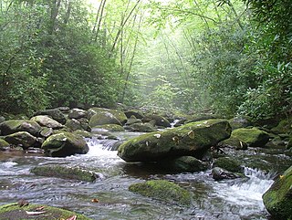
Citico Creek Wilderness is a 16,226-acre (66 km2) wilderness area within the Cherokee National Forest in the U.S. state of Tennessee. The wilderness contains the entire upper drainage of Citico Creek, which consists of the north and south forks and at least eight tributaries. Three steep-sided ridges descend west from the crest of the Unicoi Mountains — Brush Mountain, Pine Ridge, and Sassafras Ridge.
The Kyle Hills are a prominent group of volcanic cones, hills, ridges, and peaks that occupy the eastern part of Ross Island, Antarctica, between Mount Terror and Cape Crozier. The hills extend east–west for 8 nautical miles (15 km), rising from sea level at Cape Crozier to about 2,600 metres (8,500 ft) in Mount McIntosh at the western end of the group. Local relief of features is on the order of 200 metres (660 ft).
The West Hills are a 20-mile long (32 km) mountain range located in northeast Box Elder County, Utah, United States, that extends slightly north into Oneida County, Idaho. The range is connected to the Samaria Mountains, a small range on the north in southern Idaho. The West Hills are also connected to another section on the southwest, the Blue Spring Hills. West of the Blue Spring and West Hills is a long north–south valley, the Blue Creek Valley.

Skull Valley is a 40-mile (64 km) long valley located in east Tooele County, Utah, United States at the southwest of the Great Salt Lake. The valley trends north–south, but turns slightly northeast to meet Stansbury Bay,.

The Valley Mountains are a 28-mile-long (45 km) mountain range located on the southwest border of Sanpete County, Utah, United States, with the northeast border of Millard County. The north of the range is in Juab County; the south in Sevier County.

Yellow Knolls, of Arizona, is a prominence in the Virgin River Gorge's east end, located in Mohave County, part of the Arizona Strip of northwest Arizona. Yellow Knolls is located on the north side of Interstate 15, and is also in the south of the Beaver Dam Mountains Wilderness.

Marquam Nature Park is a 203.5-acre (82.4 ha) park, located in the gulch northeast of Marquam hill in southwest Portland, Oregon, United States. The park was acquired by Portland Parks & Recreation in 1979. Marquam Nature Park is in Southwest Portland in the Tualatin Mountains, also known as the West Hills, and has several miles of hiking trails.
Calhoun Hill is a mountain located in the Catskill Mountains of New York east-southeast of Delhi. Bryden Mountain is located northwest, Hemlock Knoll is located south-southeast, and Craig Hill is located west of Calhoun Hill.
Murphy Hill is a mountain located in the Catskill Mountains of New York southwest of Andes. Hemlock Knoll is located northeast, and Bryden Hill is located west of Hemlock Knoll.
Perch Lake Mountain is a mountain located in the Catskill Mountains of New York south of Andes. Hemlock Knoll is located north, and Hunt Hill is located south-southwest of Perch Lake Mountain.
Hunt Hill is a mountain located in the Catskill Mountains of New York south of Andes. Hemlock Knoll is located north, and Mary Smith Hill is located southwest of Hunt Hill.
Hemlock Mountain is a mountain located in the Catskill Mountains of New York northeast of Frost Valley. Spruce Mountain is located northwest, Wildcat Mountain is located southwest and Panther Mountain is located northeast of Hemlock Mountain.
Van Wyck Mountain is a mountain located in the Catskill Mountains of New York east-southeast of Frost Valley. Hemlock Mountain is located north, Woodhull Mountain is located west-southwest, Samson Mountain is located southeast, Bangle Hill is located south, and Wildcat Mountain is located northwest of Van Wyck Mountain.

