Goat Rocks is an extinct stratovolcano in the Cascade Range, located between Mount Rainier and Mount Adams in southern Washington, in the United States. Part of the Cascade Volcanoes, it was formed by the subduction of the Juan de Fuca Plate under the western edge of the North American Plate. The volcano was active from 3.2 million years ago until eruptions ceased between 1 and 0.5 million years ago. Throughout its complex eruptive history, volcanism shifted from silicic explosive eruptions to voluminous, mafic activity.

Nokhu Crags is a rock formation and mountain summit in the Never Summer Mountains range of the Rocky Mountains of North America. The name is derived from the Arapaho language, Neaha-no-xhu, meaning "Eagles Nest." The 12,490-foot (3,807 m) peak is located in State Forest State Park, 2.5 miles (4.0 km) south of Cameron Pass in Jackson County, Colorado, United States. The summit lies just northwest of the Continental Divide and Rocky Mountain National Park, near the headwaters of the Michigan River. The peak is prominently visible from State Highway 14 and can be seen throughout the southern North Park basin where it is known also known as "Sawtooth Mountain", "the Crags" or "Sleeping Indian" for its resemblance to the form of a supine chief. To the east lie the shallow basins of Snow Lake and the Michigan or American Lakes; to the north lies a snow filled couloir; to the west the mountain descends directly into the deep waters of Lake Agnes; and to the south lie Static Peak, Mount Richthofen, and the remainder of the Never Summer Mountain Range.

Mill Creek Mountain is a continuous mountain ridge that runs northeast through Hampshire and Hardy counties in the Eastern Panhandle region of the U.S. state of West Virginia. Rising to its greatest elevation of 2,650 feet (808 m) at High Knob, Mill Creek is a folded mountain ridge, belonging to the Ridge-and-Valley Appalachians. Mill Creek Mountain forms the western edge of the South Branch Potomac River Valley and is named for Mill Creek that carves through it at Mechanicsburg Gap allowing the Northwestern Turnpike to pass through as well. Along with Sawmill Ridge, Mill Creek Mountain forms the Trough along the South Branch.

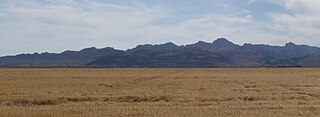
The Big Maria Mountains are located in the southeastern part of the U.S. state of California, near the Colorado River and Arizona. The range lies between Blythe and Vidal, and west of U.S. Route 95 in California and east of Midland. The mountains are home to the Eagle Nest Mine and reach an elevation of 1,030 m (3,380 ft). A power line that runs from Parker Dam to Yuma, Arizona runs through the range. A smaller range, the Little Maria Mountains, lie to the west of the Big Marias.

The Turtle Mountains, are located in northeastern San Bernardino County, in the southeastern part of California. The colorful Turtle Mountains vary from deep reds, browns, tans and grays, to black. The area has numerous springs and seeps. The Turtle Mountains are also a National Natural Landmark, with two mountain sections of entirely different composition.

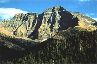
The Lewis Range is a mountain range located in the Rocky Mountains of northern Montana, United States and extreme southern Alberta, Canada. It was formed as a result of the Lewis Overthrust, a geologic thrust fault involving the overlying of younger Cretaceous rocks by older Proterozoic rocks. The range is located within Waterton Lakes National Park in Alberta, Canada and Glacier National Park and the Bob Marshall Wilderness Complex in Montana, United States. The highest peak is Mount Cleveland at 10,479 ft (3,194 m).

Seneca Creek is a 19.6-mile-long (31.5 km) tributary of the North Fork of the South Branch of the Potomac River located entirely within Pendleton County, West Virginia, USA.
The Sør Rondane Mountains are a group of mountains about 100 miles (160 km) long with main peaks rising to 3400 m, between the Queen Fabiola Mountains and Wohlthat Mountains in Queen Maud Land. They were discovered and photographed from the air by members of the Lars Christensen Expedition (LCE) on February 6, 1937, and named after Rondane, a mountain massif in southern Norway. The mountains and their constituent features were mapped in greater detail and named in 1957 by Norwegian cartographers working with air photos taken by U.S. Navy Operation Highjump, 1946–47.

North Table Mountain is a mesa on the eastern flank of the Front Range of the Rocky Mountains of North America. The 6,555-foot (1,998 m) mesa summit is located in North Table Mountain Park, 3.4 miles (5.5 km) north by east of downtown Golden, Colorado, United States, in Jefferson County.

Granite Mountain is a 7,628-foot (2,325 m) mountain located in Yavapai County, Arizona that covers roughly 12 square miles (31 km2). It was once known as Mount Gurley, for the first governor of the Arizona Territory, John A. Gurley. Its southwest face has a sheer granite cliff approximately 500 feet high that is one of the best locations for rock climbing in the state of Arizona. It is located in the Granite Mountain Wilderness, which is managed as a part of the Prescott National Forest. The mountain stands at the northern end of the Sierra Prietas, and borders Skull Valley on the west, on the northwest by the Santa Maria Mountains, and east by the Williamson Valley.

The La Garita Mountains are a high mountain range in the San Juan Mountains, a sub-range of the Southern Rocky Mountains. The mountains are located in Saguache and Mineral counties in southwestern Colorado and are almost entirely managed as public land within the Rio Grande National Forest.

The Riverside Mountains are a mountain range in Riverside County, California. The town of Vidal, California is located in the West Riverside Mountains.
The Rampart Range is a mountain range in the western United States in Colorado, located in Douglas, El Paso, and Teller counties. Part of the Front Range of the Rocky Mountains, the range is almost entirely public land within the Pike National Forest.

Whetstone Mountain, elevation 12,527 ft (3,818 m), is a summit in the Gunnison National Forest of western Colorado. The mountain is located 3 mi (4.8 km) south of Crested Butte in Gunnison County. Whetstone Mountain is one of several prominent laccoliths found in the West Elk Mountains.

Lone Cone is a prominent mountain summit at the western end of the San Miguel Mountains range of the Rocky Mountains of North America. The 12,618-foot (3,846 m) peak is located 24.2 miles (38.9 km) west by south of the Town of Telluride, Colorado, United States, on the drainage divide separating San Juan National Forest and Dolores County from Uncompahgre National Forest and San Miguel County.

Little Cone is a prominent mountain summit in the San Miguel Mountains range of the Rocky Mountains of North America. The 11,988-foot (3,654 m) peak is located in Uncompahgre National Forest, 15.0 miles (24.1 km) west of the Town of Telluride in San Miguel County, Colorado, United States. Little Cone is a laccolith, formed by underground intrusion of magma in the Miocene.

Mount Morrison is a foothill on the eastern flank of the Front Range of the Rocky Mountains of North America. The 7,881-foot (2,402 m) peak is located in Red Rocks Park, 1.9 miles (3.0 km) northwest by west of the Town of Morrison in Jefferson County, Colorado, United States. Red Rocks Amphitheatre is located on the eastern side of the mountain.

Horseshoe Mountain is a high mountain summit in the Mosquito Range of the Rocky Mountains of North America. The 13,905-foot (4,238 m) thirteener is located 7.1 miles (11.5 km) southeast by east of the City of Leadville, Colorado, United States, on the drainage divide separating San Isabel National Forest and Lake County from Pike National Forest and Park County.
High Rock Mountain is a mountain in Warren County, New Jersey. The summit rises to 889 feet (271 m), and is located on the boundary of Liberty and White Townships. It is part of the New York–New Jersey Highlands of the Appalachian Mountains, although somewhat isolated to the west of the main body of the Highlands.
High Rocks is a mountain in Warren County, New Jersey. The summit rises to 679 feet (207 m), and is located in Frelinghuysen Township. It is located in the Kittatinny Valley of the Appalachian Mountains.


