Related Research Articles

The Mendip Hills is a range of limestone hills to the south of Bristol and Bath in Somerset, England. Running from Weston-super-Mare and the Bristol Channel in the west to the Frome valley in the east, the hills overlook the Somerset Levels to the south and the Chew Valley and other tributaries of the Avon to the north. The hills give their name to the local government district of Mendip, which administers most of the area. The higher, western part of the hills, covering 198 km2 (76 sq mi) has been designated an Area of Outstanding Natural Beauty (AONB), which gives it a level of protection comparable to a national park.
Emborough Quarries is a 1 hectare geological Site of Special Scientific Interest at Emborough in the Mendip Hills, Somerset, notified in 1971.
Gripwood Quarry is a 2.9 hectare geological Site of Special Scientific Interest in Wiltshire, England, notified in 1951. The quarry is of Oolitic limestone and has a wall in the middle creating an upper and a lower quarry, last used for mushroom growing. The walls are whitewashed and there is a large wooden crane.

Stoke St Michael is a village and civil parish on the Mendip Hills 4 miles (6.4 km) north east of Shepton Mallet, and 8 miles (12.9 km) west of Frome, in the Mendip district of Somerset, England.
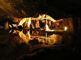
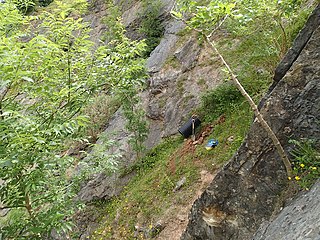
Cox's Cave is in Cheddar Gorge on the Mendip Hills, in Somerset, England. It is open to the public as a show cave.

St Cuthbert's Swallet is the second longest, and most complex, cave on the Mendip Hills, in Somerset, England. It forms a major part of the Priddy Caves system and water entering this swallet re-emerges at Wookey Hole. St Cuthbert's Swallet is part of, and lies underneath, the Priddy Pools Site of Special Scientific Interest.

Shatter Cave is a cave in Fairy Cave Quarry, near Stoke St Michael in the limestone of the Mendip Hills, in Somerset, England. It falls within the St. Dunstan's Well Catchment Site of Special Scientific Interest.
Fairy Cave Quarry is between Stoke St Michael and Oakhill in the limestone of the Mendip Hills, in Somerset, England.
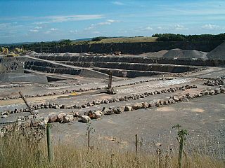
Whatley Quarry, grid reference ST731479 is a limestone quarry owned by Hanson plc, near the village of Whatley on the Mendip Hills, Somerset, England.
Halecombe, grid reference ST697474 is a limestone quarry near Leigh-on-Mendip on the Mendip Hills, Somerset, England.

Gurney Slade quarry, grid reference ST626497 is a limestone quarry near Gurney Slade between Binegar and Holcombe, on the Mendip Hills, Somerset, England.
Callow Rock quarry is a limestone quarry located in Shipham Gorge between Cheddar and Shipham on the Mendip Hills, Somerset, England.

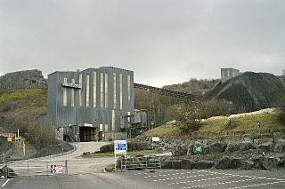
Torr Works quarry, grid reference ST695446 is a limestone quarry at East Cranmore, near Shepton Mallet on the Mendip Hills, Somerset, England. The quarry was formerly known as Merehead, a name which has been retained for its rail depot on the opposite side of the A361 road.

Stoke Lane Slocker is a cave near Stoke St Michael, in the Carboniferous Limestone of the Mendip Hills, in the English county of Somerset.
Balch Cave is a cave in Fairy Cave Quarry, near Stoke St Michael in the limestone of the Mendip Hills, in Somerset, England. The cave is part of the complex of passages feeding to St. Dunstan's Well Catchment Site of Special Scientific Interest and an abandoned Bristol Water abstraction point.

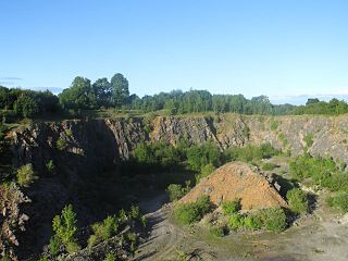
Cloud Quarry was a quarry near Temple Cloud, in the limestone of the Mendip Hills, in Somerset, England.
Norton Hill School is a state school with academy status in Midsomer Norton, Somerset, England. It is part of the Midsomer Norton Schools Partnership academy group. It was formerly the Midsomer Norton Grammar School.
Attborough Swallet is a cave in Chewton Mendip in Somerset, England.

W/L Cave is part of the Fairy Cave Quarry group of caves between Stoke St Michael and Oakhill in the limestone of the Mendip Hills, in Somerset, England.
Tyning's Barrow Swallet is a cave between Charterhouse and Shipham in the limestone of the Mendip Hills, in Somerset, England. The cave is close to GB Cave and also to Charterhouse Cave, the deepest cave in the region.
References
- ↑ "Hillier's Cave". Mendip Cave Registry & Archive.
- ↑ Johnson, Peter (1967). The History of Mendip Caving. Newton Abbot: David & Charles.
- ↑ Witcombe, Richard (2009). Who was Aveline anyway?: Mendip's Cave Names Explained (2nd ed.). Priddy: Wessex Cave Club. p. 93. ISBN 978-0-9500433-6-4.