Hunnewell, Kansas

Last updated

Hunnewell, Kansas
Sumner County Kansas Incorporated and Unincorporated areas Hunnewell Highlighted.svg
Location within Sumner County and Kansas
Map of Sumner Co, Ks, USA.png
Coordinates: 37°00′14″N97°24′27″W / 37.00389°N 97.40750°W / 37.00389; -97.40750 [1]
Country United States
State Kansas
County Sumner
Founded1880
Incorporated 1882
Named for H. H. Hunnewell
Area
[2]
  Total0.55 sq mi (1.43 km2)
  Land0.55 sq mi (1.43 km2)
  Water0.00 sq mi (0.00 km2)
Elevation
[1]
1,102 ft (336 m)
Population
 (2020) [3]
  Total44
  Density80/sq mi (31/km2)
Time zone UTC-6 (CST)
  Summer (DST) UTC-5 (CDT)
ZIP code
67140
Area code 620
FIPS code 20-33500
GNIS ID 2394449 [1]

Hunnewell is a city in Sumner County, Kansas, United States. [1] As of the 2020 census, the population of the city was 44. [3]

Contents

History

Hunnewell was founded in 1880. [4] It was named for Boston financier and railway owner H. H. Hunnewell. [5] [6]

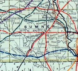
Hunnewell served as a shipping point for Texas cattle, and was a prosperous cowtown during the 1880s. The Leavenworth, Lawrence and Galveston Railroad provided quick access to the Kansas City, Kansas stockyards, and the Kansas and Southeastern Railroad was built south from Hunnewell into Oklahoma in 1898. [7] [8] The town in its heyday had one hotel, two general stores, one barber shop, two dance halls, and eight saloons. With little more than railroad workers and cowboys, violence was common. There were no lawmen to speak of during the 1880s in or around that area, and typically cattle rustling and other crimes were dealt with by the ranchers themselves. This culminated in the Hunnewell, Kansas Gunfight, on October 5, 1884. [9]

A post office was opened in Hunnewell in 1880, and remained in operation until it was discontinued in 1960. [10]

The railroads have still not abandoned Hunnewell; it continues to be served by the Blackwell Northern Gateway Railroad, which runs from Blackwell, Oklahoma through Hunnewell and on to connections with the BNSF at Wellington, Kansas and (via the BNSF) with the Union Pacific. [11]

Geography

According to the United States Census Bureau, the city has a total area of 0.49 square miles (1.27 km2), all of it land. [12]

Demographics

Historical population
CensusPop.Note
1890 168
1900 23338.7%
1910 208−10.7%
1920 2090.5%
1930 205−1.9%
1940 166−19.0%
1950 103−38.0%
1960 83−19.4%
1970 77−7.2%
1980 8611.7%
1990 871.2%
2000 83−4.6%
2010 67−19.3%
2020 44−34.3%
U.S. Decennial Census

2020 census

The 2020 United States census counted 44 people, 18 households, and 11 families in Hunnewell. [13] [14] The population density was 79.1 per square mile (30.6/km2). There were 27 housing units at an average density of 48.6 per square mile (18.7/km2). [14] [15] The racial makeup was 97.73% (43) white or European American (97.73% non-Hispanic white), 0.0% (0) black or African-American, 0.0% (0) Native American or Alaska Native, 0.0% (0) Asian, 0.0% (0) Pacific Islander or Native Hawaiian, 0.0% (0) from other races, and 2.27% (1) from two or more races. [16] Hispanic or Latino of any race was 0.0% (0) of the population. [17]

Of the 18 households, 27.8% had children under the age of 18; 50.0% were married couples living together; 22.2% had a female householder with no spouse or partner present. 33.3% of households consisted of individuals and 16.7% had someone living alone who was 65 years of age or older. [14] The average household size was 3.4 and the average family size was 3.8. [18]

18.2% of the population was under the age of 18, 4.5% from 18 to 24, 18.2% from 25 to 44, 31.8% from 45 to 64, and 27.3% who were 65 years of age or older. The median age was 50.0 years. For every 100 females, there were 175.0 males. [14] For every 100 females ages 18 and older, there were 140.0 males. [14]

The 2016-2020 5-year American Community Survey estimates show that the median household income was $101,875 (with a margin of error of +/- $95,226) and the median family income was $121,875 (+/- $41,677). [19]

2010 census

As of the census [20] of 2010, there were 67 people, 26 households, and 20 families residing in the city. The population density was 136.7 inhabitants per square mile (52.8/km2). There were 41 housing units at an average density of 83.7 per square mile (32.3/km2). The racial makeup of the city was 92.5% White, 6.0% Native American, and 1.5% from two or more races.

There were 26 households, of which 34.6% had children under the age of 18 living with them, 65.4% were married couples living together, 11.5% had a female householder with no husband present, and 23.1% were non-families. 19.2% of all households were made up of individuals, and 3.8% had someone living alone who was 65 years of age or older. The average household size was 2.58 and the average family size was 2.90.

The median age in the city was 42.3 years. 28.4% of residents were under the age of 18; 3.1% were between the ages of 18 and 24; 23.9% were from 25 to 44; 35.9% were from 45 to 64; and 9% were 65 years of age or older. The gender makeup of the city was 52.2% male and 47.8% female.

2000 census

As of the census [21] of 2000, there were 83 people, 24 households, and 21 families residing in the city. The population density was 173.4 inhabitants per square mile (67.0/km2). There were 34 housing units at an average density of 71.0 per square mile (27.4/km2). The racial makeup of the city was 97.59% White and 2.41% Native American.

There were 24 households, out of which 58.3% had children under the age of 18 living with them, 79.2% were married couples living together, 8.3% had a female householder with no husband present, and 12.5% were non-families. 8.3% of all households were made up of individuals, and 4.2% had someone living alone who was 65 years of age or older. The average household size was 3.46 and the average family size was 3.76.

In the city, the population was spread out, with 42.2% under the age of 18, 4.8% from 18 to 24, 27.7% from 25 to 44, 19.3% from 45 to 64, and 6.0% who were 65 years of age or older. The median age was 28 years. For every 100 females, there were 97.6 males. For every 100 females age 18 and over, there were 100.0 males.

The median income for a household in the city was $16,875, and the median income for a family was $49,375. Males had a median income of $67,917 versus $23,750 for females. The per capita income for the city was $12,729. There were 13.3% of families and 20.7% of the population living below the poverty line, including no under eighteens and none of those over 64.

Education

The community is served by South Haven USD 509 public school district.

Related Research Articles

<span class="mw-page-title-main">Moran, Kansas</span> City in Allen County, Kansas

Moran is a city in Allen County, Kansas, United States. As of the 2020 census, the population of the city was 466.

<span class="mw-page-title-main">Cambridge, Kansas</span> City in Cowley County, Kansas

Cambridge is a city in Cowley County, Kansas, United States. As of the 2020 census, the population of the city was 92.

<span class="mw-page-title-main">Hepler, Kansas</span> City in Crawford County, Kansas

Hepler is a city in Crawford County, Kansas, United States. As of the 2020 census, the population of the city was 90.

<span class="mw-page-title-main">Manchester, Kansas</span> City in Dickinson County, Kansas

Manchester is a city in Dickinson County, Kansas, United States. As of the 2020 census, the population of the city was 47.

<span class="mw-page-title-main">Grenola, Kansas</span> City in Elk County, Kansas

Grenola is a city in Elk County, Kansas, United States. As of the 2020 census, the population of the city was 151.

<span class="mw-page-title-main">Anthony, Kansas</span> City in Harper County, Kansas

Anthony is a city in and the county seat of Harper County, Kansas, United States. As of the 2020 census, the population of the city was 2,108.

<span class="mw-page-title-main">Hoyt, Kansas</span> City in Jackson County, Kansas

Hoyt is a city in Jackson County, Kansas, United States. As of the 2020 census, the population of the city was 593.

<span class="mw-page-title-main">Axtell, Kansas</span> City in Marshall County, Kansas

Axtell is a city in Marshall County, Kansas, United States. As of the 2020 census, the population of the city was 399.

<span class="mw-page-title-main">Ness City, Kansas</span> City in Ness County, Kansas

Ness City is a city in and the county seat of Ness County, Kansas, United States. As of the 2020 census, the population of the city was 1,329. Ness City is famous for its four-story Old Ness County Bank Building located downtown, and nicknamed Skyscraper of the Plains.

<span class="mw-page-title-main">Havensville, Kansas</span> City in Pottawatomie County, Kansas

Havensville is a city in Pottawatomie County, Kansas, United States. As of the 2020 census, the population of the city was 119.

<span class="mw-page-title-main">Preston, Kansas</span> City in Pratt County, Kansas

Preston is a city in Pratt County, Kansas, United States. As of the 2020 census, the population of the city was 115.

<span class="mw-page-title-main">Langdon, Kansas</span> City in Reno County, Kansas

Langdon is a city in Reno County, Kansas, United States. As of the 2020 census, the population of the city was 39.

<span class="mw-page-title-main">Chase, Kansas</span> City in Rice County, Kansas

Chase is a city in Rice County, Kansas, United States. As of the 2020 census, the population of the city was 396.

<span class="mw-page-title-main">Palco, Kansas</span> City in Rooks County, Kansas

Palco is a city in Rooks County, Kansas, United States. As of the 2020 census, the population of the city was 208.

<span class="mw-page-title-main">McCracken, Kansas</span> City in Rush County, Kansas

McCracken is a city in Rush County, Kansas, United States. As of the 2020 census, the population of the city was 152.

<span class="mw-page-title-main">Kechi, Kansas</span> City in Sedgwick County, Kansas

Kechi is a city in Sedgwick County, Kansas, United States, and a suburb of Wichita. As of the 2020 census, the population of the city was 2,217.

<span class="mw-page-title-main">Caldwell, Kansas</span> City in Sumner County, Kansas

Caldwell is a city in Sumner County, Kansas, United States. As of the 2020 census, the population of the city was 1,025.

<span class="mw-page-title-main">Alma, Kansas</span> City in Wabaunsee County, Kansas

Alma is a city in and the county seat of Wabaunsee County, Kansas, United States. As of the 2020 census, the population of the city was 802.

<span class="mw-page-title-main">Alta Vista, Kansas</span> City in Wabaunsee County, Kansas

Alta Vista is a city in Wabaunsee County, Kansas, United States. As of the 2020 census, the population of the city was 409.

<span class="mw-page-title-main">Hunnewell, Missouri</span> City in Missouri, United States

Hunnewell is a city in southeastern Shelby County, Missouri, United States. The population was 139 at the 2020 census.

References

  1. 1 2 3 4 U.S. Geological Survey Geographic Names Information System: Hunnewell, Kansas
  2. "2019 U.S. Gazetteer Files". United States Census Bureau. Retrieved July 24, 2020.
  3. 1 2 "Profile of Hunnewell, Kansas in 2020". United States Census Bureau. Archived from the original on April 4, 2022. Retrieved April 4, 2022.
  4. Blackmar, Frank Wilson (1912). Kansas: A Cyclopedia of State History, Embracing Events, Institutions, Industries, Counties, Cities, Towns, Prominent Persons, Etc. Standard Publishing Company. pp.  890.
  5. Gannett, Henry (1905). The Origin of Certain Place Names in the United States. Govt. Print. Off. pp.  163.
  6. Heim, Michael (2007). Exploring Kansas Highways. p. 23. ISBN   9780974435886.
  7. "The Atchison, Topeka and Santa Fe Railway Company". Railroads of Oklahoma, June 6, 1870-April 1, 1978, pp. 29-38 (accessed on Oklahoma Digital Prairie). Retrieved March 24, 2023.
  8. "Braman". Oklahoma Historical Society. Retrieved March 23, 2023.
  9. "Complete List of Old West Gunfights (archived)". Legends of America. Archived from the original on March 21, 2008. Retrieved March 26, 2014.
  10. "Kansas Post Offices, 1828-1961, page 2". Kansas Historical Society. Retrieved June 27, 2014.
  11. "Blackwell Northern Gateway Railroad Company BNGR #O41". Union Pacific. Retrieved September 23, 2021.
  12. "US Gazetteer files 2010". United States Census Bureau. Archived from the original on January 12, 2012. Retrieved July 6, 2012.
  13. "US Census Bureau, Table P16: HOUSEHOLD TYPE". data.census.gov. Retrieved January 16, 2024.
  14. 1 2 3 4 5 "US Census Bureau, Table DP1: PROFILE OF GENERAL POPULATION AND HOUSING CHARACTERISTICS". data.census.gov. Retrieved January 16, 2024.
  15. Bureau, US Census. "Gazetteer Files". Census.gov. Retrieved December 30, 2023.
  16. "US Census Bureau, Table P1: RACE". data.census.gov. Retrieved January 16, 2024.
  17. "US Census Bureau, Table P2: HISPANIC OR LATINO, AND NOT HISPANIC OR LATINO BY RACE". data.census.gov. Retrieved January 16, 2024.
  18. "US Census Bureau, Table S1101: HOUSEHOLDS AND FAMILIES". data.census.gov. Retrieved January 16, 2024.
  19. "US Census Bureau, Table S1903: MEDIAN INCOME IN THE PAST 12 MONTHS (IN 2020 INFLATION-ADJUSTED DOLLARS)". data.census.gov. Retrieved January 16, 2024.
  20. "U.S. Census website". United States Census Bureau . Retrieved July 6, 2012.
  21. "U.S. Census website". United States Census Bureau . Retrieved January 31, 2008.

Further reading