Palmer is a city in and the borough seat of the Matanuska-Susitna Borough, Alaska, United States, located 42 miles (68 km) northeast of Anchorage on the Glenn Highway in the Matanuska Valley. It is the ninth-largest city in Alaska, and forms part of the Anchorage Metropolitan Statistical Area. As of the 2020 census, the population of the city is 5,888, down from 5,937 in 2010.

Talkeetna is a census-designated place (CDP) in Matanuska-Susitna Borough, Alaska, United States. At the 2020 census the population was 1,055, up from 876 in 2010.

Susitna North is a census-designated place (CDP) in the Matanuska-Susitna Borough in the U.S. state of Alaska. It is part of the Anchorage, Alaska Metropolitan Statistical Area. The population was 1,564 at the 2020 census, up from 1,260 in 2010. The CDP was formerly named Y, for the intersection of the George Parks Highway and the Talkeetna Spur Road. In the immediate vicinity of this intersection is a community center, containing a health clinic, law enforcement, Susitna Valley High School, and retail services for highway travelers such as gasoline and food.

The Susitna River is a 313-mile (504 km) long river in the Southcentral Alaska. It is the 15th largest river in the United States, ranked by average discharge volume at its mouth. The river stretches from the Susitna Glacier to Cook Inlet's Knik Arm.

The Alaska Railroad is a Class II railroad that operates freight and passenger trains in the state of Alaska. The railroad's mainline runs between Seward on the southern coast and Fairbanks, near the center of the state. It passes through Anchorage and Denali National Park, to which 17% of visitors travel by train.

Kennecott, also known as Kennicott and Kennecott Mines, is an abandoned mining camp in the Copper River Census Area in the U.S. state of Alaska that was the center of activity for several copper mines. It is located beside the Kennicott Glacier, northeast of Valdez, inside Wrangell-St. Elias National Park and Preserve. The camp and mines are now a National Historic Landmark District administered by the National Park Service.

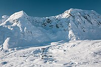
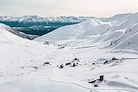
Hatcher Pass is a mountain pass through the southwest part of the Talkeetna Mountains, Alaska. It is named after Robert Hatcher, a prospector and miner. The nearest cities are Palmer and Wasilla approximately 12 miles (19 km) to the south, and Willow approximately 26 mi (42 km) to the west. The communities are at an elevation of approximately 250 ft (76 m) in the Mat-Su valley.
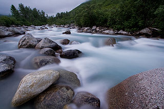
Little Susitna River (Dena'ina: Tsałtastnu) heads at Mint Glacier on Montana Peak, in Talkeetna Mountains at 61°51′30″N149°03′30″W, flows southwest to Cook Inlet, 13 miles (21 km) west of Anchorage, Alaska Cook Inlet Low.
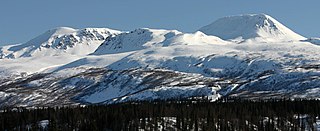
The Talkeetna Mountains are a mountain range in Alaska. The Matanuska and Susitna River valleys, with towns such as Trapper Creek, Talkeetna, Wasilla, Palmer, Sutton, and Chickaloon, roughly bound the Talkeetnas in the westerly parts of the range. Sovereign Mountain rises to 8,849 feet (2,697 m) in the remote and heavily glaciated central part of the range. The east side of the range fronts a broad, about 100 miles (160 km) wide, lake-studded lowland of forests and swamps, across which rises the gigantic Mount Wrangell volcanic edifice. Alaska Highway 4 runs northward through this lowland. Hundreds of miles to the west Alaska Highway 3 runs along the western side of the Talkeetna range, with the Alaska Range directly west. Alaska Highway 1, running along the southern front of the Talkeetna Mountains, lies mainly in a valley marking a tectonic divide between the Jurassic and Cretaceous rocks of the accretionary wedge, island-arc, and basement rocks in the Peninsular terrane, and the Chugach Mountains in the Chugach terrane to the south. The range stretches as much as a hundred miles north to south. Alaska Highway 8, seasonal and unpaved, passes over highlands rising to above 4,000 feet (1,200 m), north of the Talkeetnas.
Gold mining in Alaska, a state of the United States, has been a major industry and impetus for exploration and settlement since a few years after the United States acquired the territory in 1867 from the Russian Empire. Russian explorers discovered placer gold in the Kenai River in 1848, but no gold was produced. Gold mining started in 1870 from placers southeast of Juneau, Alaska.
Gold was discovered in the Yentna-Cache Creek Mining District in the U.S. state of Alaska of the upper Susitna River Valley in 1898, soon followed by claim staking. Placer mining was reported in the Cache Creek drainage of the Dutch Hills by 1906. Quaternary glaciofluvial deposits, alluvial deposits, and Cenozoic conglomeratic white quartz-breccia units have been mined in the Dutch Hills. About 200,000 oz of gold has been produced from these placer deposits. By 1927, a road from Talkeetna was constructed into the mining area, known today as The Petersville Road. The mining camp of Petersville, Alaska served as the area Post Office for several years in the late 1920s and early 1930s. Two areas have been set aside for recreational gold mining, the North and South units of the Petersville State Recreation Mining Areas. Many smaller one-man and family placer mining operations continue today.
The Willow Creek mining district, also known as the Independence Mine/Hatcher Pass district, is a gold-mining area in the U.S. state of Alaska. Underground hard-rock mining of gold from quartz veins accounts for most of the mineral wealth extracted from the Hatcher Pass area. The first mining efforts were placer mining of stream gravels, and placer mining in the area has continued sporadically to this day. Robert Hatcher discovered gold and staked the first claim in the Willow Creek valley in September 1906. The first lode mill in the area started operating in 1908. Underground mining continued at a variety of locations around the pass until 1951. In the 1980s one of the area's hard-rock mines was briefly re-opened. At least one mining company is actively exploring for gold in the area now. Through 2006 the district produced 667-thousand ounces of hard rock gold and 60-thousand ounces of placer gold.
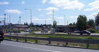
Wasilla (Dena'ina: Benteh) is a city in Matanuska-Susitna Borough, Alaska, United States, and the fourth-largest city in Alaska. It is located on the northern point of Cook Inlet in the Matanuska-Susitna Valley of the southcentral part of the state. The city's population was 9,054 at the 2020 census, up from 7,831 in 2010. Wasilla is the largest city in the borough and a part of the Anchorage metropolitan area, which had an estimated population of 398,328 in 2020.

Matanuska-Susitna Valley is an area in Southcentral Alaska south of the Alaska Range about 35 miles (56 km) north of Anchorage, Alaska. It is known for the world record sized cabbages and other vegetables displayed annually in Palmer at the Alaska State Fair. It includes the valleys of the Matanuska, Knik, and Susitna Rivers. 11,000 of Mat-Su Valley residents commute to Anchorage for work . It is the fastest growing region in Alaska and includes the towns of Palmer, Wasilla, Big Lake, Houston, Willow, Sutton, and Talkeetna. The Matanuska-Susitna Valley is primarily the land of the Dena'ina and Ahtna Athabaskan people.

The Juneau gold belt is located in the southeastern portion of the U.S. state of Alaska. This belt is approximately 100 miles (160 km) in length, north/northwest-trending, and extends from Berners Bay southeastward to Windham Bay, 60 miles (97 km) southeast of Juneau, and includes Douglas Island. The belt contains over 200 gold-quartz-vein deposits with production nearing 7,000,000 ounces (200,000,000 g) of gold. More than three-quarters of Alaska's lode gold was mined from the Juneau gold belt.
Solomon River is a waterway in the U.S. state of Alaska, near Nome.

The Fairview Inn is a historic hotel building on Main Street in the center of Talkeetna, Alaska, United States. It is a two-story frame structure, with a hip roof. The main block, 36 feet (11 m) square, was built between 1920 and 1923, following the arrival in the area of the Alaska Railroad. The building exterior is little-altered since then; its major modification has been the addition in the 1970s of an addition for owner living quarters. The interior also still follows essentially the same floor plan as when it was built.
Kirsch's Place, also known as the Fireweed Station Lodge, and now the Fireweed Station Inn, is a historic traveler accommodation near Talkeetna, Alaska. It is located about 10.5 miles (16.9 km) south of Talkeetna, roughly 200 feet (61 m) east of mile 215.3 of the Alaska Railroad, a place known as Sunshine Siding. It is a 1+1⁄2-story log structure, built in 1946 by John Kirsch as a residence and guest lodge. Kirsch operated the lodge until his death in 1959. The lodge is a rare survivor of a post-World War II rural building boom, which was later eclipsed as roads and settlement in the area became more prevalent.

The Talkeetna Historic District encompasses several blocks of the historic village center of Talkeetna, Alaska. It includes buildings on Main Street, roughly between C and D Streets, along with a few buildings on C and D Streets between Front and East First Streets. The village was established in 1916 as a regional construction headquarters of the Alaska Railroad, and became a home to area miners after the railroad's completion. The district includes three buildings that date to the time of the railroad construction, and another ten that were built before 1940. Most of the buildings in the district are one or two stories in height, and are either of wood frame or log construction. Notable among them are the Fairview Inn, the town's first schoolhouse, now the Talkeetna Museum, and the Talkeetna Roadhouse, which was built as a residential log house in 1917 and expanded in the 1940s to serve as a roadhouse.

The Talkeetna Airstrip is a historic runway in Talkeetna, Alaska. It is a rectangular area of land, covered by grass and gravel, extending southward along D Street from First Street toward the Susitna River. It is about 1,800 feet (550 m) long and 30 feet (9.1 m) wide, with its northern stretch now lined with private residences and its southern stretch surrounded by public woodlands. The airstrip was created in 1940 as the result of a presidential executive order issued by President Franklin Delano Roosevelt in 1937, which set aside federal land near Talkeetna for aviation-related purposes. It played a major role in the economic development of the community, as air transport was the most reliable method of bringing supplies and travelers into the area.


