This is a list of the National Register of Historic Places listings in Kodiak Island Borough, Alaska.
This is intended to be a complete list of the properties and districts on the National Register of Historic Places in Kodiak Island Borough, Alaska, United States. The locations of National Register properties and districts for which the latitude and longitude coordinates are included below, may be seen in a Google map. [1]
There are 27 properties and districts listed on the National Register in the borough, including 4 National Historic Landmarks.
This National Park Service list is complete through NPS recent listings posted September 29, 2023. [2]
[3] | Name on the Register [4] | Image | Date listed [5] | Location | City or town | Description |
---|---|---|---|---|---|---|
1 | Agricultural Experiment Station Barn | July 21, 2004 (#04000716) | 614 Egan Way 57°47′32″N152°23′51″W / 57.79222°N 152.39747°W | Kodiak | ||
2 | AHRS Site KOD-207 | December 1, 1978 (#78003428) | Address restricted [6] | Kodiak | ||
3 | Amalik Bay Archeological District | ![]() | April 5, 2005 (#05000460) | Katmai National Park and Preserve 58°03′41″N154°29′40″W / 58.06135°N 154.49438°W | King Salmon | |
4 | American Cemetery | ![]() | April 10, 1980 (#80004570) | Upper Mill Bay Road 57°47′28″N152°24′05″W / 57.79108°N 152.40135°W | Kodiak | |
5 | Archeological Site 49 AF 3 | February 17, 1978 (#78000276) | Address restricted [6] | Katmai National Park and Preserve | Originally listed as being in Dillingham Census Area. | |
6 | Archeological Site 49 MK 10 | June 23, 1978 (#78000425) | near Dakavak Bay [7] | Katmai National Park and Preserve | Originally listed as being in Bristol Bay Borough. | |
7 | Ascension of Our Lord Chapel | ![]() | June 6, 1980 (#80004580) | In Karluk 57°34′09″N154°27′30″W / 57.56925°N 154.45844°W | Karluk | |
8 | Cape Alitak Petroglyphs District | April 9, 2013 (#13000139) | Address restricted [6] | Akhiok | ||
9 | Fort Abercrombie State Historic Site | October 27, 1970 (#70000917) | Miller Point, about 5 miles (8.0 km) northeast of Kodiak 57°49′52″N152°21′21″W / 57.83114°N 152.35574°W | Kodiak Island | Also part of the Kodiak Naval Operating Base and Forts Greely and Abercrombie National Historic Landmark. | |
10 | Holy Resurrection Church | ![]() | December 12, 1977 (#77001574) | Corner of Mission Road and Kashevaroff Avenue 57°47′19″N152°24′09″W / 57.78851°N 152.40244°W | Kodiak | |
11 | Kad'yak | July 14, 2004 (#04000678) | Address restricted [6] | Kodiak | Wreck of a Russian-era ship. | |
12 | Kaguyak Village Site | June 23, 1978 (#78000274) | Address restricted [6] | Katmai National Park and Preserve | Originally listed as being in Dillingham Census Area. | |
13 | KOD-171 Site | August 13, 1981 (#81000707) | Address restricted [6] | Larsen Bay | ||
14 | KOD-233 Site | August 13, 1981 (#81000708) | Address restricted [6] | Larsen Bay | ||
15 | Kodiak 011 Site | July 21, 1980 (#80004571) | Address restricted [6] | Kodiak | ||
16 | Kodiak Naval Operating Base and Forts Greely and Abercrombie | ![]() | February 4, 1985 (#85002731) | Vicinity of Kodiak 57°44′19″N152°30′17″W / 57.738611°N 152.504722°W | Kodiak | Surviving World War II military infrastructures on Kodiak Island, comprising several areas. Kodiak Naval Base is about 6 miles (9.7 km) southwest of Kodiak. Fort Greely is about 3 miles (4.8 km) southwest of Kodiak. Fort Abercombie is about 5 miles (8.0 km) northeast of Kodiak. |
17 | Kukak Cannery Archeological Historic District | ![]() | April 7, 2003 (#03000192) | In Kukak Bay 58°19′01″N154°11′19″W / 58.31694°N 154.18873°W | Katmai National Park and Preserve | Site of a 1920s-30s razor clam cannery, burned in 1936. Originally listed as being in Lake and Peninsula Borough. |
18 | Kukak Village Site | ![]() | July 20, 1978 (#78000343) | At the entrance to Kukak Bay [8] 58°20′51″N154°12′28″W / 58.3475°N 154.2078°W | Kanatak | Originally listed as being in the Dillingham Census Area. |
19 | Church of the Nativity of the Theotokos | ![]() | June 6, 1980 (#80004577) | In Afognak 58°00′38″N152°45′52″W / 58.01042°N 152.76445°W | Afognak | |
20 | Nativity of Our Lord Chapel | ![]() | June 6, 1980 (#80004582) | Church Street 57°55′23″N152°30′01″W / 57.92313°N 152.50034°W | Ouzinkie | |
21 | Protection of the Theotokos Chapel | ![]() | June 6, 1980 (#80004590) | E Street 56°56′42″N154°10′05″W / 56.94487°N 154.16808°W | Akhiok | |
22 | Russian-American Company Magazin | ![]() | October 15, 1966 (#66000954) | 101 East Marine Way 57°47′16″N152°24′12″W / 57.78765°N 152.40338°W | Kodiak | Also known as the "Erskine House and Baranof Museum". |
23 | SS Aleutian (Shipwreck) | ![]() | June 18, 2004 (#04000593) | Southern tip of Amook Island 57°29′N153°50′W / 57.48°N 153.84°W | Larsen Bay | |
24 | Sts. Sergius and Herman of Valaam Chapel | ![]() | June 6, 1980 (#80004581) [lower-alpha 1] | Spruce Island, Monk's Lagoon 57°54′22″N152°21′10″W / 57.90607°N 152.35277°W | Ouzinkie | |
25 | Takli Island Archeological District | ![]() | May 23, 1978 (#78000275) | Katmai National Park and Preserve 58°03′50″N154°30′25″W / 58.0639°N 154.5069°W | Kanatak | This district is entirely within the Amalik Bay Archeological District; Takli Island is in Amalik Bay. [9] Originally listed as being in the Dillingham Census Area. |
26 | Three Saints Site | ![]() | February 23, 1972 (#72001541) | Address restricted [6] | Old Harbor | |
27 | Woody Island Historic Archeological District | January 27, 2015 (#14001196) | Address restricted [6] | Kodiak |
This is a list of the National Register of Historic Places listings in Aleutians West Census Area, Alaska.
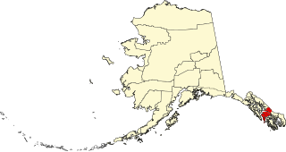
This is a list of the National Register of Historic Places listings in Petersburg, Alaska.
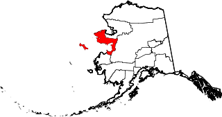
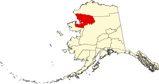
This is a list of the National Register of Historic Places listings in Nome Census Area, Alaska.
This is a list of the National Register of Historic Places listings in Yakutat, Alaska.
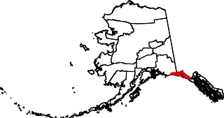
This is a list of the National Register of Historic Places listings in Wrangell, Alaska.
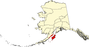
This is a list of the National Register of Historic Places listings in Aleutians East Borough, Alaska.
This is a list of the National Register of Historic Places listings in Bristol Bay Borough, Alaska.
This is a list of the National Register of Historic Places listings in Haines Borough, Alaska.
This is a list of the National Register of Historic Places listings in Denali Borough, Alaska.
This is a list of the National Register of Historic Places listings in Fairbanks North Star Borough, Alaska.
This is a list of the National Register of Historic Places listings in Kenai Peninsula Borough, Alaska.
This is a list of the National Register of Historic Places listings in Ketchikan Gateway Borough, Alaska.
This is a list of the National Register of Historic Places listings in Lake and Peninsula Borough, Alaska, United States.
This is a list of the National Register of Historic Places listings in Northwest Arctic Borough, Alaska.
This is a list of the National Register of Historic Places listings in Matanuska-Susitna Borough, Alaska.
This is a list of the National Register of Historic Places listings in North Slope Borough, Alaska.
This is a list of the National Register of Historic Places listings in Lake Clark National Park and Preserve.
This is a list of the National Register of Historic Places listings in Katmai National Park and Preserve.
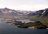
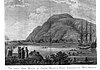
Takli Island is an island off the southern coast of the Alaska Peninsula in the Shelikof Strait of southwestern Alaska. It is located at the mouth of Amalik Bay, off the mainland portion of Kodiak Island Borough, in Katmai National Park and Preserve. The area was first archaeologically investigated in the 1960s, when the prehistory of the area was little known, and the island's sites are type sites for a series of archaeological cultures.
This is a list of the National Register of Historic Places listings in Copper River Census Area, Alaska.