National Register of Historic Places listings in Aleutians West Census Area, Alaska

Last updated
Location of the Aleutians West Census Area in Alaska Map of Alaska highlighting Aleutians West Census Area.svg
Location of the Aleutians West Census Area in Alaska

This is a list of the National Register of Historic Places listings in Aleutians West Census Area, Alaska.

Contents

This is intended to be a complete list of the properties and districts on the National Register of Historic Places in Aleutians West Census Area, Alaska, United States. The locations of National Register properties and districts for which the latitude and longitude coordinates are included below, may be seen in a Google map. [1]

There are 15 properties and districts listed on the National Register in the census area, including 10 National Historic Landmarks.

This National Park Service list is complete through NPS recent listings posted February 7, 2020. [2]
Map all coordinates using: OpenStreetMap  
Download coordinates as: KML  ·  GPX

Current listings

[3] Name on the Register [4] ImageDate listed [5] Location City or townDescription
1 Adak Army Base and Adak Naval Operating Station
Adak Army Base and Adak Naval Operating Station KiskaInvasionFleet.gif
Adak Army Base and Adak Naval Operating Station
February 27, 1987
(#87000841)
Adak Island
51°52′54″N176°38′53″W / 51.88158°N 176.6481°W / 51.88158; -176.6481 (Adak Army Base and Adak Naval Operating Station)
Adak The historical 47,000 acres (19,000 ha) area covers the town of Adak and most of Adak Island north of it. It is roughly bounded by Cape Adagdak, Scabbard Bay, and Shagak Bay. [4]
2 Anangula Archeological District
Anangula Archeological District Anangula Site.jpg
Anangula Archeological District
June 2, 1978
(#78000512)
Southern end of Anangula Island
52°59′47″N168°54′47″W / 52.99648°N 168.91299°W / 52.99648; -168.91299 (Anangula Archeological District)
Nikolski
3 Atka B-24D Liberator
Atka B-24D Liberator World war 2 plane wreckage.jpg
Atka B-24D Liberator
July 26, 1979
(#79000407)
Address restricted [6]
Atka
4 Attu Battlefield and U.S. Army and Navy Airfields on Attu
Attu Battlefield and U.S. Army and Navy Airfields on Attu US troops at the Battle of Attu.jpg
Attu Battlefield and U.S. Army and Navy Airfields on Attu
February 4, 1985
(#85002729)
Attu Island
52°53′26″N173°04′29″E / 52.89068°N 173.07484°E / 52.89068; 173.07484 (Attu Battlefield and U.S. Army and Navy Airfields on Attu)
Attu Island The historical 7,000 acres (2,800 ha) area covers the whole eastern part of Attu Island, roughly Temnac Bay to Austin Cove. [4]
5 Cape Field at Fort Glenn (Umnak Island)
Cape Field at Fort Glenn (Umnak Island) Fort Glenn Army Airfield 1942.jpg
Cape Field at Fort Glenn (Umnak Island)
May 28, 1987
(#87001301)
Umnak Island
53°22′38″N167°53′22″W / 53.37722°N 167.88946°W / 53.37722; -167.88946 (Cape Field at Fort Glenn (Umnak Island))
Fort Glenn The historical 7,550 acres (3,060 ha) area covering the airfield and the naval base is roughly comprised between Otter Bight and Camp Bay. [4]
6 Chaluka Site
Chaluka Site Chaluka Site.jpg
Chaluka Site
October 15, 1966
(#66000155)
Address restricted [6]
Nikolski
7 Church of the Holy Ascension
Church of the Holy Ascension Unalaska church.jpg
Church of the Holy Ascension
April 15, 1970
(#70000112)
In Unalaska
53°52′32″N166°32′11″W / 53.87563°N 166.53638°W / 53.87563; -166.53638 (Church of the Holy Ascension)
Unalaska
8 Dutch Harbor Naval Operating Base and Fort Mears, U.S. Army
Dutch Harbor Naval Operating Base and Fort Mears, U.S. Army DutchHarborMarines.jpg
Dutch Harbor Naval Operating Base and Fort Mears, U.S. Army
February 4, 1985
(#85002733)
Amaknak Island
53°53′17″N166°32′31″W / 53.88793°N 166.54201°W / 53.88793; -166.54201 (Dutch Harbor Naval Operating Base and Fort Mears, U.S. Army)
Unalaska The historical 1,000 acres (400 ha) area roughly covers the central part of Amaknak Island. [4]
9 Japanese Occupation Site, Kiska Island
Japanese Occupation Site, Kiska Island JapaneseKiska.jpg
Japanese Occupation Site, Kiska Island
February 4, 1985
(#85002732)
Kiska Island
51°59′05″N177°31′46″E / 51.984722°N 177.529444°E / 51.984722; 177.529444 (Japanese Occupation Site, Kiska Island)
Kiska Island The historical 48,900 acres (19,800 ha) area covers almost the whole Kiska Island, with the exception of Kiska Volcano and the area south of Lief Cove and Vega Bay. [4]
10 S.S. NORTHWESTERN Shipwreck Site
S.S. NORTHWESTERN Shipwreck Site NorthwesternInFlames-2.jpg
S.S. NORTHWESTERN Shipwreck Site
September 12, 1994
(#94001065)
Captains Bay [7] [8]
53°49′50″N166°36′37″W / 53.83055°N 166.61035°W / 53.83055; -166.61035 (S.S. NORTHWESTERN Shipwreck Site)
Unalaska Bombed by the Japanese during the World War II Battle of Dutch Harbor, the ship's remnant hulk sank at Port Levashef, at the head of Captains Bay in 1945. [7] [8]
11 St. George the Great Martyr Orthodox Church
St. George the Great Martyr Orthodox Church St. George Church Pribolof AK HABS1.jpg
St. George the Great Martyr Orthodox Church
June 6, 1980
(#80000743)
In St. George
56°36′07″N169°32′52″W / 56.60181°N 169.54789°W / 56.60181; -169.54789 (St. George the Great Martyr Orthodox Church)
St. George Island
12 St. Nicholas Church
St. Nicholas Church Nikolski Orthodox Church Alaska HABS1.jpg
St. Nicholas Church
June 6, 1980
(#80000740)
In Nikolski
52°56′18″N168°51′42″W / 52.93835°N 168.86163°W / 52.93835; -168.86163 (St. Nicholas Church)
Nikolski
13 Sts. Peter and Paul Church
Sts. Peter and Paul Church Sts Peter and Paul Church Saint Paul Island, Alaska.jpg
Sts. Peter and Paul Church
June 6, 1980
(#80000744)
In St. Paul
57°07′15″N170°16′51″W / 57.1209°N 170.28088°W / 57.1209; -170.28088 (Sts. Peter and Paul Church)
St. Paul Island
14 Seal Island Historic District
Seal Island Historic District Saint Paul Island Alaska aerial view.jpg
Seal Island Historic District
October 15, 1966
(#66000156)
St. Paul and St. George Islands
56°54′28″N170°02′26″W / 56.907778°N 170.040556°W / 56.907778; -170.040556 (Seal Island Historic District)
Pribilof Islands The historical 6,970 acres (2,820 ha) district covers 106 buildings, 2 structures, 12 historic sites and 2 archeological sites distributed in St. Paul village, St. George village, and in the area of Northeast Point on St. Paul Island. [4]
15 Sitka Spruce Plantation
Sitka Spruce Plantation SitkaSprucePlantation.png
Sitka Spruce Plantation
February 14, 1978
(#78000513)
Along Biorka Drive, on Amaknak Island
53°53′17″N166°32′40″W / 53.88798°N 166.54435°W / 53.88798; -166.54435 (Sitka Spruce Plantation)
Unalaska

See also

Related Research Articles

National Register of Historic Places listings in Bethel Census Area, Alaska Wikimedia list article

This is a list of the National Register of Historic Places listings in Bethel Census Area, Alaska.

National Register of Historic Places listings in Dillingham Census Area, Alaska Wikimedia list article

This is a list of the National Register of Historic Places listings in Dillingham Census Area, Alaska.

National Register of Historic Places listings in Hoonah–Angoon Census Area, Alaska Wikimedia list article

This is a list of the National Register of Historic Places listings in Hoonah–Angoon Census Area, Alaska.

National Register of Historic Places listings in Nome Census Area, Alaska Wikimedia list article

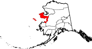
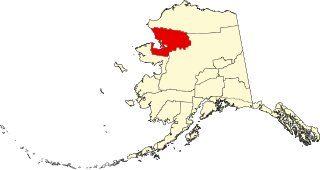
This is a list of the National Register of Historic Places listings in Nome Census Area, Alaska.

National Register of Historic Places listings in Prince of Wales–Hyder Census Area, Alaska Wikimedia list article

This is a list of the National Register of Historic Places listings in Prince of Wales–Hyder Census Area, Alaska.

National Register of Historic Places listings in Southeast Fairbanks Census Area, Alaska Wikimedia list article

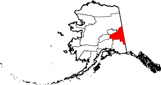
This is a list of the National Register of Historic Places listings in Southeast Fairbanks Census Area, Alaska.

National Register of Historic Places listings in Valdez–Cordova Census Area, Alaska Wikimedia list article

This is a list of the National Register of Historic Places listings in Valdez–Cordova Census Area, Alaska.

National Register of Historic Places listings in Yukon–Koyukuk Census Area, Alaska Wikimedia list article

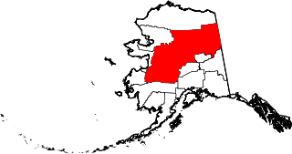
This is a list of the National Register of Historic Places listings in Yukon–Koyukuk Census Area, Alaska.

National Register of Historic Places listings in Anchorage, Alaska Wikimedia list article

This is a list of the National Register of Historic Places listings in Anchorage, Alaska.

National Register of Historic Places listings in Aleutians East Borough, Alaska Wikimedia list article

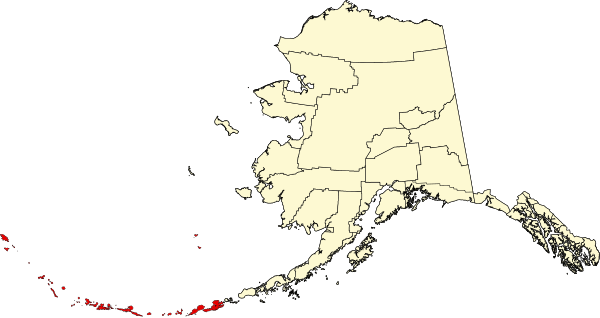
This is a list of the National Register of Historic Places listings in Aleutians East Borough, Alaska.

National Register of Historic Places listings in Denali Borough, Alaska Wikimedia list article

This is a list of the National Register of Historic Places listings in Denali Borough, Alaska.

National Register of Historic Places listings in Kenai Peninsula Borough, Alaska Wikimedia list article

This is a list of the National Register of Historic Places listings in Kenai Peninsula Borough, Alaska.

National Register of Historic Places listings in Kodiak Island Borough, Alaska Wikimedia list article

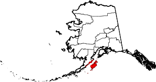
This is a list of the National Register of Historic Places listings in Kodiak Island Borough, Alaska.

National Register of Historic Places listings in Lake and Peninsula Borough, Alaska Wikimedia list article

This is a list of the National Register of Historic Places listings in Lake and Peninsula Borough, Alaska.

National Register of Historic Places listings in Northwest Arctic Borough, Alaska Wikimedia list article

This is a list of the National Register of Historic Places listings in Northwest Arctic Borough, Alaska.

National Register of Historic Places listings in Matanuska-Susitna Borough, Alaska Wikimedia list article

This is a list of the National Register of Historic Places listings in Matanuska-Susitna Borough, Alaska.

National Register of Historic Places listings in North Slope Borough, Alaska Wikimedia list article

This is a list of the National Register of Historic Places listings in North Slope Borough, Alaska.

This is a list of the National Register of Historic Places listings in Denali National Park and Preserve.

This is a list of the National Register of Historic Places listings in Wrangell–St. Elias National Park and Preserve.

This is a list of the National Register of Historic Places listings in Katmai National Park and Preserve.

References

  1. The latitude and longitude information provided in this table was derived originally from the National Register Information System, which has been found to be fairly accurate for about 99% of listings. Some locations in this table may have been corrected to current GPS standards.
  2. "National Register of Historic Places: Weekly List Actions". National Park Service, United States Department of the Interior. Retrieved on February 7, 2020.
  3. Numbers represent an ordering by significant words. Various colorings, defined here, differentiate National Historic Landmarks and historic districts from other NRHP buildings, structures, sites or objects.
  4. 1 2 3 4 5 6 7 "National Register Information System". National Register of Historic Places . National Park Service. April 24, 2008.
  5. The eight-digit number below each date is the number assigned to each location in the National Register Information System database, which can be viewed by clicking the number.
  6. 1 2 Federal and state laws and practices restrict general public access to information regarding the specific location of this resource. In some cases, this is to protect archeological sites from vandalism, while in other cases it is restricted at the request of the owner. See: Knoerl, John; Miller, Diane; Shrimpton, Rebecca H. (1990), Guidelines for Restricting Information about Historic and Prehistoric Resources, National Register Bulletin, National Park Service, U.S. Department of the Interior, OCLC   20706997 .
  7. 1 2 Alaska Maritime NWR Shipwreck List
  8. 1 2 Broderick, Francis; Burwell, Michael (2014). "Aleutian Voices - VOLUME 1, NO. 1, 2014 - S.S. NORTHWESTERN SAILING SHELTERED SEAS" (PDF). National Park Service. ISBN   978-0-98539 48-3-7 . Retrieved May 4, 2017.