National Register of Historic Places listings in Southeast Fairbanks Census Area, Alaska

Last updated
Location of the Southeast Fairbanks Census Area in Alaska Map of Alaska highlighting Southeast Fairbanks Census Area.svg
Location of the Southeast Fairbanks Census Area in Alaska

This is a list of the National Register of Historic Places listings in Southeast Fairbanks Census Area, Alaska.

Contents

This is intended to be a complete list of the properties and districts on the National Register of Historic Places in Southeast Fairbanks Census Area, Alaska, United States. The locations of National Register properties and districts for which the latitude and longitude coordinates are included below, may be seen in a Google map. [1]

There are 12 properties and districts listed on the National Register in the census area, including 1 National Historic Landmark.


    This National Park Service list is complete through NPS recent listings posted March 10, 2023. [2]

Map all coordinates using: OpenStreetMap  
Download coordinates as: KML
GPX (primary)
GPX (secondary)
GPX (all)

Current listings

[3] Name on the Register [4] ImageDate listed [5] Location City or townDescription
1 Alaska-Canada Military Highway (Segment)
Alaska-Canada Military Highway (Segment) Bypassed segment of Alaska Highway, near Craig Lake, Alaska.jpg
Alaska-Canada Military Highway (Segment)
July 31, 2013
(#13000543)
West of Alaska Highway, about 37 miles (60 km) southeast of Delta Junction
63°43′53″N144°42′02″W / 63.731465°N 144.700526°W / 63.731465; -144.700526 (Alaska-Canada Military Highway (Segment))
Delta Junction Now part of the access road to Craig Lake
2 Big Delta Historic District
Big Delta Historic District Rika's Landing Roadhouse - side and outbuildings - DSCN0511.JPG
Big Delta Historic District
March 20, 1991
(#91000252)
Mile 274.5 of Richardson Highway at the junction of the Delta and Tanana Rivers
64°09′17″N145°50′24″W / 64.15463°N 145.84012°W / 64.15463; -145.84012 (Big Delta Historic District)
Big Delta
3 Chicken Historic District
Chicken Historic District Miner's Cabin, Chicken, Alaska.JPG
Chicken Historic District
September 30, 2001
(#01001053)
Mile 66.5 of Taylor Highway
64°04′29″N141°55′56″W / 64.07475°N 141.93233°W / 64.07475; -141.93233 (Chicken Historic District)
Chicken
4 Chisana Historic Mining Landscape
Chisana Historic Mining Landscape Earl Hirst operations along Bonanza Creek.jpg
Chisana Historic Mining Landscape
May 14, 1998
(#98000436)
Vicinity of Chisana and Gold Hill [6] [7]
62°06′10″N141°53′58″W / 62.102778°N 141.899444°W / 62.102778; -141.899444 (Chisana Historic Mining Landscape)
Northway Also partly comprised in Copper River Census Area
5 Eagle Historic District
Eagle Historic District Courthouse in Eagle, Alaska.jpg
Eagle Historic District
October 27, 1970
(#70000919)
Roughly the town of Eagle and the area of Fort Egbert
64°47′28″N141°12′56″W / 64.7911°N 141.21547°W / 64.7911; -141.21547 (Eagle Historic District)
Eagle
6 F.E. Company Dredge No. 4
F.E. Company Dredge No. 4 Dredge in Chicken, Alaska.jpg
F.E. Company Dredge No. 4
May 18, 2006
(#06000435)
Along Airport Road, south of mile 66.4 of Taylor Highway
64°04′11″N141°56′19″W / 64.06983°N 141.93849°W / 64.06983; -141.93849 (F.E. Company Dredge No. 4)
Chicken
7 The Kink
The Kink TheKinkCabin.jpg
The Kink
November 20, 1975
(#75002161)
Along the North Fork Fortymile River, about 21.5 miles (34.6 km) north of Chicken
64°23′08″N142°01′38″W / 64.38562°N 142.02734°W / 64.38562; -142.02734 (The Kink)
Chicken
8 Rapids Roadhouse
Rapids Roadhouse Blackrapidsroadhouse3.JPG
Rapids Roadhouse
February 2, 2001
(#01000021)
Mile 227.4 of Richardson Highway, about 35 miles (56 km) south of Delta Junction
63°31′46″N145°51′31″W / 63.52946°N 145.85854°W / 63.52946; -145.85854 (Rapids Roadhouse)
Delta Junction
9 Rika's Landing Roadhouse
Rika's Landing Roadhouse Rika's Landing Roadhouse - front - DSCN0514.JPG
Rika's Landing Roadhouse
September 1, 1976
(#76000364)
Mile 274.5 of Richardson Highway near the junction of the Delta and Tanana Rivers
64°09′19″N145°50′26″W / 64.15524°N 145.84058°W / 64.15524; -145.84058 (Rika's Landing Roadhouse)
Big Delta
10 Steele Creek Roadhouse
Steele Creek Roadhouse SteeleCreekRoadhouseFlooded.jpg
Steele Creek Roadhouse
April 29, 1980
(#80004576)
South side of Fortymile River, about 24 miles (39 km) northeast of Chicken, Alaska
64°16′17″N141°17′14″W / 64.27139°N 141.28722°W / 64.27139; -141.28722 (Steele Creek Roadhouse)
Chicken
11 Sullivan Roadhouse
Sullivan Roadhouse Sullivan Roadhouse.JPG
Sullivan Roadhouse
August 10, 1979
(#79003756)
266 Richardson Highway
64°02′08″N145°43′51″W / 64.03559°N 145.73088°W / 64.03559; -145.73088 (Sullivan Roadhouse)
Delta Junction
12 Swan Point Archaeological Site
Swan Point Archaeological Site SwanPointExcavation.jpg
Swan Point Archaeological Site
September 26, 2008
(#08000929)
Northern edge of the Shaw Creek Flats, 90 kilometres (56 mi) southeast of Fairbanks [8]
63°18′00″N146°02′00″W / 63.300000°N 146.033333°W / 63.300000; -146.033333 (Swan Point Archaeological Site)
Big Delta

See also

Related Research Articles

<span class="mw-page-title-main">National Register of Historic Places listings in Lancaster County, Pennsylvania</span>

This is a list of the National Register of Historic Places listings in Lancaster County, Pennsylvania.

<span class="mw-page-title-main">National Register of Historic Places listings in Cuyahoga County, Ohio</span>

This is a list of the National Register of Historic Places listings in Cuyahoga County, Ohio.

<span class="mw-page-title-main">National Register of Historic Places listings in Franklin County, Ohio</span>

This is a list of the National Register of Historic Places listings in Franklin County, Ohio.

<span class="mw-page-title-main">National Register of Historic Places listings in Hamilton County, Ohio</span>

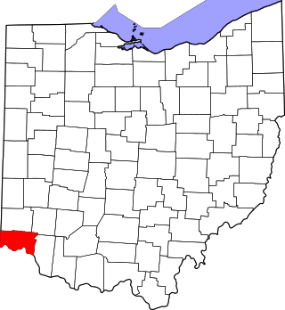
This is a list of the National Register of Historic Places listings in Hamilton County, Ohio.

<span class="mw-page-title-main">National Register of Historic Places listings in Dauphin County, Pennsylvania</span>

This is a list of the National Register of Historic Places listings in Dauphin County, Pennsylvania.

<span class="mw-page-title-main">National Register of Historic Places listings in Alachua County, Florida</span>

This is a list of the National Register of Historic Places listings in Alachua County, Florida.

<span class="mw-page-title-main">National Register of Historic Places listings in Delaware County, Ohio</span>

This is a list of the National Register of Historic Places listings in Delaware County, Ohio.

<span class="mw-page-title-main">National Register of Historic Places listings in Warren County, Ohio</span>

This is a list of the National Register of Historic Places listings in Warren County, Ohio.

<span class="mw-page-title-main">National Register of Historic Places listings in Adams County, Ohio</span>

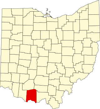
This is a list of the National Register of Historic Places listings in Adams County, Ohio.

<span class="mw-page-title-main">National Register of Historic Places listings in Beaver County, Pennsylvania</span>

This is a list of the National Register of Historic Places listings in Beaver County, Pennsylvania.

<span class="mw-page-title-main">National Register of Historic Places listings in Bethel Census Area, Alaska</span>

This is a list of the National Register of Historic Places listings in Bethel Census Area, Alaska.

<span class="mw-page-title-main">National Register of Historic Places listings in Nome Census Area, Alaska</span>

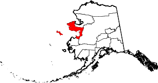
This is a list of the National Register of Historic Places listings in Nome Census Area, Alaska.

<span class="mw-page-title-main">National Register of Historic Places listings in Fairbanks North Star Borough, Alaska</span>

This is a list of the National Register of Historic Places listings in Fairbanks North Star Borough, Alaska.

<span class="mw-page-title-main">National Register of Historic Places listings in Kenai Peninsula Borough, Alaska</span>

This is a list of the National Register of Historic Places listings in Kenai Peninsula Borough, Alaska.

<span class="mw-page-title-main">National Register of Historic Places listings in Lake and Peninsula Borough, Alaska</span>

This is a list of the National Register of Historic Places listings in Lake and Peninsula Borough, Alaska.

<span class="mw-page-title-main">National Register of Historic Places listings in North Slope Borough, Alaska</span>

This is a list of the National Register of Historic Places listings in North Slope Borough, Alaska.

<span class="mw-page-title-main">National Register of Historic Places listings in Larimer County, Colorado</span>

This is a list of the National Register of Historic Places listings in Larimer County, Colorado.

<span class="mw-page-title-main">National Register of Historic Places listings in Gibson County, Indiana</span>

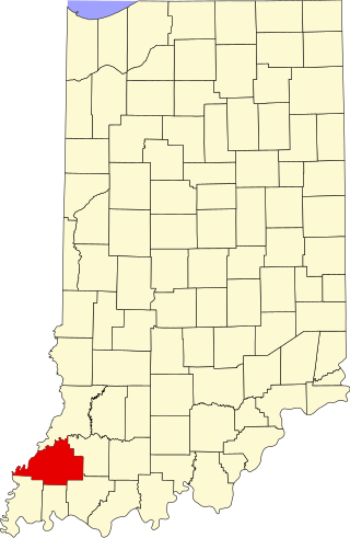
This is a list of the National Register of Historic Places listings in Gibson County, Indiana.

<span class="mw-page-title-main">National Register of Historic Places listings in Knox County, Indiana</span>

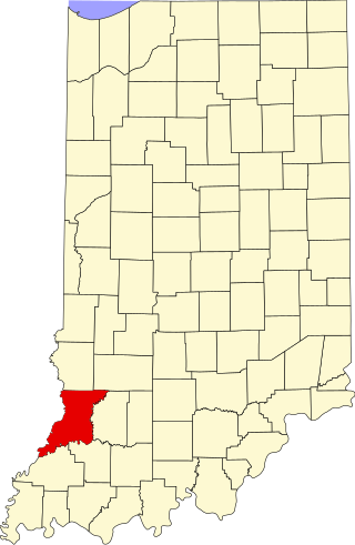
This is a list of the National Register of Historic Places listings in Knox County, Indiana.

<span class="mw-page-title-main">National Register of Historic Places listings in Posey County, Indiana</span>

This is a list of the National Register of Historic Places listings in Posey County, Indiana.

References

  1. The latitude and longitude information provided in this table was derived originally from the National Register Information System, which has been found to be fairly accurate for about 99% of listings. Some locations in this table may have been corrected to current GPS standards.
  2. National Park Service, United States Department of the Interior, "National Register of Historic Places: Weekly List Actions", retrieved March 10, 2023.
  3. Numbers represent an alphabetical ordering by significant words. Various colorings, defined here, differentiate National Historic Landmarks and historic districts from other NRHP buildings, structures, sites or objects.
  4. "National Register Information System". National Register of Historic Places . National Park Service. April 24, 2008.
  5. The eight-digit number below each date is the number assigned to each location in the National Register Information System database, which can be viewed by clicking the number.
  6. Location derived from Fensterman, Greg. Hiking Alaska's Wrangell-St. Elias National Park and Preserve: From Day Hikes to Backcountry Treks . Guilford: Falcon, 2008, 5. The NRIS lists the site as "Address Restricted".
  7. Coordinates derived from the GNIS feature record for Gold Hill
  8. Location derived from Holmes, Charles, et al. "Swan Point" in American Beginnings: The Prehistory and Palaeoecology of Beringia, Frank Hadleigh West, ed. Chicago: U of Chicago P, 1996, 319. The NRIS lists the site as "Address Restricted".