Indian Lake is a town in Hamilton County, New York, United States. The population was 1,352 at the 2010 census. The name is from a lake of the same name that is largely inside the town. There are no permanent stop lights in the town. Law enforcement is provided by New York State Troopers and Hamilton County Sheriff's Office.

The Blue Ridge Mountains are a physiographic province of the larger Appalachian Highlands range. The mountain range is located in the Eastern United States and extends 550 miles southwest from southern Pennsylvania through Maryland, West Virginia, Virginia, North Carolina, South Carolina, Tennessee, and Georgia. The province consists of northern and southern physiographic regions, which divide near the Roanoke River gap. To the west of the Blue Ridge, between it and the bulk of the Appalachians, lies the Great Appalachian Valley, bordered on the west by the Ridge and Valley province of the Appalachian range.

Springer Mountain is a mountain located in the Chattahoochee National Forest on the border of Fannin and Gilmer counties. Located in the Blue Ridge Mountains in northern Georgia, the mountain has an elevation of about 3,770 feet (1,149 m). Springer Mountain serves as the southern terminus for the Appalachian and Benton MacKaye trails.

The South Mountains, known locally as simply South Mountain, is a mountain range in central Arizona in south Phoenix, Arizona. The majority of the range is public land managed by the City of Phoenix as South Mountain Park, but a small portion extends into the Gila River Indian Community.

Catoctin Mountain, along with the geologically associated Bull Run Mountains, forms the easternmost mountain ridge of the Blue Ridge Mountains, which are in turn a part of the Appalachian Mountains range. The ridge runs northeast–southwest for about 50 miles (80 km) departing from South Mountain near Emmitsburg, Maryland, and running south past Leesburg, Virginia, where it disappears into the Piedmont in a series of low-lying hills near New Baltimore, Virginia. The ridge forms the eastern rampart of the Loudoun and Middletown valleys.

Blue Mountain, Blue Mountain Ridge, or the Blue Mountains of Pennsylvania is a ridge of the Appalachian Mountains in eastern Pennsylvania. Forming the southern and eastern edge of the Ridge-and-Valley Appalachians physiographic province in Pennsylvania, Blue Mountain extends 150 miles (240 km) from the Delaware Water Gap on the New Jersey border in the east to Big Gap in Franklin County in south-central Pennsylvania at its southwestern end.
Spring Gap Mountain runs southwest northeast through Morgan and Hampshire counties in West Virginia's Eastern Panhandle, rising to its greatest elevation of 2,237 ft (682 m) north of "Spring Gap", from which the mountain takes its name. The gap is the source for Dug Hill Run, a tributary stream of the Little Cacapon River.

Mill Creek Mountain is a continuous mountain ridge that runs northeast through Hampshire and Hardy counties in the Eastern Panhandle region of the U.S. state of West Virginia. Rising to its greatest elevation of 2,650 feet (808 m) at High Knob, Mill Creek is a folded mountain ridge, belonging to the Ridge-and-Valley Appalachians. Mill Creek Mountain forms the western edge of the South Branch Potomac River Valley and is named for Mill Creek that carves through it at Mechanicsburg Gap allowing the Northwestern Turnpike to pass through as well. Along with Sawmill Ridge, Mill Creek Mountain forms the Trough along the South Branch.

Standing Indian Mountain, elevation 5,499 feet (1,676 m), is part of the North Carolina portion of the Southern Nantahala Wilderness within the boundaries of the Nantahala National Forest. The mountain lies along the Appalachian Trail and is the highest point along the Nantahala River.

Waterrock Knob is a mountain peak in the U.S. state of North Carolina. It is the highest peak in the Plott Balsams and is the 16th-highest mountain in the Eastern United States.

The Sauratown Mountains, which are sometimes called "the mountains away from the mountains", are an isolated mountain range located within Stokes and Surry counties in the U.S. state of North Carolina. The vast majority of the range is located in Stokes County. Although the range occupies only 5% of Stokes County's area, it dominates the county's scenery from almost every direction. The Sauras rise sharply 800 to 1,700 feet above the surrounding terrain.

Sugarloaf Ridge State Park is a state park in Northern California, United States. Located in the Mayacamas Mountains north of Kenwood, the park straddles the boundary between Sonoma and Napa counties. The park contains the 2,729-foot (832 m) Bald Mountain and the headwaters of Sonoma Creek including a 25-foot (8 m) tall seasonal waterfall. The park is also home to the volunteer-run Robert Ferguson Observatory. Camping, picnicking, horseback riding, mountain biking, stargazing, fishing and hiking are common attractions of Sugarloaf. The park boasts 25 miles of trails with trails ranging from less than a mile to 8.8 miles, and elevation gains reaching 2,500 feet.

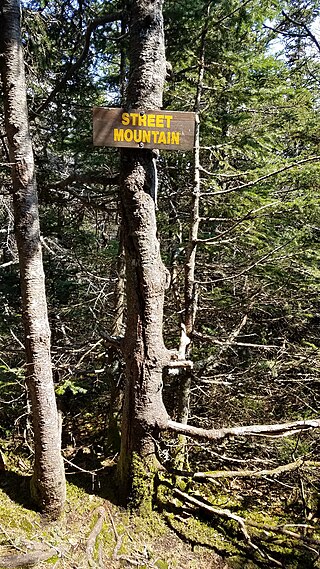
Street Mountain is a mountain located in Essex County, New York, named after Alfred Billings Street (1811–1881), a poet and New York State Librarian. The mountain is the high point of the Street Range of the Adirondack Mountains. Street's northeast ridge is Nye Mountain.

Pocumtuck Mountain is a mountain peak in Charlemont, Massachusetts, located west of the abandoned Catamount settlement. Its summit ledge features wide views of western Franklin County and northern Berkshire County. Pocumtuck Mountain is often confused with the nearby Pocumtuck Range in Deerfield, Massachusetts.
Peter's Rock, also known as Rabbit Rock, Rabbit Hill, Indian Rock and Great Rock, with a high point of (est.) 373 feet (114 m) above sea level, is a trap rock peak located 4 miles (6 km) northeast of downtown New Haven, Connecticut in the town of North Haven. It is part of the Metacomet Ridge that extends from Long Island Sound near New Haven, north through the Connecticut River Valley of Massachusetts to the Vermont border. Peter's Rock is known for its scenic views, unique microclimate ecosystems, rare plant communities, and columnar basalt rock formations. It is traversed by a number of hiking trails managed by the non-profit Peter's Rock Association.

Plateau Mountain is located in the town of Hunter in Greene County, New York, United States. It is part of the Devil's Path range of the Catskill Mountains. Plateau has a two-mile-long (3.2 km) summit ridge above 3,500 feet (1,100 m). The highest point, at least 3,840 feet (1,170 m), is at the southeast end, facing Sugarloaf Mountain to the east across Mink Hollow Notch. It is the 12th-highest peak in the range Devils Tombstone is located west of Plateau Mountain. The northwest end faces Hunter Mountain to the west across 1,400-foot deep (430 m) Stony Clove Notch.

Graham Mountain is the seventh highest of the Catskill High Peaks and the highest privately owned mountain in the range. It is located in the town of Hardenburgh, New York, United States.

North Arapaho Peak is the highest summit of the Indian Peaks in the northern Front Range of the Rocky Mountains of North America. The 13,508-foot (4,117 m) thirteener is located in the Indian Peaks Wilderness, 7.8 miles (12.6 km) west-southwest of the Town of Ward, Colorado, United States, on the Continental Divide separating Roosevelt National Forest and Boulder County from Arapaho National Forest and Grand County.

Albert Mountain is a mountain in North Carolina's Nantahala National Forest of the Appalachian Mountains. The Appalachian Trail goes along its summit, which is around 5,200 feet (1,600 m) high. A fire tower offers views of the Blue Ridge and the Little Tennessee River valley.

Sheep Mountain is located in the U.S. state of Wyoming. Sheep Mountain forms a 5-mile (8 km) long ridge in the Gros Ventre Range and is easily seen from Jackson Hole. The town of Jackson is 13 miles (21 km) southwest of the peak. The southern end of Sheep Mountain is above the tree line and consists of rocky cliffs that are referred to as the "Sleeping Indian" due to their appearance as viewed from Jackson Hole. Sheep Mountain is in the Gros Ventre Wilderness of Bridger–Teton National Forest. At the northern end of Sheep Mountain is the location of the Gros Ventre landslide.


