Kumeū is an affluent rural town and suburb of Auckland situated 25 km north-west of the City Centre in New Zealand. State Highway 16 and the North Auckland Line pass through the town. Huapai lies to the west, Riverhead to the north, Whenuapai to the east, and Taupaki to the south.
The Walton Park Branch was located in Otago, New Zealand and operated from 1874 until 1957, except for the first section, which survived until 1980. It was adjacent to the Fernhill Branch and was, in the words of David Leitch and Brian Scott, essentially "an industrial service siding rejoicing in the status of a branch line."

The Foxton Branch was a railway line in New Zealand. It began life as a tramway, reopened as a railway on 27 April 1876, and operated until 18 July 1959. At Himatangi there was a junction with the Sanson Tramway, a line operated by the Manawatu County Council that was never upgraded to the status of a railway.
The Mount Somers Branch, sometimes known as the Springburn Branch, was a branch line railway in the region of Canterbury, New Zealand. The line was built in stages from 1878, reaching Mount Somers in 1885. A further section to Springburn was added in 1889; this closed in 1957, followed by the rest of the line in 1968. A portion has been preserved as the Plains Vintage Railway.
The Mossburn Branch was a branch line railway in New Zealand from Lumsden on the Kingston Branch to the town of Mossburn in northern Southland. Construction began in 1879, Mossburn was reached in 1887, and the line closed in 1982. It was operated by the New Zealand Railways Department.
The Donnellys Crossing Section, also known as the Kaihu Valley Railway or Kaihu Branch, was a railway line in Northland, New Zealand. Initially an isolated line of 35.91 kilometres (22.31 mi), it became a branch line when the Dargaville Branch was opened and connected it with the North Auckland Line and the rest of the national rail network in 1943. The branch was closed in 1959.

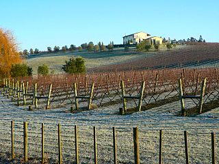
Riverhead is a small, historically predominantly working-class town located at the head of the Waitematā Harbour in the north-west of Auckland, New Zealand. The region around Riverhead and the neighbouring towns of Kumeu and Huapai is known for its vineyards. This town has had its 15 minutes in the spotlight appearing in movies Bridge to Teribithia and Crooked Earth and the odd television show such as Outrageous Fortune. The region features a pine plantation forest that is popular with horse riders, mountain bikers and motorcyclists. Riverhead Forest is operated by Matariki Forests, under Crown Licence. The forest was originally planted on poor kauri gum fields.

The North Auckland Line is a major section of New Zealand's national rail network, and is made up of the following parts: the portion of track that runs northward from Westfield Junction to Newmarket Station; from there, westward to Waitakere; from there, northward to Otiria via Whangārei. The first section was opened in 1868 and the line was completed in 1925. The line, or sections of it, have been known at various times as the Kaipara Line, the Waikato-Kaipara Line, the Kaipara Branch and the North Auckland Main Trunk.

The Okaihau Branch, sometimes known as the Kaikohe Branch and rarely the Rangiahua Branch, was a branch line railway that joined the North Auckland Line of the national rail network of New Zealand at Otiria. It was the most northerly line in New Zealand and was intended to run all the way to Kaitaia. It opened to Ōkaihau in 1923 and closed in 1987.
The Onerahi Branch, sometimes known as the Grahamstown Railway, was a branch line railway in the Northland Region of New Zealand. It operated from 1911 until 1933 and linked the city of Whangārei to the nearby harbour in Onerahi.
The New Zealand Railways Department, NZR or NZGR and often known as the "Railways", was a government department charged with owning and maintaining New Zealand's railway infrastructure and operating the railway system. The Department was created in 1880 and was corporatised on 1 April 1982 into the New Zealand Railways Corporation. Originally, railway construction and operation took place under the auspices of the former provincial governments and some private railways, before all of the provincial operations came under the central Public Works Department. The role of operating the rail network was subsequently separated from that of the network's construction. From 1895 to 1993 there was a responsible Minister, the Minister of Railways. He was often also the Minister of Public Works.

Huapai is a locality north-west of Auckland, New Zealand. State Highway 16 and the North Auckland Railway Line pass through it. Kumeū is adjacent to the east, Riverhead is to the north-east, and Waimauku to the west.

Kaukapakapa is a town in the North Island of New Zealand. It is situated in the Rodney ward of the Auckland Region and is around 50 kilometres northwest of Auckland city. State Highway 16 passes through the town, connecting it to Helensville about 12 km to the south-west, and Araparera about 14 km to the north. The North Auckland Line also passes through Kaukapakapa. The Kaukapakapa River flows from the town to the Kaipara Harbour to the west.
The Kurow Branch was part of New Zealand's national rail network. In the North Otago region of the South Island, it was built in the 1870s to open up the land behind Oamaru for development, and closed in 1983.

The East Coast Main Trunk (ECMT) is a railway line in the North Island of New Zealand, originally running between Hamilton and Taneatua via Tauranga, connecting the Waikato with the Bay of Plenty. The ECMT now runs between Hamilton and Kawerau, with a branch line to Taneatua from the junction at Hawkens. The line is built to narrow gauge of 1,067 mm, the uniform gauge in New Zealand. It was known as the East Coast Main Trunk Railway until 2011, when the word "Railway" was dropped.

The Seddonville Branch, later truncated as the Ngākawau Branch, is a branch line railway in the West Coast region of New Zealand's South Island. Construction began in 1874 and it reached its terminus at the Mokihinui Mine just beyond Seddonville in 1895. In 1981 it was closed past Ngākawau and effectively became an extension of the Stillwater–Westport Line, since formalised as the Stillwater–Ngākawau Line.

The Western Line in Auckland, New Zealand is the name given to suburban rail services that operate between Britomart and Swanson via Newmarket.
The Moutohora Branch was a branch line railway that formed part of New Zealand's national rail network in Poverty Bay in the North Island of New Zealand. The branch ran for 78 km approximately North-West from Gisborne into the rugged and steep Raukumara Range to the terminus at Moutohora. Construction started in 1900, and the line was opened to Moutohora on 26 November 1917.
The Ngatapa Branch was a secondary branch line railway 18.5 kilometres (11.5 mi) long that for a short time formed part of the national rail network in Poverty Bay in the North Island of New Zealand. The Ngatapa branch diverged from the Moutohora branch line about 6 kilometres (3.7 mi) from Gisborne and ran a further 12.5 kilometres (7.8 mi) across the coastal flat to a terminus at Ngatapa.

Portages in New Zealand, known in Māori as Tō or Tōanga Waka, are locations where waka (canoes) could easily be transported overland. Portages were extremely important for early Māori, especially along the narrow Tāmaki isthmus of modern-day Auckland, as they served as crucial transportation and trade links between the east and west coasts. Portages can be found across New Zealand, especially in the narrow Northland and Auckland regions, and the rivers of the Waikato Region.


