This page is based on this
Wikipedia article Text is available under the
CC BY-SA 4.0 license; additional terms may apply.
Images, videos and audio are available under their respective licenses.

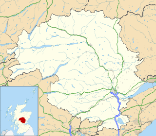
Perth and Kinross is one of the 32 council areas of Scotland and a Lieutenancy Area. It borders onto the Aberdeenshire, Angus, Argyll and Bute, Clackmannanshire, Dundee, Fife, Highland and Stirling council areas. Perth is the administrative centre. With the exception of a large area of south-western Perthshire, the council area mostly corresponds to the historic counties of Perthshire and Kinross-shire.
The Battle of Methven took place at Methven, Scotland on 19 June 1306, during the Wars of Scottish Independence. The battlefield is currently under research to be included in the Inventory of Historic Battlefields in Scotland and protected by Historic Scotland under the Scottish Historical Environment Policy of 2009.

Strathearn or Strath Earn is the strath of the River Earn, in Scotland. It extends from Loch Earn to the River Tay, and was bounded on the north by Atholl, north west by Breadalbane, south west by Menteith, south east by Fife, and on the east by Perthia. The region formed a traditional province of Scotland, and hence had a mormaer and then an Earl.

Tayside was one of the nine regions used for local government in Scotland from 15 May 1975 to 31 March 1996. The region was named for the River Tay.

Stirling and Falkirk is a lieutenancy area of Scotland. It consists of the local government areas of Stirling and Falkirk,
which cover the same areas as the previous districts from 1975—1996.

Leetown is an unincorporated community in Jefferson County in the U.S. state of West Virginia. It lies along West Virginia Secondary Route 1 at its junction with Leetown Pike.
Beechmount is a suburb of Edinburgh, the capital of Scotland. It is south of the A8.
Curriehill is a suburb of Edinburgh, the capital of Scotland. It is north-west of Currie.

Meikleour, pronounced, is a village in Perth and Kinross, Scotland. Approximately twelve miles north of Perth and four miles south of Blairgowrie, it is home to the Meikleour Beech Hedges, the tallest and longest hedge in the world.

Kinrossie is a linear village in the Perth and Kinross area of Scotland.
It is less than a mile south off the A94 road, 8 miles (13 km) from Perth and 6 miles (9.7 km) from Coupar Angus.
Templeton, Angus is a rural area to the north west of Dundee, Scotland, UK, close to Camperdown House.
Ballechin is an estate in Logierait parish, Perthshire, Scotland located 3 miles west north-west of Ballinluig junction. The main residence on the estate is Ballechin House. Ballechin distillery operated between 1810 and 1927 and was one of seven original farm distilleries operating in Perthshire. Out of these seven, Edradour is the only one remaining. Since 2002, Edradour have resurrected the Ballechin brand of whisky.

Glencarse is a village in the Scottish council area of Perth and Kinross.
Murthly is a village in Perth and Kinross, Scotland. It is located on the south bank of the River Tay, 7 kilometres (4.3 mi) south-east of Dunkeld, and 15 kilometres (9.3 mi) north of Perth. Perth District Asylum, later known as Murthly Hospital, was opened in the village on 1 April 1864 for 'pauper lunatics'. It was the second district asylum to be built in Scotland under the terms of the 1857 Lunacy (Scotland) Act. It closed in 1984 and was later demolished. A stone circle is located within the village, in the former grounds of the hospital. The village formerly had a railway station on the Perth and Dunkeld Railway.

Tullibardine is a location in Perth and Kinross, Scotland, which gives its name to a village, a castle, and a grant of nobility.

Leetown, also known as Lee Town, was a historic village in Benton County, Arkansas, United States. The first day of the Battle of Pea Ridge was fought around Leetown.
Humbug Park also previously known as Crossgates Greyhound Stadium is a football ground and former greyhound racing track on Inverkeithing Road in Crossgates, Fife, Scotland.


