
Perth is a city in central Scotland, on the banks of the River Tay. It is the administrative centre of Perth and Kinross council area and the historic county town of Perthshire. It had a population of about 47,180 in 2012. Perth has been known as The Fair City since the publication of the story Fair Maid of Perth by Scottish writer Sir Walter Scott in 1828. During the later medieval period the city was also called St John's Toun or Saint Johnstoun by its inhabitants—a reference to its principal church, which was dedicated to St John the Baptist. This name is preserved in the name of the city's football club, St Johnstone F.C. Perth is twinned with Aschaffenburg in the German state of Bavaria and there are several places in the world named after Scotland’s Perth, including Perth in Western Australia, Perth in Tasmania, and Perth in Ontario, Canada.

Perth and Kinross is one of the 32 council areas of Scotland and a Lieutenancy Area. It borders onto the Aberdeenshire, Angus, Argyll and Bute, Clackmannanshire, Dundee, Fife, Highland and Stirling council areas. Perth is the administrative centre. With the exception of a large area of south-western Perthshire, the council area mostly corresponds to the historic counties of Perthshire and Kinross-shire.

The Carse of Gowrie is a stretch of low-lying country in the southern part of Gowrie, Perth and Kinross, Scotland. It stretches for about 20 miles along the north shore of the Firth of Tay between Perth and Dundee. The area offers high-quality agricultural land and is well known as a major area for strawberry, raspberry and general fruit growing. Fruit is easy to cultivate in the area because of its southerly aspect and low rainfall. It has been suggested that monks brought new varieties of apples and pears to the area in the Middle Ages and there may have been vineyards gowing on slopes near the Tay.

Alyth is a town in Perth and Kinross, Scotland, 5 miles northeast of Blairgowrie and about 17 miles northwest of Dundee. In 2016 the town had an estimated population of 2,400.

Errol is a village in Perth and Kinross, Scotland about halfway between Dundee and Perth. It is one of the principal settlements of the Carse of Gowrie. It lies just north of the River Tay. The 2016 population of Errol was estimated to be 1,500 persons, compared to 1,070 in the 2001 Census.

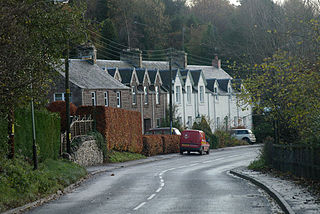
Abbots Deuglie is a hamlet in the Scottish region of Perth and Kinross, Scotland. It is located in the Ochil Hills, in Arngask parish, about one mile (1.5 km) west of Glenfarg. Glenfarg Reservoir lies just to the west of the village, and was built in 1912.

Aberdalgie is a small village in the Scottish council area of Perth and Kinross. It is 3 miles southwest of Perth, and lies between the B9112 road, to the north, and the River Earn, to the south. Milltown Burn and Cotton Burn streams meet in the village centre, The village contains Aberdalgie Parish Church, the present building of which dates to 1773. The historic Dupplin Castle is 1+1⁄2 miles east of the village.

Aberuthven is a small village in Perth and Kinross, Scotland. It lies approximately 2+1⁄2 miles northeast of Auchterarder and 10 miles southwest of Perth at an elevation of 128 feet. It lies on the A9 and A824 roads which has been bypassed along with Auchterarder since 1983. The village is centred on the village hall and has changed over the years almost doubling in size and population.

Clunie is a small settlement in Perthshire, Scotland, four miles west of Blairgowrie. It lies on the western shore of the Loch of Clunie.
Bankfoot is a village in Perth and Kinross, Scotland, approximately 8 miles (13 km) north of Perth and 7 miles (11 km) south of Dunkeld. Bankfoot had a population of 1,136 in 2001. In the 2011 Census the population of Bankfoot was 1,110 people with there being a slightly higher number of male residents (51.4%) than female residents (48.6%). It was found that 33% of Bankfoot residents were aged 60 or older.

Luncarty ) is a village in Perth and Kinross, Scotland, approximately 4 miles north of Perth. It lies between the A9 to the west, and the River Tay to the east.
Braco is a village in Perth and Kinross, Scotland, with a population of 515. It is located 5 miles north of Dunblane towards Perth off the A9 road.

Kinloch is a small settlement along the A94 road in the Coupar Angus and Meigle ward of the council area of Perth and Kinross in eastern Scotland. Approximately 4+1⁄2 miles east is the village of Eassie, noted for the presence of the Eassie Stone; this carved Pictish stone is dated prior to the Early Middle Ages.

Stanley is a village on the north side of the River Tay in Perthshire, Scotland, around 6 miles north of Perth.
Rhynd is a hamlet in Perth and Kinross, Scotland. It is located 3+1⁄4 miles southeast of Perth, on the south side of the River Tay.

Caputh is a parish and village in Perth and Kinross, Scotland. It lies on the A984 Coupar Angus to Dunkeld road about 6 miles southeast of Dunkeld and 8 miles west of Coupar Angus.
Carpow is a diffuse hamlet in Perth and Kinross, Scotland. It is situated immediately to the east of the confluence of the River Tay and River Earn, 2 km north east of Abernethy.
Invermay is a diffuse settlement in Perth and Kinross, Scotland. It is situated approximately 2 km southeast of Forteviot on the Water of May, some 8 km southwest of Perth.
Moneydie {/ˌmʌnˈiːˌɗiː/} is a small hamlet and former parish in Perth and Kinross. It is about 6 miles northwest of Perth.

