
Aberuthven is a small village in Perth and Kinross, Scotland. It lies approximately 2+1⁄2 miles northeast of Auchterarder and 10 miles southwest of Perth at an elevation of 128 feet. It lies on the A9 and A824 roads which has been bypassed along with Auchterarder since 1983. The village is centred on the village hall and has changed over the years almost doubling in size and population.

Achalader is a settlement in the council area of Perth and Kinross, Scotland.

Meikleour is a village in Perth and Kinross, Scotland. It lies 12 miles north of Perth and 4 miles south of Blairgowrie. It is in the parish of Caputh.
Aldclune is a village in Perth and Kinross, Scotland. It is on the B8079 road, approximately 1+1⁄2 miles east of Blair Atholl, on the north bank of the River Garry. At the eastern edge of the village is the site of the Battle of Killiecrankie, which took place in 1689 during the Jacobite rising of 1689–92.
Waterloo is a small hamlet in Perth and Kinross, Scotland approximately 1⁄2 mile north of Bankfoot on the old A9.

The Cateran Trail is a 103-kilometre (64 mi) circular long-distance walking route in central Scotland. The trail has no official beginning or end and can be joined at any stage. The route was established, way-marked and is now maintained by, the Perth & Kinross Countryside Trust. A variety of terrain is covered by the trail including farmland, mountains and forest. The path itself follows old drovers' roads, minor paved roads and farm tracks and can be walked in 4 or 5 days. It is now designated as one of Scotland's Great Trails by NatureScot. As of 2018 it was estimated that around 8,000 people were using the trail each year.
Ardoch is a community in Perth and Kinross in Scotland, the largest population of which is in the village of Braco, west-southwest of Perth.
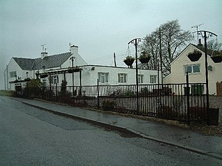
Greenloaning is a village in Perth and Kinross, Perthshire, Scotland. It lies by the Allan Water and the Stirling-Perth Railway line. It is 1 mile south of Braco and 5 miles north of Dunblane.

Rait is a small village in Perth and Kinross, Scotland. It lies 2+1⁄2 miles northwest of Errol, in the Gowrie area west of Dundee, on a minor road crossing the Sidlaw Hills through the Glen of Rait. The village is mainly residential with stone cottages, some modern developments and also features some single storey thatched cottages dating back to the 1700s or early 1800s which form a fermtoun. The former parish church, now ruined, was built in the Middle Ages, and abandoned in the 17th century when the parish of Rait was merged with Kilspindie. The remains of a prehistoric promontory fort lie to the east of the village. The 16th-century Fingask Castle is located to the north of the village, on the south-facing slopes of the Sidlaw Hills.

Dalqueich is a hamlet in Perth and Kinross, Scotland. It lies approximately 3 miles west of Kinross, north of the A91 road on the North Queich burn.

Blairingone is a village in Perth and Kinross, Scotland. It lies on the A977 road at its intersection with Vicar's Bridge Road near the extreme south-westerly point of the region, approximately 3 miles southeast of Dollar. The Arndean agricultural estate lies about 1 mile northeast, near the River Devon.

Powmill is a village in Perth and Kinross, Scotland. It lies at the junction of the A823 and A977 roads at the southwest of the region, approximately 5 miles southwest of Kinross and 5 miles east of Dollar.

Scotlandwell is a village in Portmoak, Kinross-shire, Scotland. It is within the Perth and Kinross council area. It lies to the east of Loch Leven, at the junction of the A977 and B920 roads, approximately 4 miles west of Glenrothes and 4 miles east of Kinross.

Kinnesswood, possibly from the Scottish Gaelic: Ceann eas ciad is a village in Perth and Kinross, Scotland. It lies to the east of Loch Leven, on the A911 road, below Bishop Hill in the Lomond Hills. It is approximately 4 miles west of Glenrothes and 4 miles east of Kinross.

Carnbo is a hamlet in Perth and Kinross, Scotland. It lies approximately 6 miles east of Kinross, on the A91 road on the South Queich burn.
Glenlomond is a village in Perth and Kinross, Scotland. It lies northeast of Loch Leven, north of the A911 road, at the foot of Bishop Hill in the Lomond Hills. It is approximately 4 miles east of Kinross.

Duncrievie is a village in Perth and Kinross, Scotland. It lies approximately 6 miles north of Kinross, to the west of the M90 motorway, 1 mile south of Glenfarg.

Middleton is a hamlet and farmstead in Perth and Kinross, Scotland. It lies approximately 3 miles north of Kinross, to the west of the M90 motorway.
Kettins is a village in Perth and Kinross, Scotland about 14 miles northeast of Perth and 11 miles northwest of Dundee. It is 1 mile from Coupar Angus, north of the A923 road.
Balbeggie is a village in Perth and Kinross, Scotland about 7 miles northeast of Perth on the A94 road.

