
The Carse of Gowrie is a stretch of low-lying country in the southern part of Gowrie, Perth and Kinross, Scotland. It stretches for about 20 miles along the north shore of the Firth of Tay between Perth and Dundee. The area offers high-quality agricultural land and is well known as a major area for strawberry, raspberry and general fruit growing. Fruit is easy to cultivate in the area because of its southerly aspect and low rainfall. It has been suggested that monks brought new varieties of apples and pears to the area in the Middle Ages and there may have been vineyards growing on slopes near the River Tay.

Abbots Deuglie is a hamlet in Perth and Kinross, Scotland. It is located in the Ochil Hills, in Arngask parish, about one mile (1.5 km) west of Glenfarg. Glenfarg Reservoir lies just to the west of the village, and was built in 1912.

Achnafauld is a settlement in the Scottish Highlands, about 15 miles (24 km) northwest of Perth. It is located in the parish of Dull in the council area of Perth and Kinross.
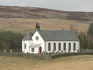
Amulree is a small hamlet in Perth and Kinross, Scotland. It lies in hilly country on the A822 road, 1 km (0.62 mi) east of Loch Freuchie in Strathbraan, 8 km (5.0 mi) west of Dunkeld and 10 km (6.2 mi) north of Crieff. It lies close to the geographical centre of Scotland.
Cottown is a village in Perth and Kinross, Scotland, east of the village of St.Madoes and approximately 8 miles east of Perth. This area is in the Carse of Gowrie, and Cottown sits on a bank a rich alluvial soil to the north of the Firth of Tay between Perth and Dundee. It is the location of one of the largest concentrations of mudwall structures in Scotland, centred on the parish of Errol.

Craigie is a village 6 kilometres west of Blairgowrie, in Perth and Kinross, Scotland. It is situated on the eastern side of Loch Clunie.

Dalqueich is a hamlet in Perth and Kinross, Scotland. It lies approximately 3 miles west of Kinross, north of the A91 road on the North Queich burn.

Blairingone is a village in Perth and Kinross, Scotland. It lies on the A977 road at its intersection with Vicar's Bridge Road near the extreme south-westerly point of the region, approximately 3 miles southeast of Dollar. The Arndean agricultural estate lies about 1 mile northeast, near the River Devon.

Powmill is a village in Perth and Kinross, Scotland. It lies at the junction of the A823 and A977 roads at the southwest of the region, approximately 5 miles southwest of Kinross and 5 miles east of Dollar.

Kinnesswood, possibly from the Scottish Gaelic: Ceann eas ciad is a village in Perth and Kinross, Scotland, and is in the historic county of Kinross-shire. It lies to the east of Loch Leven, on the A911 road, below Bishop Hill in the Lomond Hills. It is approximately 4 miles west of Glenrothes and 4 miles east of Kinross.

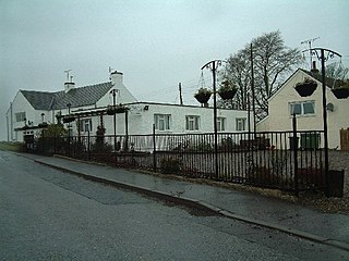
Carsehall is a village in Perth and Kinross, Scotland. It is northeast of Loch Leven and west of Bishop Hill in the Lomond Hills. It is on the A911 road at its junction with the B919 road. It is approximately 5 miles west of Glenrothes and 3 miles east of Kinross. It is the location of the Balgedie Toll Tavern.

Carnbo is a hamlet in Perth and Kinross, Scotland. It lies approximately 6 miles west of Kinross, on the A91 road on the South Queich burn.
Glenlomond is a village in Perth and Kinross, Scotland. It lies northeast of Loch Leven, north of the A911 road, at the foot of Bishop Hill in the Lomond Hills. It is approximately 4 miles east of Kinross.

Duncrievie is a village in Perth and Kinross, Scotland. It lies approximately 6 miles north of Kinross, to the west of the M90 motorway, 1 mile south of Glenfarg.
Kettins is a village in Perth and Kinross, Scotland about 14 miles northeast of Perth and 11 miles northwest of Dundee. It is 1 mile from Coupar Angus, north of the A923 road.
Balbeggie is a village in Perth and Kinross, Scotland about 7 miles northeast of Perth on the A94 road.

Invermay is a diffuse settlement in Perth and Kinross, Scotland. It is situated approximately 2 km southeast of Forteviot on the Water of May, some 8 km southwest of Perth.
Campmuir is a small village in the Perth and Kinross area of Scotland.

Garrow is a clachan in the Breadalbane region of Perth and Kinross, Scotland. It is located about midway between Kenmore, 4.5 miles to the northwest, and Amulree, 5.3 mi (8.5 km) to the southeast. It sits below the River Quaich, which flows into nearby Loch Freuchie, itself situated between Garrow and Amulree, 2.3 mi (3.7 km) away. Garrow's elevation is about 314 metres.

Keltybridge is a village in Perth and Kinross, Scotland, about one mile north of Kelty, which is across the Fife border. It stands on the northern banks of Kelty Burn.

