Leitrim Liatroim (Irish) | |
|---|---|
 Crossroads near Duniry | |
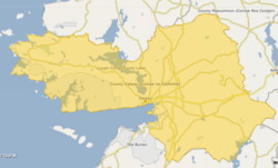
 Barony map of County Galway, 1900; Leitrim is in the south, coloured pink. | |
 Leitrim | |
| Coordinates: 53°07′N8°26′W / 53.12°N 8.43°W | |
| Sovereign state | Ireland |
| Province | Connacht Munster |
| County | Clare Galway |
| Area | |
• Total | 443.4 km2 (171.2 sq mi) |
Leitrim (Irish : Liatroim) is a historical barony in Ireland that lies partly in County Galway and partly in County Clare. [la 1] It is located in the south-eastern corner of County Galway and the north-eastern corner of County Clare. Prior to 1898, the entire barony was contained in County Galway. The Local Government (Ireland) Act 1898 split the barony: part of the barony was transferred to County Clare. Leitrim is bounded, clockwise from the southwest, by the Clare baronies of Tulla Upper and Tulla Lower; the Galway baronies of Loughrea to the west, Kilconnell to the north, and Longford to the east; and by Lough Derg to the south and southeast. [1] It measures 20 miles (32 km) from north to south and 9.5 miles (15.3 km) from east to west. [2]
