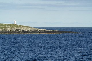
It is situated off the east coast of Yell, near the village of Gutcher, and has an area of 111 acres (0.45km2). It is separated from Yell by Linga Sound, and Unst is to the north east. Sound Gruney, Urie Lingey are to the south east, and Hascosay to the south.
There is little freshwater on the island.
History
A hut in the north of the island.
It is said that Jan Tait of Fetlar once kept a bear on the island, and this is commemorated in the placename - "Bear's Bait". It was said to be from Norway, where he had been taken for trial for murder, but he was pardoned for capturing this particular bear, which had been causing problems over there.[2]
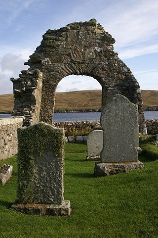
An abandoned chapel is located on the island. An unknown duke once planned to build a large house there after buying land on it. However this was cancelled as doctors and other services refused to provide a service to such a small remote island.
On 19 July 1923, the SS Jane ran aground on the island.[5] The 840-ton ship, carrying herring from Baltasound, Unst to Lerwick, later sank into 20m of water just off the island.
There is also the remains of a sheep fold in the north.
Wildlife
Surprisingly for an island whose name derives from the Norse for "heather isle", very little grows here.
Yell is one of the North Isles of Shetland, Scotland. In the 2011 census it had a usually resident population of 966. It is the second largest island in Shetland after the Mainland with an area of 82 square miles (212 km2), and is the third most populous in the archipelago, after the Mainland and Whalsay.
Fetlar is one of the North Isles of Shetland, Scotland, with a usually resident population of 61 at the time of the 2011 census. Its main settlement is Houbie on the south coast, home to the Fetlar Interpretive Centre. Other settlements include Aith, Funzie, Herra and Tresta. Fetlar is the fourth-largest island of Shetland and has an area of just over 4,000 ha.
Unst is one of the North Isles of the Shetland Islands, Scotland. It is the northernmost of the inhabited British Isles and is the third-largest island in Shetland after Mainland and Yell. It has an area of 46 sq mi (120 km2).
The North Isles are the northern islands of the Shetland Islands, Scotland. The main islands in the group are Yell, Unst and Fetlar. Sometimes the islands in Yell Sound are included in this group.
Balta is an uninhabited island in Shetland, Scotland.
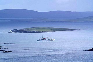
Hascosay is a small island lying between Yell and Fetlar in the Shetland Islands, Scotland.
Uyea is an uninhabited island, lying south of Unst in Shetland, Scotland.
Huney is an uninhabited island due east of the island of Unst in the Shetland Islands, Scotland. The island is located approximately 1 kilometre south west of Balta and has an area of just under 0.2 square kilometres (0.08 sq mi). Huney is separated from Unst by a narrow channel called The Yei. At extremely low tides a sandy tombolo may connect Huney to Unst.
Linga is a small, uninhabited island, 1 km (0.62 mi) east of Muckle Roe in the Shetland Islands. The island is roughly circular in shape and its highest elevation is 69 metres (226 ft). Its area is 70 hectares (0.27 sq mi).
Uyea is an uninhabited tidal island located to the northwest of Mainland, Shetland. Uyea lies off the Northmavine peninsula, from where it can be reached by foot at low tide. The island's highest elevation is 70 metres (230 ft) and its area is 45 hectares (0.17 sq mi).
West Linga is an uninhabited island located between Mainland and Whalsay in Shetland, Scotland.
Haaf Gruney is a small island in the north east of the Shetland Islands.
Yell Sound is the Sound running between Yell and Mainland, Shetland, Scotland. It is the boundary between the Mainland and the North Isles, and it contains many small islands. Sullom Voe, on the shores of which is a substantial oil terminal, is an arm of Yell Sound.
Linga is one of the Shetland Islands, in Yell Sound.
Bluemull Sound is the strait between Unst and Yell in Shetland's North Isles. A ferry service crosses it regularly. Cullivoe is on the Yell side, and the island of Linga lies in the strait.
Sandsting is a parish in the West Mainland of Shetland, Scotland, forming a southern arm of the Walls Peninsula. After the parish of Aithsting was annexed into Sandsting in the sixteenth century, it became known as Sandsting and Aithsting parish.
There are numerous islands containing the word holm, mainly in northern Europe. In many cases the name is derived from the Old Norse holmr, meaning "a small and rounded islet". These include:
This page is based on this Wikipedia article Text is available under the CC BY-SA 4.0 license; additional terms may apply. Images, videos and audio are available under their respective licenses.